
CALGARY -- Synoptically, the whole of the province is looking relatively benign today. Gusts could hit upwards of 40 km/h from the south this afternoon, dredged along by an upper ridge pulling air up, but it won’t amount to an above-normal high against the mass of slightly cooler air that lingered through the weekend, following that weekend cold front.
In spite of the below-average temperature, we’re going to be watching for our early-day cloud layer to waltz on eastward, creating a solid mimicry from yesterday, which presented lovely conditions.
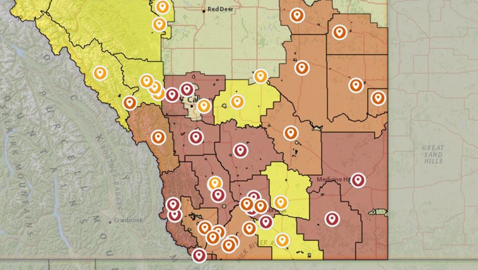
It was a very, VERY dry month of August, to the point where we were pushing toward record territory:
Another reminder, especially as temperatures cool and the fire-pit out back looks more inviting: Be sure to monitor AlbertaFireBans.ca for the latest on what you can and cannot do in your area. The lack of moisture we’ve had of late can make for fire threats.
Here’s the five-day forecast:
Today:
- Gradually clearing cloud, mainly sunny
- Daytime high: 18C
- Evening: some cloud, low 12C
Tomorrow:
- Partly cloudy
- Daytime high: 20C
- Evening: mainly clear, low 12C
Wednesday:
- Mainly sunny, afternoon scattered showers are possible
- Daytime high: 16C
- Evening: clear, low 6C
Thursday:
- Sunny
- Daytime high: 22C
- Evening: clear, low 9C
Friday:
- Mainly sunny
- Daytime high: 24C
- Evening: building cloud, low 8C
Ron (among others!) caught the beautiful sunrise yesterday morning, featuring a few stipples of cloud off the Rockies.
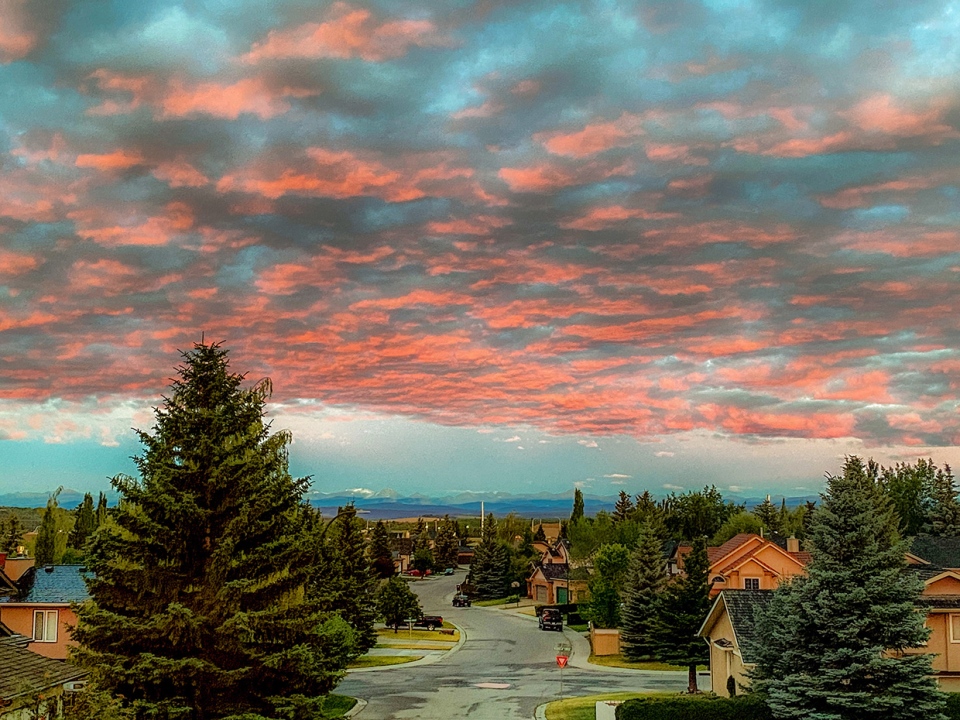
You can submit your weather photos here.


