Flames game day forecast: You may want to bring a red umbrella
UPDATE: The way this system is developing, Calgary's not out of the woods on rainshowers yet.
Firstly, there are two images below; the first is what's expected Friday morning, but with that system popping free of the foothills, Calgary gets a chance of showers this evening; light stuff, as we cool off, somewhat. If you're planning on taking in the Flames game somewhere out-of-doors, that's worth considering. Yesterday's modeling had this setup further north; while a chance for 1-3 mm is in the immediate forecast, it's spread out over six plus hours.
For the weekend, there's still a wide spread among forecast models, but I'm comfortable suggesting over 10 millimetres will fall between Saturday afternoon and midnight Sunday. Spotty showers still exist beyond then, as well. Most of this is pulled free of the foothills.
We may also run into periods with mixed precipitation. Low temperature trends have started improving, however, so that chance is presently quite remote.
It's time for the Thursday edition of "How Warm Today, And How Much Rain This Weekend?" The answers to these questions are 22 C, and… less than previously predicted.
Let's break it all down.
A number of forecast models pin today squarely on a high near 20 C, but we're still coping with warm wind. Today it rises from the south instead of yesterday's westerlies, which popped sections of the city to 22-23 C. Still, that's a contributing factor to the high, though it will involve gusts to at least 40 km/h, with a chance we crack 50.
Ditto Friday, but with a directional shift back to westerlies.
So what's changing, again, for precipitation? Here's the early Friday look:

So that low bursts onto the scene tomorrow morning. It'll help create westerlies for us. There's a wildly small chance of showers late Friday from it. But that’s not the low we’re interested in; this is:
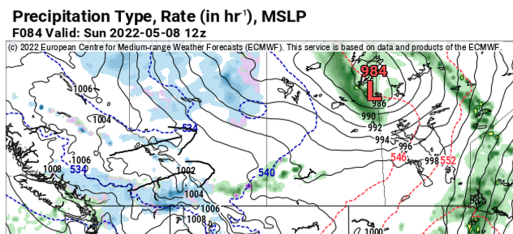
The expectation is that this one (which would arrive on the Saskatchewan-Manitoba boundary Sunday morning) would be grabbing moisture off the foothills and throwing it at us. This one was projected this week to form in Montana before swinging to the north-northeast. The previous track took longer – it's moving a lot more rapidly now, which limits the impact in southern Alberta. It's a small change, but it's further proof that forecast models don’t like mountains, much.
The Saturday forecast is not completely dried out, but as we close in and models verify, we're down from "rain" to "chance of showers." Not great.
Sunday still runs a shot, and so does Monday. Now, we're peaking at 15 millimetres, but likely closer to eight mm.
YOUR FIVE-DAY CALGARY FORECAST
Tonight
- Evening: shower risk, some cloud, low 7 C
Friday
- Partly cloudy
- Daytime high: 17 C
- Evening: some cloud, low 6 C
Saturday
- Mainly sunny, chance of p.m. showers
- Daytime high: 13 C
- Evening: chance of showers, low 2 C
Sunday
- Showers
- Daytime high: 10 C
- Evening: mainly cloudy, chance of showers, low 0 C
Monday
- Mainly cloudy, scattered showers
- Daytime high: 10 C
- Evening: clearing, low -1 C
Tuesday
- Partly cloudy
- Daytime high: 12 C
- Evening: clearing, low -1 C
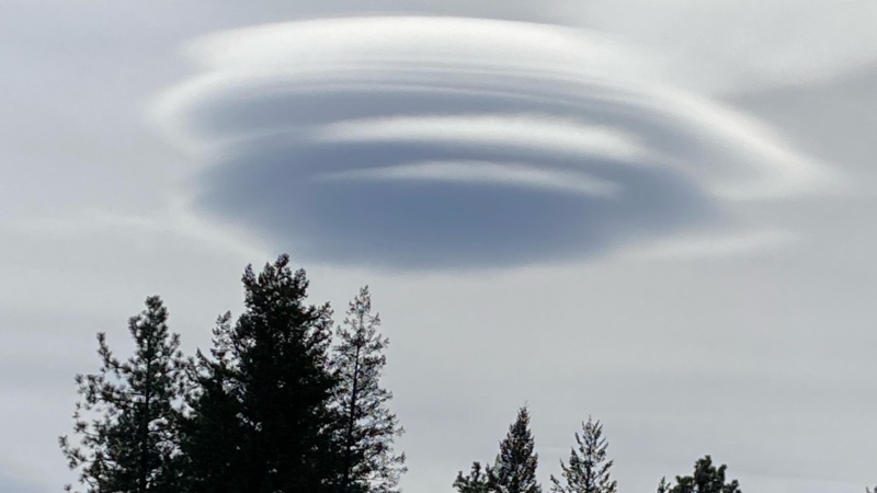
Today's pictures are all the awesome chinook arch honourable mentions that came through on Twitter:
Whether it's wildlife, weather or pets – submit your photos here, email me here, or tweet them over.
CTVNews.ca Top Stories

Doctors say capital gains tax changes will jeopardize their retirement. Is that true?
The Canadian Medical Association asserts the Liberals' proposed changes to capital gains taxation will put doctors' retirement savings in jeopardy, but some financial experts insist incorporated professionals are not as doomed as they say they are.
Something in the water? Canadian family latest to spot elusive 'Loch Ness Monster'
For centuries, people have wondered what, if anything, might be lurking beneath the surface of Loch Ness in Scotland. When Canadian couple Parry Malm and Shannon Wiseman visited the Scottish highlands earlier this month with their two children, they didn’t expect to become part of the mystery.
Fair in Ontario, flurries in Labrador: Weather systems make for an erratic spring
It's no secret that spring can be a tumultuous time for Canadian weather, and as an unseasonably mild El Nino winter gives way to summer, there's bound to be a few swings in temperature that seem out of the ordinary. From Ontario to the Atlantic, though, this week is about to feel a little erratic.
What do weight loss drugs mean for a diet industry built on eating less and exercising more?
Recent injected drugs like Wegovy and its predecessor, the diabetes medication Ozempic, are reshaping the health and fitness industries.
He replaced Mickey Mantle. Now baseball's oldest living major leaguer is turning 100
The oldest living former major leaguer, Art Schallock turns 100 on Thursday and is being celebrated in the Bay Area and beyond as the milestone approaches.
What a urologist wants you to know about male infertility
When opposite sex couples are trying and failing to get pregnant, the attention often focuses on the woman. That’s not always the case.
'It was instant karma': Viral video captures failed theft attempt in Nanaimo, B.C.
Mounties in Nanaimo, B.C., say two late-night revellers are lucky their allegedly drunken antics weren't reported to police after security cameras captured the men trying to steal a heavy sign from a downtown business.
Bank of Canada officials split on when to start cutting interest rates
Members of the Bank of Canada's governing council were split on how long the central bank should wait before it starts cutting interest rates when they met earlier this month.
Quebec nurse had to clean up after husband's death in Montreal hospital
On a night she should have been mourning, a nurse from Quebec's Laurentians region says she was forced to clean up her husband after he died at a hospital in Montreal.


