Calgary's forecast: Our conditions match today - our temperatures improve
UPDATE: ...at least, as it pertains to the title, the next two days will drive flurries, ranging from scattered to a new operative word I'm working in on the fly: "sparse." There isn't a great magnitude of additional snow around the corner. Saturday into Sunday, no big change, yet. I'm still seeing a fair centimetre of overnight snow, but the model trends right now for the weekend involve a temperature bump in the positive direction, and a precipitation downturn for that period. There's a fresh shot for some drizzle (yes --- DRIZZLE) Sunday afternoon.
Our five-day forecast is going to look a little better every single day moving forward, as the warmer conditions we've been angling for begin to emerge.
Today, however… today is another day that may feel more suited to November than April. Flurries today are potentially bringing one to two centimetres of snow, smattering down over the course of the day. This won't be a major impactor of our roadways, by merit of the volume it takes – it’s just how long it may last (upward of eight hours) that could slow us down.
The steady warm-up will begin after several more days like this – though with lighter snowfall potential. Friday will push to just shy of the freezing mark, and Saturday, a burst of wind from the south will perk us back above seasonal, though we may have to wait until next week to see the full effect of our warming cycle. The afternoon article will likely have something a lot closer to seasonal… stay tuned!
Also, the snow event that was previously tracked for Saturday? Yeah, that fell off hard. Chalk up another day like yesterday and expect a little blanket on the ground by Sunday morning.
YOUR FIVE-DAY CALGARY FORECAST:
Tonight
- Mainly cloudy, scattered flurries, low -11 C
Thursday
- Mainly cloudy, sparse flurries
- Daytime high: -5 C
- Evening: mainly cloudy, scattered flurries, low -10 C
Friday
- Partly cloudy, scattered flurries
- Daytime high: -2 C
- Evening: some cloud, low -11 C
Saturday
- Building cloud, p.m. flurries
- Daytime high: 2 C
- Evening: some cloud, low -4 C
Sunday
- Cloudy, a.m. snow, p.m. drizzle
- Daytime high: 6 C
- Evening: some cloud, low -3 C
Monday
- Partly cloudy
- Daytime high: 8 C
- Evening: some cloud, low -2 C
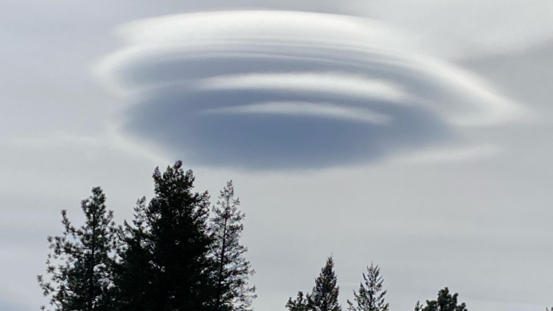
Today’s pic is from Laurellea of STEVE in Steveville, Alberta! How perfect! Steve stands for Strong Thermal Emission Velocity Enhancement, as named by Alberta aurora watchers a few years ago. Here's a link to space.com’s explanation of it.
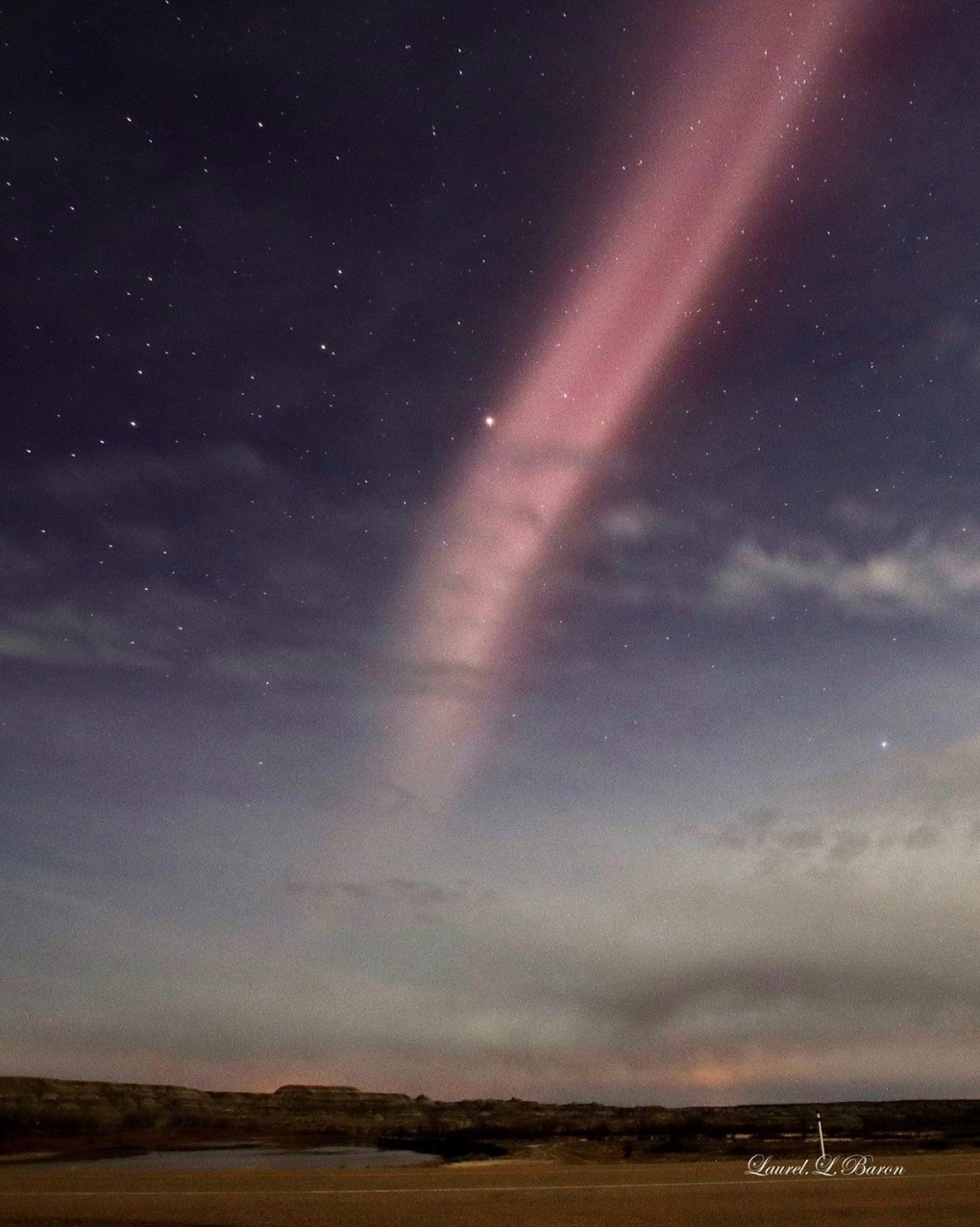 Strong Thermal Emission Velocity Enhancement (STEVE) captured near Steveville, Alta. by Laurellea.
We love to see your pictures of weather, wildlife, and pets – submit your photos here, email me here, or tweet them over.
CTVNews.ca Top Stories

Quebec nurse had to clean up after husband's death in Montreal hospital
On a night she should have been mourning, a nurse from Quebec's Laurentians region says she was forced to clean up her husband after he died at a hospital in Montreal.
Northern Ont. lawyer who abandoned clients in child protection cases disbarred
A North Bay, Ont., lawyer who abandoned 15 clients – many of them child protection cases – has lost his licence to practise law.
Bank of Canada officials split on when to start cutting interest rates
Members of the Bank of Canada's governing council were split on how long the central bank should wait before it starts cutting interest rates when they met earlier this month.
Maple Leafs fall to Bruins in Game 3, trail series 2-1
Brad Marchand scored twice, including the winner in the third period, and added an assist as the Boston Bruins downed the Toronto Maple Leafs 4-2 to take a 2-1 lead in their first-round playoff series Wednesday
Cuban government apologizes to Montreal-area family after delivering wrong body
Cuba's foreign affairs minister has apologized to a Montreal-area family after they were sent the wrong body following the death of a loved one.
'It was instant karma': Viral video captures failed theft attempt in Nanaimo, B.C.
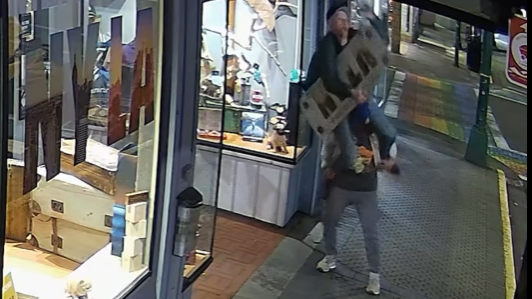
Mounties in Nanaimo, B.C., say two late-night revellers are lucky their allegedly drunken antics weren't reported to police after security cameras captured the men trying to steal a heavy sign from a downtown business.
What is changing about Canada's capital gains tax and how does it impact me?
The federal government's proposed change to capital gains taxation is expected to increase taxes on investments and mainly affect wealthy Canadians and businesses. Here's what you need to know about the move.
New Indigenous loan guarantee program a 'really big deal,' Freeland says at Toronto conference
Canada's Deputy Prime Minister Chrystia Freeland was among the 1,700 delegates attending the two-day First Nations Major Projects Coalition (FNMPC) conference that concluded Tuesday in Toronto.
'Life was not fair to him': Daughter of N.B. man exonerated of murder remembers him as a kind soul
The daughter of a New Brunswick man recently exonerated from murder, is remembering her father as somebody who, despite a wrongful conviction, never became bitter or angry.


