Cold, snowy in the back half of Calgary's weekend
 A stock photo of a sunrise in Calgary. (Getty Images)
UPDATE: Loaded with better news than this morning's edition. Well, we can run a strike-through on the opening sentence of the earlier edition - Saturday has continued perking up, and the next wave of snow anticipated for Saturday, Sunday with a trailer out to Monday has also been reduced. We're still anticipating ~10 cm by Monday, but "20 cm" has toned down across the board.
The only point where you might find the news falters is temperature. The Alaskan high that's pushing in will hammer our high temperatures for a few days. Give it a week. We'll get back to normal. And by normal, I mean actual normal: near-freezing highs.
The warmest of our five-day forecast has arrived.
Wind warning-level gusts are a possibility in the communities along the southern Foothills, which may prompt actual warnings; they will be brief, if they arrive at all.
The large low that has driven Slave Lake and Whitecourt into snowfall warnings will continue to pass into central Saskatchewan, where it becomes a battery for pulling west wind down off the Rockies locally.
The consequence in Calgary will be wind gusts between 50 and 60 km/h, and a high temperature exceeding seasonal averages.
Then, the low moves on. With it, our wind takes on a northerly approach…. Again.
The daytime high Friday will be back below the norm. This may trigger a wave of flurries. Then, a gradual overnight warming into Saturday.
Saturday will start with west wind, strong gusts, and a positive high temperature. But, model outputs have taken a strong shift. The expectation was always that by Saturday afternoon, northern gusts would take over and our temperature would drop like a stone to negative double-digits; that component hasn't changed.
There was a look for flurries Saturday evening. The word "flurries" just doesn't work anymore. Model expectations are calling for another strong band of snow to develop and carry straight through Sunday, with some suggesting 20 centimetres by Monday,
At least the skiers and snowboarders are happy.
I'll have another look at it this afternoon with the latest data. You may need to create some extra time and space for your weekend plans.
Your five-day forecast:
Tonight
- Flurries, low -8 C
Friday
- AM flurries, cloudy
- Daytime high: 0 C
- Evening: some cloud, low 0 C
Saturday
- Building cloud, evening snow
- Daytime high: 9 C
- Evening: snow, low -15 C
Sunday
- Snow
- Daytime high: -15 C
- Evening: some cloud, low -22 C
Monday
- Flurries
- Daytime high: -19 C
- Evening: some cloud, low -24 C
Tuesday
- Sunny
- Daytime high: -12 C
- Evening: clear, low -17 C
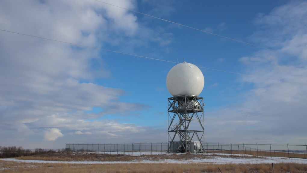
Our pic of the day today is of the Strathmore Weather station, taken by Marlene. Thanks for sending this over!
 A weather station in Strathmore, Alta. (submitted by Marlene) You can submit your photos here, email me here, or tweet them over! We’re also freshly minted on Instagram and waiting on a few approvals before daily posts pop up there: @CTVCalgaryWeather
CTVNews.ca Top Stories

Walking pneumonia is surging in Canada. Is it peaking now?
CTVNews.ca spoke with various medical experts to find out the latest situation with the typically mild walking pneumonia in their area and whether parents should be worried.
Whole Foods carrots pulled in expanded recall for E. coli: CFIA
The Canadian Food Inspection Agency has announced an expanded recall on carrots over risks of E. coli O121 contamination, according to a notice issued Friday.
Prime Minister Trudeau attends Taylor Swift's Eras Tour in Toronto with family
Prime Minister Justin Trudeau is a Swiftie. His office confirmed to CTV News Toronto that he and members of his family are attending the penultimate show of Taylor Swift's 'The Eras Tour' in Toronto on Friday evening.
Afraid of losing the U.S.-Canada trade pact, Mexico alters its laws and removes Chinese parts
Mexico has been taking a bashing lately for allegedly serving as a conduit for Chinese parts and products into North America, and officials here are afraid a re-elected Donald Trump or politically struggling Prime Minister Justin Trudeau could try to leave their country out of the U.S.-Mexico-Canada free trade agreement.
Even with access to blockbuster obesity drugs, some people don't lose weight
Unlike scores of people who scrambled for the blockbuster drugs Ozempic and Wegovy to lose weight in recent years, Danielle Griffin had no trouble getting them.
NEW Thinking about taking an 'adult gap year'? Here's what experts say you should know
Canadian employees are developing an appetite for an 'adult gap year': a meaningful break later in life to refocus, refresh and indulge in something outside their daily routine, according to experts.
UN talks in disarray as a rough draft deal for climate cash is rejected by developing nations
As nerves frayed and the clock ticked, negotiators from rich and poor nations were huddled in one room Saturday during overtime United Nations climate talks to try to hash out an elusive deal on money for developing countries to curb and adapt to climate change.
The Thriftmas Special: The benefits of second-hand holiday shopping
The holidays may be a time for family, joy and togetherness, but they can also be hard on the wallet.
'Her shoe got sucked into the escalator': Toronto family warns of potential risk of wearing Crocs
A Toronto family is speaking out after their 10-year-old daughter's Crocs got stuck in an escalator, ripping the entire toe area of the clog off.


