
CALGARY -- Get ready for a lot of charts.
Weather conditions for the coming days will be largely benign as the bulk of instability will trend far to our north. A combined westerly flow across the Rockies interacting with a south-driven jet will keep our temperatures in the 20s through the weekend. When the jet stream is south of the city, cooler air from the north is allowed to sweep in.
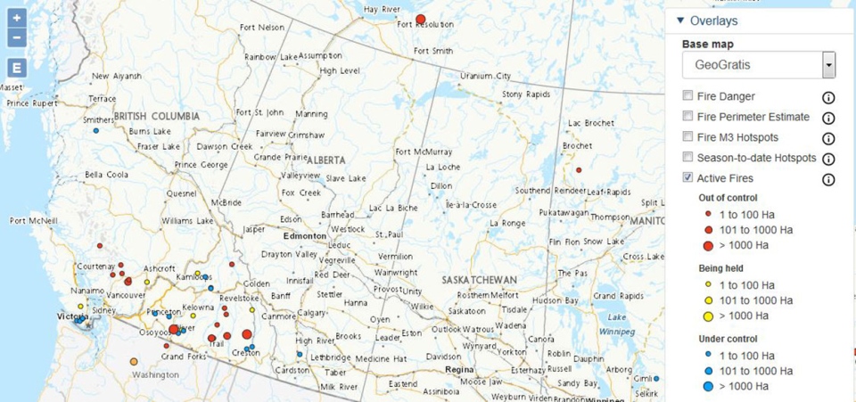
The more prevalent concern for the coming days is going to be air quality. Wildfires continue raging through the BC interior and, as the chart shows, many are not under control and spreading rapidly:
Thanks to our westerly upper air pattern, that smoke is going to have an impact in Alberta. This will not likely be to the extent of the 2018 wildfires just yet, but it’s still something to be very aware of, especially for individuals with pre-existing respiratory conditions.
First, two charts. These are the 00-24 hour and 24-48 hour average particulate matter charts, courtesy of FireWork: Canada’s Wildfire Smoke Prediction System. Key word: prediction. This is not absolute, but paints a pretty good picture of what could happen, all the same.
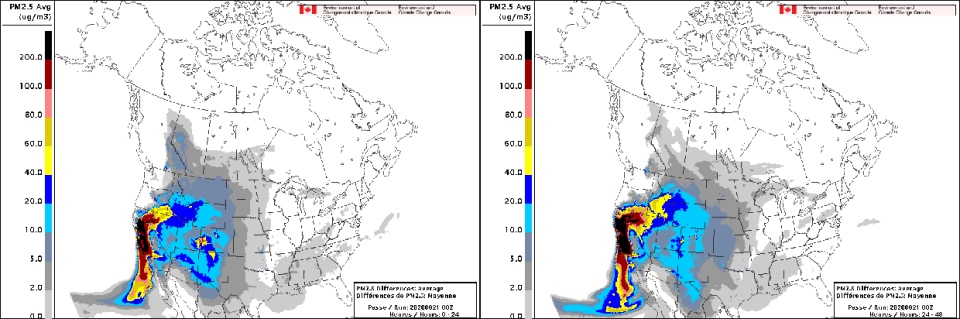
With these models run at 00Z, they’re from Thursday at around 6pm. That is to say that this afternoon may represent worse conditions than the offerings on Saturday.
To speak on the 2.5pm Avg (ug/m3) that this chart tracks: it’s keeping a watch on the amount of particulate matter of a size at 2.5 microns or smaller per cubic meter of air. For reference: the dust particles that float around our homes are 10 microns thick. Human hair is 50-70 microns thick. These are tiny, tiny particles, which can have an impact as they enter one’s respiratory tract, causing irritation to the lungs. Shortness of breath, coughing, sneezing, and runny nose are also common signs in these conditions that one should spend some time indoors.
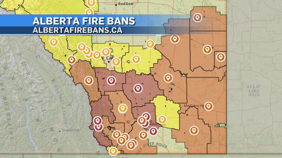
Lastly, as the five-day forecast reflects, we’re faced with continuing dry weather, which translates to additional fire restrictions. Check for the latest right here.
Here’s the five-day forecast:
Today:
- Partly cloudy, haze possible this afternoon
- Daytime high: 25C
- Evening: mainly clear, low 14C
Saturday:
- Mainly sunny
- Daytime high: 23C
- Evening: mainly clear, low 10C
Sunday:
- Partly cloudy
- Daytime high: 22C
- Evening: mainly clear, low 11C
Monday:
- Partly cloudy
- Daytime high: 23C
- Evening: mainly clear, low 11C
Tuesday:
- Partly cloudy, afternoon scattered showers possible
- Daytime high: 21C
- Evening: mainly clear, low 10C
ON THIS DAY: Well, I’ll let CTV’s Darrel Janz tell the tale.
"We mark 28 years since the start of the biggest, baddest August snowstorm in southern Alberta history. It started as rain Aug. 21, 1992 but south of Calgary quickly turned to snow. Lethbridge got 20 cm but Vulcan was the epicentre with over two feet!!!
"Millions of acres of nearly ripe crops were crushed making that year’s harvest incredibly difficult and expensive."
While the snow continued through to Aug. 23rd off-and-on, that evening, it helped push the Calgary Stampeders to a 44-23 win over the BC Lions. CTV videojournalist Kevin Fleming recalls the game fondly. "I’m pretty sure I was at a Stamps game that night and froze!"
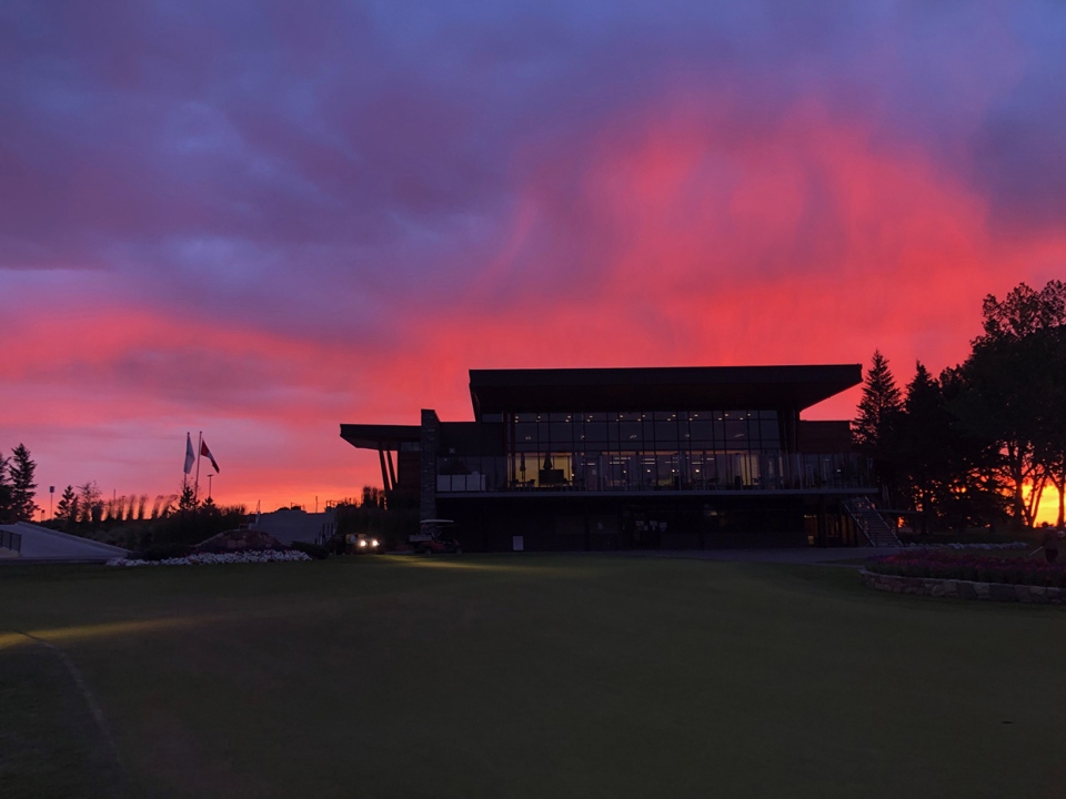
In weather photos, Shelby was likely among the first to tee off at the Earl Grey Golf Club. Nice one, Shelby! I hope it was a good round.
You can submit your weather photos here.


