Flurries, possible freezing rain in Calgary Tuesday evening
It’s still there. Barely. But the possibility of freezing rain has not been completely dismissed yet.
Late this evening, our temperature will likely have fallen away far enough to present flurries, instead of anything else – all the same, there’s potential for that layer to sit a little closer to the freezing mark and drop freezing rain thanks to a warm front moving through, especially in central Alberta. Most forecast models place the capital region beneath the freezing rain event, and then fall into arguing with each other when predicting how far south and east it goes.
Some show HWY-56 north of Drumheller getting a coat of ice overnight; others keep it north of Red Deer.
UPDATE: Environment Canada has issued a number of weather statements to this effect; Edmonton still holds as the strongest chance for freezing rain. Calgary is included. Warnings will be issued when a verified freezing rain event is imminent.This low’s strengthening overnight will generate plenty of warmth along the southern foothills, with some strong gust potential – maybe even enough to build a wind warning or two (Crowsnest and Cardston, if we're naming names - UPDATE - Crowsnest! Nothing yet for Cardston - UPDATE AGAIN: Cardston, too, now).
The total projected precipitation, regardless of this evening's offering, will remain a small number. This holds true tomorrow, as well, as a large low slates to roll free of northern Alberta before swinging like a pendulum into southern Saskatchewan, then returning northward near Thompson, Manitoba. The warm front from this setup will get to us early in the day, but the cold front in the afternoon will have the last word and push our temperature away from a positive high by the early afternoon. This, too, could generate flurries for southern Alberta, though snowfall totals aren’t expected to amount to more than 1-2 cm for communities in southern Alberta.
Believe it or not, we may also catch the rare phenomenon of thundersnow at some points along that cold front's passage! Conditions look good, but time will tell…
YOUR FIVE-DAY FORECAST:
Tonight:
- Evening: chance of freezing rain/flurries, low -4 C
Wednesday:
- Partly cloudy, NW pm gusts (50 km/h), another chance of afternoon flurries (1-2 cm)
- Daytime high: 3 C – downtrending
- Evening: some cloud, low -8 C
Thursday:
- Partly cloudy
- Daytime high: -1 C
- Evening: some cloud, low -6 C
Friday:
- Mainly sunny
- Daytime high: -1 C
- Evening: some cloud, low -3 C
Saturday:
- Mainly sunny
- Daytime high: 6 C
- Evening: some cloud, low -3 C
Sunday:
- Mainly sunny
- Daytime high: 1 C
- Evening: some cloud, low -7 C
Jim snapped a beauty from Nose Hill for us:

Send us your weather pics! You can submit your photos here, email me here, or tweet them over!


CTVNews.ca Top Stories

Cuban government apologizes to Montreal-area family after delivering wrong body
Cuba's foreign affairs minister has apologized to a Montreal-area family after they were sent the wrong body following the death of a loved one.
What is changing about Canada's capital gains tax and how does it impact me?
The federal government's proposed change to capital gains taxation is expected to increase taxes on investments and mainly affect wealthy Canadians and businesses. Here's what you need to know about the move.
'Anything to win': Trudeau says as Poilievre defends meeting protesters
Prime Minister Justin Trudeau is accusing Conservative Leader Pierre Poilievre of welcoming 'the support of conspiracy theorists and extremists,' after the Conservative leader was photographed meeting with protesters, which his office has defended.
Fair in Ontario, flurries in Labrador: Weather systems make for an erratic spring
"It's a bit of a complicated pattern; we've got a lot going on," said Jennifer Smith of the Meteorological Service of Canada in an interview with CTVNews.ca on Wednesday. "[As is] typical with weather, all of these things are related."
Quebec nurse had to clean up after husband's death in Montreal hospital
On a night she should have been mourning, a nurse from Quebec's Laurentians region says she was forced to clean up her husband after he died at a hospital in Montreal.
Police tangle with students in Texas and California as wave of campus protest against Gaza war grows
Police tangled with student demonstrators in Texas and California while new encampments sprouted Wednesday at Harvard and other colleges as school leaders sought ways to defuse a growing wave of pro-Palestinian protests.
Bank of Canada officials split on when to start cutting interest rates
Members of the Bank of Canada's governing council were split on how long the central bank should wait before it starts cutting interest rates when they met earlier this month.
Northern Ont. lawyer who abandoned clients in child protection cases disbarred
A North Bay, Ont., lawyer who abandoned 15 clients – many of them child protection cases – has lost his licence to practise law.
'My stomach dropped': Winnipeg man speaks out after being criminally harassed following single online date
A Winnipeg man said a single date gone wrong led to years of criminal harassment, false arrests, stress and depression.
Shopping Trends
The Shopping Trends team is independent of the journalists at CTV News. We may earn a commission when you use our links to shop. Read about us.


Edmonton
-

Measles case in Edmonton prompts exposure warning
Alberta Health Services issued a measles alert in Edmonton Wednesday after confirming a case.
-
7 surveillance videos linked to extortions of South Asian home builders in Edmonton released
The Edmonton Police Service has released a number of surveillance videos related to a series of extortion cases in the city now dubbed 'Project Gaslight.'
-
8.9% property tax approved by Edmonton council
Edmonton city council unanimously agreed on an 8.9-per cent property tax increase Tuesday evening.
Lethbridge
-

Alberta, B.C. preparing for early start to wildfire season
Wildfires in Alberta and B.C. appear to be getting off to an early start this year. Both province's wildfire services are doing what they can to prepare for what's expected to be a tough summer.
-
Man sent to hospital with head injury following Lethbridge encampment assault
An assault over property at a Lethbridge encampment ended with a man in hospital suffering from a serious head injury.
-
Southern Alberta woman wins $2M on Western 6-49 lottery
A southern Alberta woman says she began to hyperventilate when she realized she had won $2 million.
Vancouver
-

'It was instant karma': Viral video captures failed theft attempt in Nanaimo, B.C.
Mounties in Nanaimo, B.C., say two late-night revellers are lucky their allegedly drunken antics weren't reported to police after security cameras captured the men trying to steal a heavy sign from a downtown business.
-
RCMP officers 'refused' to provide evidence to Crown to assist drug, firearms prosecution: report
Crown counsel was unable to approve "significant" drug and weapons charges stemming from an arrest in Quesnel, B.C., last year because the officers involved "refused to provide any evidence," according to a report from the province’s police watchdog.
-
B.C. man rescues starving dachshund trapped in carrier: BC SPCA
An emaciated dachshund is now recovering thanks to a Good Samaritan who found the pup near a biking trail in Kelowna, according to the BC SPCA.
Vancouver Island
-
'It was instant karma': Viral video captures failed theft attempt in Nanaimo, B.C.
Mounties in Nanaimo, B.C., say two late-night revellers are lucky their allegedly drunken antics weren't reported to police after security cameras captured the men trying to steal a heavy sign from a downtown business.
-
RCMP officers 'refused' to provide evidence to Crown to assist drug, firearms prosecution: report
Crown counsel was unable to approve "significant" drug and weapons charges stemming from an arrest in Quesnel, B.C., last year because the officers involved "refused to provide any evidence," according to a report from the province’s police watchdog.
-
B.C. man rescues starving dachshund trapped in carrier: BC SPCA
An emaciated dachshund is now recovering thanks to a Good Samaritan who found the pup near a biking trail in Kelowna, according to the BC SPCA.
Saskatoon
-

Sask. woman helping fill bellies and hearts with free grocery store
Darlene Hartshorn is a mother and grandmother from Warman who is making a difference by helping those who need a hand up.
-
Sask. woman fights to find out who had her apprehended for a psych. assessment
A Saskatchewan woman who was taken for an involuntary mental health assessment is entitled to find out who had her committed, a provincial court judge has ruled.
-
Sask. judge sets date to decide if evidence in fatal THC-impaired driving case is admissible
A date has been set for a Saskatoon judge to decide whether a woman’s admission to consuming drugs can be used in her trial.
Regina
-
'Learn to walk again': Sask. doctor tells story of miracle recovery from deadly heart condition
It was a powerful morning at Regina's Conexus Arts Centre Wednesday, where the Lieutenant Governor hosted the annual Saskatchewan Prayer Breakfast and a provincial doctor told his story of survival from a deadly heart condition.
-
Throwing star, crossbow found during Sask. RCMP searches at George Gordon FN, Punnichy
A throwing star and crossbow were among the seizures by police as part of a drug trafficking investigation on George Gordon First Nation and in Punnichy, Sask. last week.
-
Sask. police caught 454 impaired drivers in March: SGI
Saskatchewan police caught 454 impaired drivers around the province in March. Of those, 142 are facing Criminal Code charges and the other 312 faced licence suspensions, according to a news release from Saskatchewan Government Insurance (SGI).
Toronto
-

Speed limits to increase on some sections of Ontario highways, province says
The Ontario government says it will be raising the speed limit along certain stretches of provincial highways soon, including Highway 401 and Highway 403.
-
Driver dead after vehicle collides with parked trailer in Mississauga
Peel police are investigating a collision in Mississauga that left one person dead Wednesday afternoon.
-
Officials to visit all dangerous dog owners in Toronto as new compliance measures go in effect
Owners of all dogs who have received a dangerous dog order in Toronto should expect to receive a visit in the near future from officials as the city begins rolling out new measures for responding to and preventing serious dog attacks.
Montreal
-

Quebec nurse had to clean up after husband's death in Montreal hospital
On a night she should have been mourning, a nurse from Quebec's Laurentians region says she was forced to clean up her husband after he died at a hospital in Montreal.
-
REM delayed: Stations in West Island, North Shore now opening in 2025
Officials for Montreal's REM line confirmed that the lines to the West Island and the North Shore are being delayed and won't open until 2025.
-
Cuban government apologizes to Montreal-area family after delivering wrong body
Cuba's foreign affairs minister has apologized to a Montreal-area family after they were sent the wrong body following the death of a loved one.
Atlantic
-

A community in mourning: 16-year-old killed at Halifax parkade remembered
Community members gathered at a mosque for Ahmad Al Marrach — a 16-year-old murder victim — for his funeral on Wednesday.
-
N.S. man wins $1.5M through Atlantic Lottery
A Cape Breton man won $1.5 million after buying $200-worth of Atlantic Lottery Scratch’N Win tickets.
-
'Life was not fair to him': Daughter of N.B. man exonerated of murder remembers him as a kind soul
The daughter of a New Brunswick man recently exonerated from murder, is remembering her father as somebody who, despite a wrongful conviction, never became bitter or angry.
Winnipeg
-

Manitoba lifts ban on homegrown cannabis, pauses some new retail licences
The Manitoba government is lifting its ban on homegrown recreational cannabis while at the same time pausing approval of some new retail outlets.
-
'I just wanted to stand out': Winnipeg Jets fan goes viral for wearing salmon shirt at Whiteout
A Winnipeg Jets fan found a unique way to stand out amid the Winnipeg Whiteout; he wore a salmon-coloured shirt.
-
Child dies following collision with trailer: Brandon police
A four-year-old child has died following a collision with a trailer in Brandon, Man.
Ottawa
-

NCC buys golf course near Gatineau Park for $3.9 million
The National Capital Commission has purchased the old Dunnderosa Golf Course in Chelsea, Que., as part of its plan to acquire private properties in Gatineau Park.
-
Can cars and bikes fit on the Queen Elizabeth Driveway and Colonel By Drive?
There are questions about how the National Capital Commission might fit bike lanes on the Queen Elizabeth Driveway and Colonel By Drive.
-
Eastern Ont. knitters make 80 peacekeeper 'Izzy Dolls' for D-Day anniversary
Volunteers in Perth, Ont. have knit small peacekeeper "Izzy Dolls" that will be sent to France in commemoration of the 80th anniversary of D-Day and the Battle of Normandy.
Northern Ontario
-

Northern Ont. lawyer who abandoned clients in child protection cases disbarred
A North Bay, Ont., lawyer who abandoned 15 clients – many of them child protection cases – has lost his licence to practise law.
-
'My stomach dropped': Winnipeg man speaks out after being criminally harassed following single online date
A Winnipeg man said a single date gone wrong led to years of criminal harassment, false arrests, stress and depression.
-
Garden River chief meets with disgruntled band members over payout concerns
Some members of the Garden River First Nation are demanding answers regarding the disbursement of the Robinson-Huron Treaty settlement funds.
Barrie
-

Suspected remains of missing Thornbury man found six years after disappearance
It was mid-October 2018 when Eric Spencer was last seen in Honey Harbour, a full-scale search by the OPP for the then 60-year-old from Thornbury scaled back when the search came up empty.
-
U.S. Marshals join search for Wasaga Beach kidnapping suspect
U.S. Marshals joins search for Deshawn Davis, one of Canada’s most wanted, accused of the kidnapping of Elnaz Hajtamiri in Wasaga Beach January 2022 and the suspect in a nightclub shooting that took place in May of last year.
-
Students celebrate 75th anniversary of OFSAA
High school students in Barrie joined thousands of other students across Ontario as they celebrated an important milestone for OFSAA .
Kitchener
-

Ont. teacher says she's being forced to switch pharmacies to maintain medication coverage
A Waterloo, Ont. teacher says she’s frustrated after learning the arthritis medication she depends on is no longer covered under her benefits plan and she'll have to switch pharmacies to avoid paying out of pocket.
-
Film crew transforms Cambridge pizza shop
A Cambridge pizza restaurant got a temporary makeover this week, turning into a fictitious donut shop as part of a film production.
-
Pedestrian seriously hurt after crash in Kitchener
A pedestrian had to be taken to an out-of-region hospital following a crash in Kitchener.
London
-
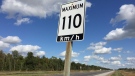
'I think 110 is fast enough': Speed limit to increase on some sections of 400 series highways
The speed you travel on sections of 400 series highways in our region is increasing. The province says it will raise the speed limit to 110 km/h on multiple sections, including some in the London region.
-
Nuclear waste referendum date set for October
Residents in the Municipality of South Bruce will decide whether they want to host Canada’s first permanent nuclear waste storage facility this October.
-
How do U.S. decisions about TikTok impact Canada?
U.S. President Joe Biden has signed a bill that will force TikTok to be sold or be banned in his country, but what does it mean for Canada?
Windsor
-
 BREAKING
BREAKING Convicted killer can ask for parole now: Windsor, Ont. jury accepts 'faint hope' application
A Windsor man convicted in a violent murder 20 years ago was successful in his ‘faint hope’ bid for an early chance at freedom after a jury agreed he should be given the chance to apply for early parole eligibility.
-
Essex concert series needs to pay its performers, say local musicians
If musicians are the sole focus of a commercial event, those performers should be paid for their efforts. That's according to a local musician who set up an online petition after the Town of Essex issued a call for artists to perform at their annual summer concert series for free.
-
Witnesses sought after Porsche and motorcycle collide
The Windsor Police Collision Reconstruction Unit is looking for witnesses after a collision involving a motorcycle and a Porsche.


