
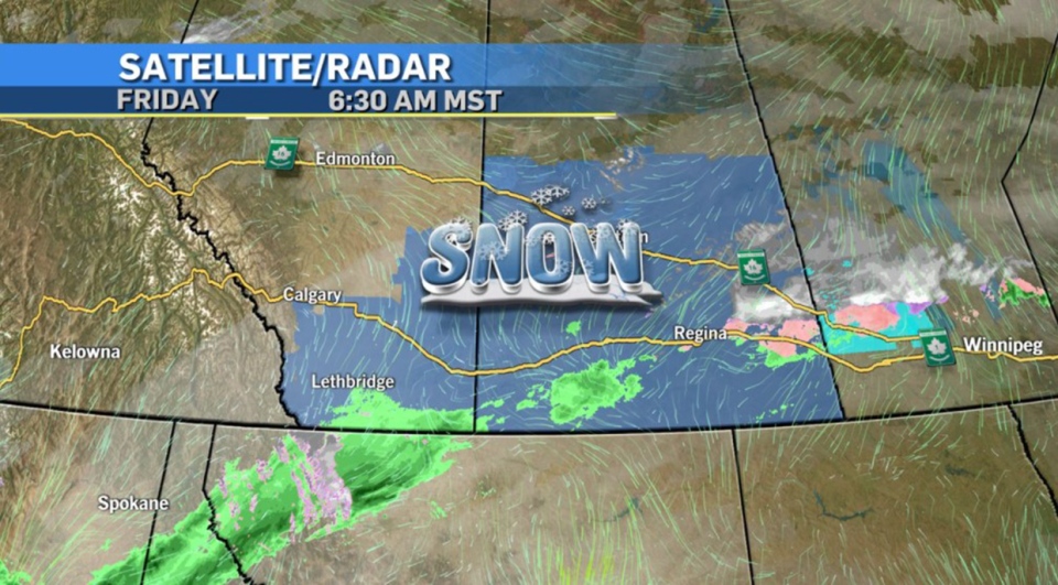
CALGARY -- For the past few days, we've been eyes-up on the winter storm that's on its way to Canada. The low that David Spence was projecting to form and roll through northern Wyoming and Montana will indeed come to pass and provide the second of a one-two snowy punch in our province, preceded by the exit region of a steep trough piling in an initial wave off the Pacific.
Here's Environment Canada's full assessment:
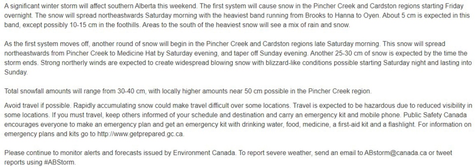
<EnvCan>
We're pretty par for that course for now, but we're still seeing some model inconsistency. Some forecast models are projecting Calgary getting a skiff (0-3 cm). The majority of forecast models (GEM, ECMWF, NAM) keep Calgary under 10 cm, but the RPM (the Air Force/NOAA's model) pushes us closer to 12 cm.
The model runs that push us to 10 cm are those most closely matching Environment Canada's assessment. Quite a few model runs show the drop-off across the board, but the process of snow along this Colorado Low could bring significant totals along that band from the southwest of the prairies right across the northeast.
The strength of this trough is also going to pull in a wave of cooler air, and we should expect our temperatures to embody that for parts of the weekend.
Here's the five-day forecast:
Today:
- Mainly cloudy
- Daytime high: 6 C
- Evening: flurries, low -2 C
Tomorrow:
- Flurries, variable snow (5-10 cm)
- Daytime high: 0 C
- Evening: snow, low -10 C
Sunday:
- Flurries
- Daytime high: -6 C
- Evening: mainly cloudy, low -11 C
Monday:
- Partly cloudy
- Daytime high: 0 C
- Evening: building cloud, low -2 C
Tuesday:
- Snow! 5-10 cm again
- Daytime high: 1 C
- Evening: ongoing snow, low -9 C
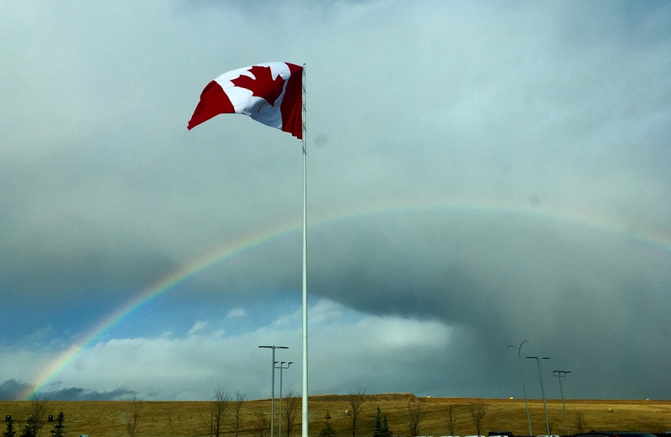
We had some showers yesterday, and Terrance caught the best part of it!
You can submit your weather photos here.


