
CALGARY -- Today is an enhanced storm potential day in parts of Alberta, including Calgary, as storms are potentially rolling off the foothills around the dinner hour.
We’re entering the lee region of a trough, which is precisely where air is given opportunity to rise. Today, we’ll see that rising process occur at two key moments: first, right as the trough strengthens, and second, near our peak highs for the day. We will have a very strong zone of uplift, with bulk shear potentially reaching 60 knots. That means there is a strong vertical profile of moving air; if storms are going to develop, anything above 40 knots usually translates to the development of supercells.
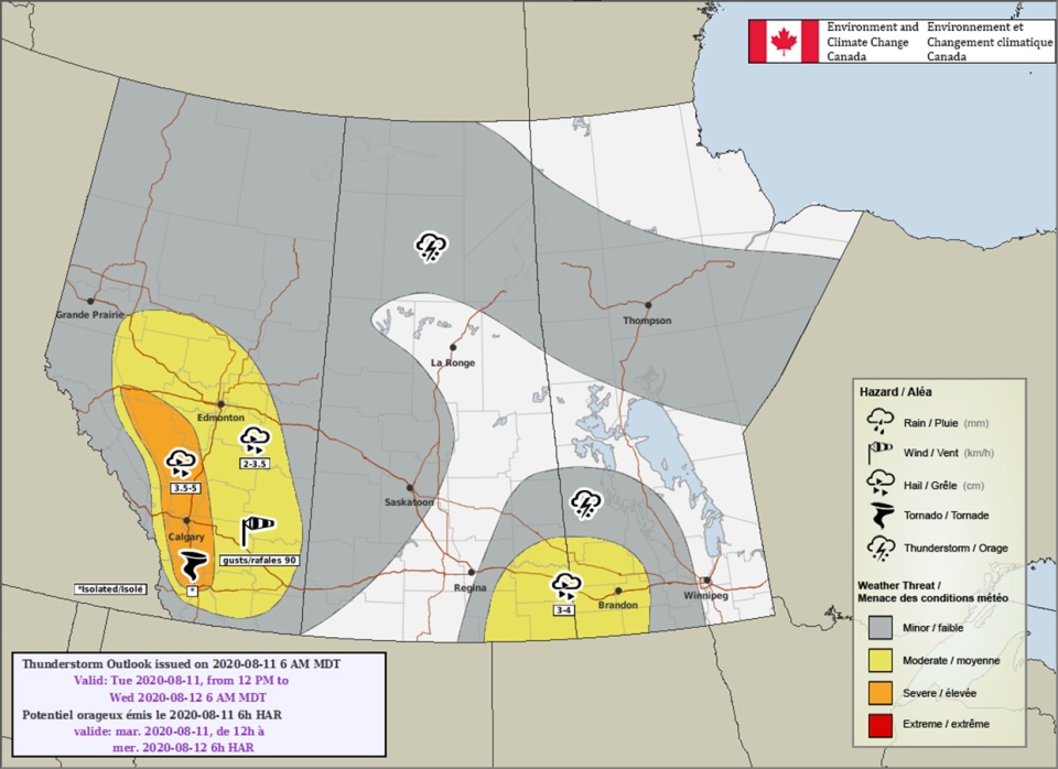
Environment Canada's Thunderstorm Outlook for Aug. 11, 2020
As I said, the best potential for this is along the foothills and thereafter; this rapid rise in air means the possibility of tornado development cannot be overlooked either. Hailstones between 3.5 cm and five cm isn’t out of the question where that rapidly rising air exists, either, as it allows hail to stay in the growth zone for longer, and for those hailstones to get larger.
Here’s the five-day forecast:
Today
- Partly cloudy, chance for afternoon storms
- Daytime high: 22C
- Evening: some cloud, low 10C
Wednesday
- Mainly sunny
- Daytime high: 19C
- Evening: some cloud, low 7C
Thursday
- Mainly sunny
- Daytime high: 22C
- Evening: some cloud, low 8C
Friday
- Partly cloudy
- Daytime high: 22C
- Evening: mainly clear, low 7C
Saturday
- Mainly sunny
- Daytime high: 19C
- Evening: mainly clear, low 8C
<Michelle>
Michelle sent this lovely shot of our sunrise this morning!
You can submit your weather photos here!


