
CALGARY -- As with yesterday, that troughing motion aloft is going to swing in toward us. Today, we'll experience a period of marginal instability, which could result in not only spotty showers, but also periods of isolated storms; they'd be short-lived, a little loud, and pass quickly. Can we start calling them "toddler tantrums?"
Areas west of the city could see some light flurries, which may equate to a full centimetre in areas. Melting temperatures will make short work of it.
The rest of the week is going to ride a wave of west wind aloft. Surface conditions enter a "pressure neutral" zone, largely dominated by weak high pressure areas that won't do much to inhibit showers.
I'll say again and always – isolated showers (even thundershowers) aren't enough. Here, making its triumphant return, the fire ban outlook:
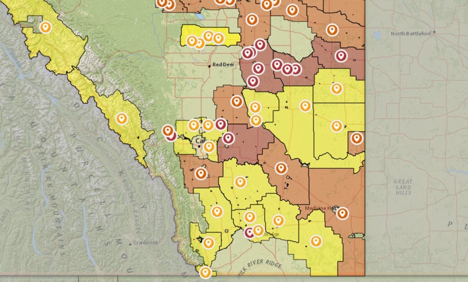
Wildfires west of Tomahawk, Alta. have prompted an air quality advisory for the neighbouring community of Spruce Grove. The latest updates have it under control.
Your five-day forecast:
Today:
- Partly cloudy, afternoon and evening shower/storm potential
- Daytime high: 13 C
- Evening: storm risk, low 3 C
Wednesday:
- A mix of sun and cloud
- Daytime high: 17 C
- Evening: some cloud, low 7 C
Thursday:
- Partly cloudy, evening shower potential
- Daytime high: 18 C
- Evening: another chance of showers, low 8 C
Friday:
- Mainly sunny, afternoon and evening shower potential
- Daytime high: 20 C
- Evening: another chance of showers, low 7 C
Saturday:
- Mainly sunny
- Daytime high: 21 C
- Evening: another chance of showers, low 6 C
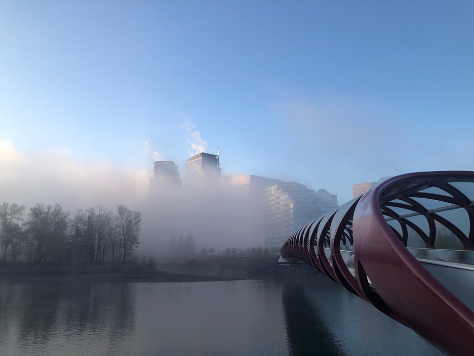
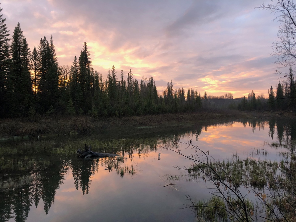
Two photos today:
Katherine caught a cool, misty sunrise after yesterday's fog:
And Ryan brings in this excellent nature shot, taken at Weaselhead Flats
You can submit your weather photos here, or email me: Kevin Stanfield , OR you can just tweet at me!


