
CALGARY -- We'll happily take a half-day off from snow
It's barely respite, but it's the best we can do. Pulling some focus into yesterday's event…
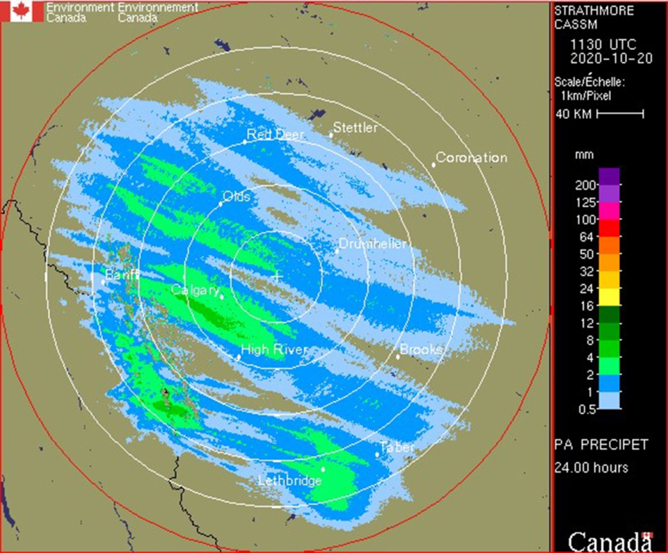
Snow is a tricky one. This radar shows off our precipitation total as precipitable water, which is to say, "how much moisture made it to the ground". The thing is, it didn't exactly come down as water, since our temperatures were strictly in the negatives. Liquid-to-snow ratio is a measurement of the snowfall depth per millimeter of this precipitable water. This all to say, that 4 mm converted to nearly 4 cm of reasonably wet snow across a wide swathe of the greater Calgary area, with an under-layer of icy patches in a few spots. Drive safe!
Moving into the next few days, were facing off-and-on snow showers, coupled with a heavier event Friday into Saturday, where we will see the majority of a "10 cm week" wrap up.
A weak low-pressure area is responsible for any warming we get today, and repositions us to southerly wind. By tomorrow, we're plunging once again, and farther based on our upper air pattern. We’re going to be dropping off into the negatives for a few days.
Here's the five-day forecast:
Today:
- Late scattered snow showers, otherwise partly cloudy
- Daytime high: 3C
- Evening: some cloud, low -6C
Tomorrow:
- Mainly cloudy, scattered snow showers
- Daytime high: -3C
- Evening: scattered flurries, low -12C
Thursday:
- Scattered flurries
- Daytime high: -8C
- Evening: scattered flurries, low -13C
Friday:
- Evening snow
- Daytime high: -10C
- Evening: cloudy, low -13C
Saturday:
- Morning snow
- Daytime high: -9C
- Evening: clear, low -11C
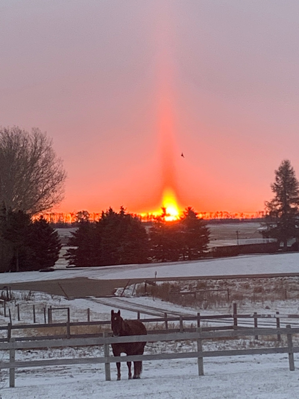
Marlene caught this amazing sunset northeast of Strathmore.
You can submit your snowy weather photos here.


