
CTV News Calgary Meteorologist Kevin Stanfield compares weather conditions over the next few days to those in 2013.
To start, a disclaimer: drive according to conditions, commit to activities according to conditions. It feels necessary to include that as we dive in, just to translate the language away from establishing a difference in conditions over the next day and a half.
We’ll start in 2013. That was a 100-year-flood, with high pressure in northern Alberta and low pressure in southern Alberta combining into a Rex Block, the pattern pictured below:
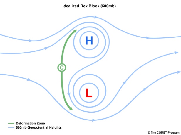
Note the direction of flow between these elements: it’s moving from the northeast to the southwest, and through a moisture-packed low and into upslope flow along a field of snow at higher elevations that “started near Thanksgiving and didn’t stop until after Easter”, when the rain developed, it “melted up to 60 cm of snowpack” (Source).
That source above also notes rainfall totals that were similar in Calgary to what we’ll likely end up dealing with by the end of this system (~68 mm).
Technical elements aside, here are the bullet points that led to the 2013 Flood.
- Heavy snowpack in the Rockies melting down
- Consistent precipitation for nearly 60 hours around and to the west of Calgary
- Overrun river basins
This year, our snowpack at this time was below seasonal averages. This is from data in this BC River Forecast Centre report from May 15, 2019. A snippet: “Along with 2015 and 2016, this year is amongst the lowest May 15th snowpacks that have been observed in BC over the past 40 years”
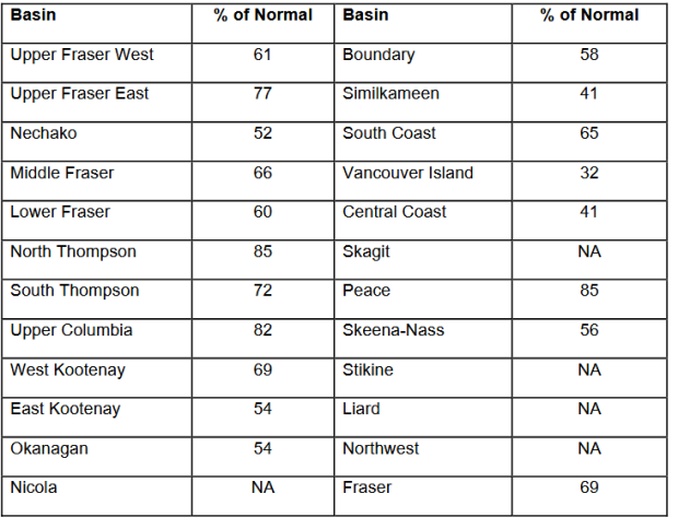
Boiled-down, it suggests that those early periods of above-average warmth in the spring caused considerable enough melting to leave Alberta’s river basins flowing well below normal, though this recent rash of rain has assisted with normalization. Here are some of our river basins, as listed by name through Alberta River Basins:
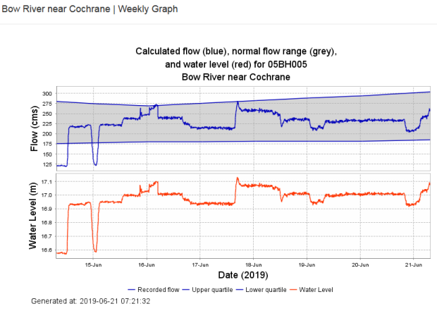
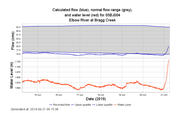
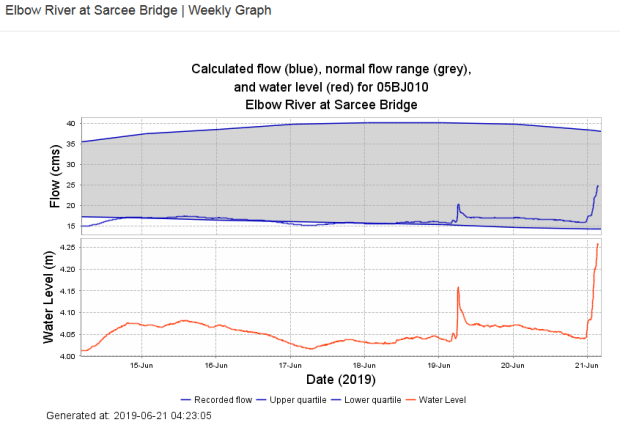
While you can see a significant spike in water level and flow (by cubic meters per second), it’s merely pushing toward a mid-range normal; the upper quartiles (~75%) is still a ways off for these basins.
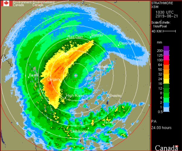
As far as event duration is concerned, we started to see rainfall building yesterday and all models point to the heaviest bands wrapping up this evening and overnight tonight. Below, a model showing our rainfall from a 0430-0430 period between the 20th and 21st this year indicates heavy pockets that push above 64 mm of rain, which is consistent with 2013’s event, but in 2013, as noted above, rainfall was consistent for a period that essentially over doubles our current projections.
This very well could tax southwestern Alberta’s reservoirs at times, but cumulatively is substantially weaker than 2013’s event. Localized flooding has already occurred, and we’ll be keeping a watchful eye on these developments as the day progresses.
For updated information regarding weather warnings and watches, visit Environment Canada – Public Weather Alerts.


