Cooler conditions to ring in the new year

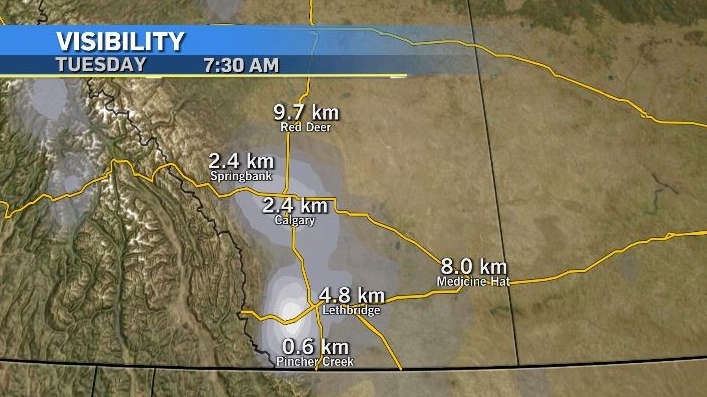
Similar to Monday, light flurries fell across portions of southern Alberta early Tuesday morning and that, combined with cooler temperatures and little to no wind, compromised visibility.
As of 7:30 a.m. Tuesday, the visibility at the Calgary International Airport and in Springbank was 2.4 kilometres, 4.8 kilometres in Lethbridge and less than a kilometre of visibility reported in Pincher Creek.

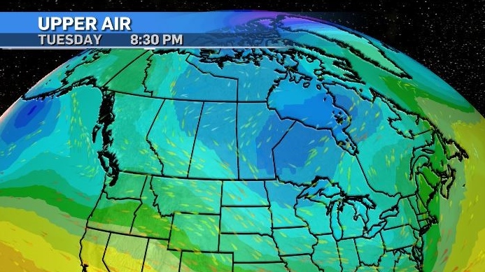
Light and scattered flurries will continue throughout the day in Calgary and surrounding communities as that same northwest to southeast flow continues across the province.
A low-riding jet stream will enhance a cooler pattern and suppress temperatures across much of the country on New Year’s Eve and for the start of 2025.

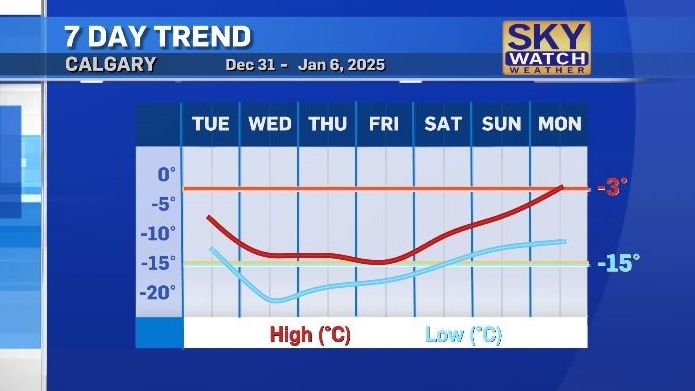
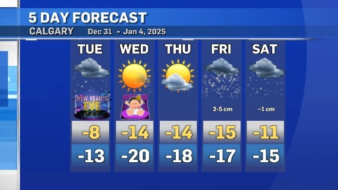
In Calgary, a totalof two to four centimetres of snow is forecast for Tuesday into Wednesday, with temperatures expected to continue to fall, so that Wednesday’s high will occur before sunrise.
Daytime highs in Calgary will remain closer to average overnight low temperatures for the end of the week, and low temperatures will drop down to -20 C.

More snow is expected in the eastern B.C. interior on Thursday before tracking along the southern Alberta border on Friday.
Seasonal conditions will resume in Calgary by early next week.

CTVNews.ca Top Stories

NEW When do I receive federal benefits this year? Payment dates for 2025
From the Canada Child Benefit to Old Age Security, federal payment dates have been determined for 2025. Find out when you can expect your payments.
opinion Trump in 2025: A fluid and fragile global landscape awaits the president-elect
The road ahead for U.S. President-elect Donald Trump is fraught with peril, and the landmines that await could severely undermine his ambitions amid the slightest miscalculation, writes Washington political analyst Eric Ham in his column for CTVNews.ca.
Canada crashes out of world juniors in quarterfinals for second straight year
Canada has been eliminated from the world junior hockey championship with a 4-3 loss to Czechia in the quarterfinals.
Pickering pausing in-person meeting due to alt-right threats, mayor says
Pickering Mayor Kevin Ashe says the city is pausing all in-person meetings, moving them to a virtual format, for the time being due to “alt-right” threats.
Athabasca 'chop shop' bust yields millions in stolen vehicles, heavy equipment: RCMP
RCMP have made what they call a "major recovery" of stolen property in Athabasca.
2 dead and 18 injured in Southern California plane crash
Two people died and 18 were injured Thursday when a small plane crashed through the roof of a sprawling furniture manufacturing building in Southern California where at least 200 people were working, police said.
Toys "R" Us Canada closing 5 stores, expand HMV and add play spaces to some shops
Toys 'R' Us Canada says it is closing five Ontario stores and revamping several others as it works to 'optimize' its business.
Wayne Osmond, singer and guitarist for The Osmonds, is dead at 73
Wayne Osmond, a singer, guitarist and founding member of the million-selling family act The Osmonds, who were known for such 1970s teen hits as 'One Bad Apple,' 'Yo-Yo' and 'Down By the Lazy River,' has died. He was 73.
Grieving orca mother Tahlequah carries dead baby for the second time
The famous mother orca who made waves around the world for carrying her dead calf for 17 days has suffered another tragic loss.


