The rain should clear out in the afternoon but you can expect a cooler day on Friday
Thursday was a very active weather day in parts of central and southern Alberta.
Just before noon, storms started to develop near Cremona.
As they tracked east, the area of instability intensified.
There was a strong downburst from a thunderstorm creating damaging winds near Crossfield.
Then, pea-sized hail north of Hanna.
Funnel clouds were reported near Youngstown.
Also lots of lightning with these cells.
Friday, most of the thunderstorm risk will be for areas south of Lethbridge, and a small risk for Calgary and west near the supper hours.
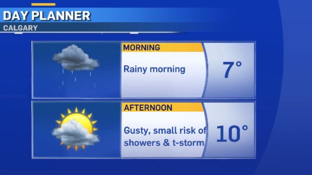
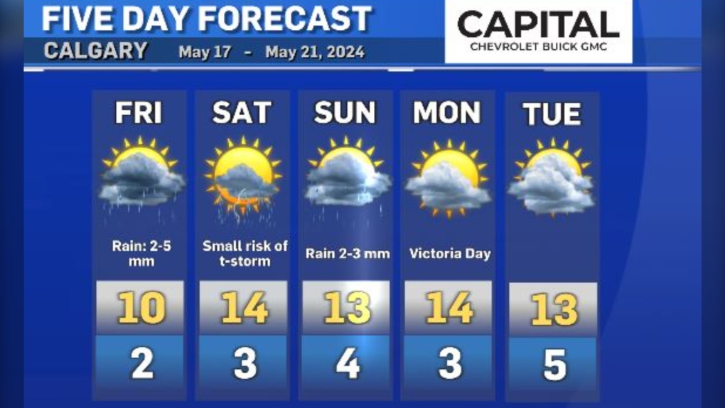
In Calgary, the rain Thursday night will carry into Friday morning, then clear out for much of the afternoon.
There is a small chance of a couple of raindrops returning near the supper hours.
Be prepared for a cooler day on Friday, with a high of just 10 C.
Saturday will be stable for much of the day with sun and cloud.
Rain will return on Sunday, clearing out again on Monday (but likely still mainly cloudy for much of Monday).
Daytime highs will be in the low teens for May Long, and the overnight lows and morning temperatures will be chilly, ranging from 2 to 4 C.
It will also likely be a little smoky on Friday and Saturday, bringing us to moderate on the Air Quality Health Index.
CTVNews.ca Top Stories

BREAKING Plane burst into flames after skidding off runway at an airport in South Korea, killing at least 28
A plane burst into flames after veering off a runway at an airport in South Korea on Sunday, killing at least 28 people on board, emergency officials said.
Canadian model Dayle Haddon dies from suspected carbon monoxide poisoning
Dayle Haddon, an actor, activist and trailblazing former 'Sports Illustrated' model who pushed back against age discrimination by reentering the industry as a widow, has died in a Pennsylvania home from what authorities believe was carbon monoxide poisoning.
Trump appears to side with Musk, tech allies in debate over foreign workers roiling his supporters
U.S. president-elect Donald Trump appears to be siding with Elon Musk and his other backers in the tech industry as a dispute over immigration visas has divided his supporters.
Mississauga tow truck driver charged for impersonating a cop in northern Ont.
A southern Ontario resident has been charged for allegedly impersonating a peace officer during a towing incident in northwestern Ontario.
Vancouver man defrauded Chinese developers of US$500K, court rules
A Vancouver man has been ordered to pay more than US$500,000 after a B.C. Supreme Court judge found he had defrauded the would-be developers of a real estate project in China of that amount.
15 hurt when passenger train strikes fire truck that drove into crossing after freight train passed
Three firefighters and a dozen passengers were injured in Florida on Saturday when a fire truck drove around rail crossing arms and into the path of a high-speed passenger train after waiting for another train to pass, according to a person briefed on what happened.
G2 driver stopped going more than 100 km/h over the speed limit on Hwy. 401 in eastern Ontario
A 17-year-old driver is facing charges after being caught speeding and driving dangerously on Highway 401 in eastern Ontario Friday evening, according to the Ontario Provincial Police (OPP).
If you're mentally struggling during the holidays, here’s how to cope
For many people, celebrating New Year’s Day can include reflecting on a life well lived or a chance to start anew. But for some, the holiday may have dark undertones, according to a recent large study.
Physical therapy is 'the best-kept secret in health care'
If you think physical therapy is only about rehabilitation after surgery or recovering from an accident, think again. For the vast majority, seeing a physical therapist should be about prevention, routine assessment and staying well.


