A fair weekend for Calgary; next week is wintry
As we pull up to the end of the week, we remain on the precipice of a rather significant shift – yesterday, Ian White said on CTV News at Five that we were set to pay our dues. He's very correct.
Wind warnings are in place for southwestern Alberta due to downslope wind gusts (Waterton Park Gate has gusts on their hourly report in the high 80s near midnight). This warm, west wind plays driver once again for a temperature shift in the local forecast, as Calgary faces gusts in the 40s today and tomorrow to help out.
Sunday, those gusts could reach the 50s, but thereafter will turn from the north and open us up to early-morning snow beginning Monday. The snowfall total range across modeling platforms is lingering between 12 and 20 centimetres, but, because it's coming straight from the north, there is potential for this wave to enhance due to upslope flow; the precipitation climbs higher and higher off of the foothills, and totals enhance as the airmass cools.
Enjoy the weekend – it’s cooler from here!
YOUR FIVE-DAY CALGARY FORECAST
Friday
- Evening: some cloud, low -7 C
Saturday
- Partly cloudy, chance of flurries
- Daytime high: 2 C
- Evening: some cloud, low -5 C
Sunday
- Mainly cloudy
- Daytime high: 7 C
- Evening: snow showers, low -3 C
Monday
- Snow
- Daytime high: -2 C
- Evening: snow, low -15 C
Tuesday
- Snow
- Daytime high: -14 C
- Evening: snow showers, low -22 C
Wednesday
- Flurries
- Daytime high: -16 C
- Evening: snow showers, low -25 C
Roy snapped this pic yesterday morning at sunrise southwest of Calgary:
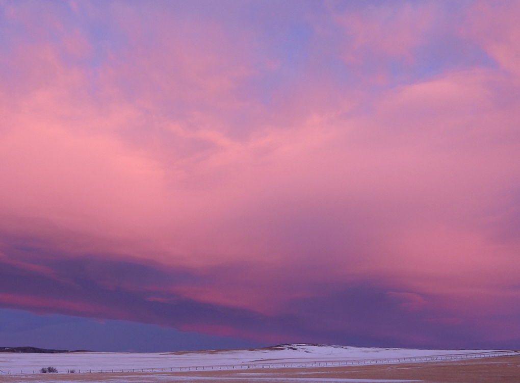 Viewer Roy captured Thursday's sunrise in southwest Calgary.
Submit your weather photos here to see them featured in our article, and perhaps even as the pic of the day during our News at Six! You can also share on Twitter, or to our Instagram at @CTVCalgaryWeather.
Shopping Trends
The Shopping Trends team is independent of the journalists at CTV News. We may earn a commission when you use our links to shop. Read about us.


CTVNews.ca Top Stories

Driver who entered Canada 'without stopping' at B.C. border crossing arrested: police
A man who illegally blew through the Canada-U.S. border crossing in Surrey, B.C., Sunday morning has been arrested, according to authorities.
Man responsible for New Year's truck attack previously visited New Orleans, Ontario, Egypt: FBI
The man responsible for the truck attack in New Orleans on New Year's Day that killed 14 people visited the city twice before and recorded video of the French Quarter with hands-free glasses, an FBI official said Sunday.
Thousands are without power due to winter storm hitting Newfoundland and Labrador
Massive waves slammed Newfoundland and Labrador's coastline on Sunday, as a powerful winter storm left thousands without power.
Pamela Anderson, Ryan Reynolds among Canadians vying for Golden Globes tonight
Tonight’s Golden Globes will feature a strong Canadian presence, with British Columbia actors Pamela Anderson and Gabriel LaBelle among the first-time nominees.
'It was just devastating': Southern Manitoba golf course clubhouse burns for second time in 4 years
A golf course clubhouse in Morden, Man. went up in flames Sunday for the second time in less than four years, and mere days after its reopening from the previous fire was celebrated.
WATCH
WATCH Woman critically injured in explosive Ottawa crash caught on camera
Dashcam footage sent to CTV News shows a vehicle travelling at a high rate of speed in the wrong direction before striking and damaging a hydro pole.
Maserati driver critically injures one, seriously injures another in Surrey hit-and-run: police
The driver of a Maserati fled the scene of a high-speed crash in Surrey that sent two people to hospital, one in critical condition on Saturday night, according to authorities.
Motocross rider injured after executing jump during North American International Motorcycle Supershow
Christian Martinez, a motocross rider participating in the North American International Motorcycle Supershow in Mississauga, was rushed to the hospital after executing a big jump during the show, a source tells CP24.
Here’s why you should monitor your blood pressure, keep it in check
An Ottawa pharmacist says blood pressure is a good indicator of overall health, noting the importance of keeping it at healthy rates.
Edmonton
-

Premier Smith weighs in on promised tax cut
The start of a new year has renewed inquiries about when Albertans can expect the UCP to deliver on its promised tax cut.
-
'Flames were shooting higher than the garage': Block heater cords cause 2 fires in 2 days in Edmonton
Peter Claffey was shocked Thursday morning to find his truck in flames outside his southwest Edmonton home.
-
Oilers pounce on Kraken early en route to 4-2 win
Vasily Podkolzin and Jeff Skinner scored in the first 5 1/2 minutes and the Edmonton Oilers beat the Seattle Kraken 4-2 on Saturday night for their third straight victory.
Lethbridge
-

Oil Kings jump out to quick start as they beat Hurricanes 5-2 in Edmonton
The Edmonton Oil Kings came roaring out of the gate Saturday night against the Lethbridge Hurricanes, building a 2-0 first-period lead en route to a 5-2 win.
-
Family of hospitalized Lethbridge man in Thailand reach out for support
The family of a Lethbridge man is reaching out to the public for help after he suffered a series of medical emergencies while travelling in Thailand.
-
Checkstop Campaign ends in Lethbridge with 10 impaired drivers removed from the road: police
The Lethbridge Police service concluded its annual Checkstop Campaign over the holiday season, resulting in the removal of 10 impaired drivers from the road.
Vancouver
-
Driver who entered Canada 'without stopping' at B.C. border crossing arrested: police
A man who illegally blew through the Canada-U.S. border crossing in Surrey, B.C., Sunday morning has been arrested, according to authorities.
-
No one home at site of 28th floor condo fire in Vancouver, officials say
Vancouver fire investigators are poring over a condominium in the Woodward's building in Gastown after firefighters found flames in the suite with no one inside.
-
Maserati driver critically injures one, seriously injures another in Surrey hit-and-run: police
The driver of a Maserati fled the scene of a high-speed crash in Surrey that sent two people to hospital, one in critical condition on Saturday night, according to authorities.
Vancouver Island
-

Driver dead after collision with construction vehicle in Saanich, B.C.
A driver is dead after colliding with a construction vehicle in Saanich Friday night.
-
B.C. man ordered to pay damages for smashing Smart car window during road rage incident
A man who smashed the window of a woman’s Smart car during a road rage incident with a former co-worker has been ordered to pay $1,245 in damages by the B.C. Civil Resolution Tribunal.
-
Pamela Anderson, Ryan Reynolds among Canadians vying for Golden Globes tonight
Tonight’s Golden Globes will feature a strong Canadian presence, with British Columbia actors Pamela Anderson and Gabriel LaBelle among the first-time nominees.
Saskatoon
-

Saskatoon's Forestry Farm goes dark after successful enchanted forest run
That's a wrap on the 26th annual BHP Enchanted Forest, which illuminated the holidays for more than 80,000 visitors from around Saskatchewan this year.
-
$20k of equipment stolen from rural Sask. Fire hall. And it's not the only one
Rural firehalls surrounding Saskatoon are having to deal with escalating thefts that could put rescue efforts in jeopardy.
-
Two people charged with murder after suspicious death on Sask. First Nation
A man and a woman have been charged with first degree murder after a 24-year-old man died of injuries on Saulteaux First Nation.
Regina
-

Regina Fire investigating Toronto Street blaze
Regina Fire and Protective Services (RFPS) are investigating following a blaze on Toronto Street Saturday.
-
Family of man shot by Hamilton police hold vigil and rally in Regina
The family and community of a man shot by police in Hamilton in November continue to seek answers surrounding the circumstances of his death.
-
Regina woman turns to social media to find donor match for kidney transplant
A Regina woman currently waiting for a kidney transplant is now seeking a donor through a social media post.
Toronto
-

Fire near Toronto Pearson not impacting operations: airport
A two-alarm fire near Toronto Pearson International Airport is not impacting the airport's operations.
-
TTC special constables to wear bodycams starting on Monday
The TTC’s special constables will be wearing body-worn cameras starting on Monday, followed by the fare inspectors by the end of February, the service told CTV News.
-
Motocross rider injured after executing jump during North American International Motorcycle Supershow
Christian Martinez, a motocross rider participating in the North American International Motorcycle Supershow in Mississauga, was rushed to the hospital after executing a big jump during the show, a source tells CP24.
Montreal
-

Elvis Gratton actor Julien Poulin has died at 78
Actor Julien Poulin passed away at the age of 78 on Saturday.. Born in Montreal on April 20, 1946, Poulin appeared in some 100 films. His most memorable role was certainly that of Bob Gratton in the cult classic trilogy 'Elvis Gratton', directed by his friend Pierre Falardeau.
-
These Quebec border crossings will have new hours of operation tomorrow
The hours of operation at 10 Quebec border crossings will change as of 12:01 a.m. on Jan. 6, 2025.
-
Hold the sauce! Dry January continues to gain popularity
Dry January has become more and more popular as people of all ages make the healthy lifestyle choice to start the year.
Atlantic
-

Second aircraft emergency in a week at Halifax Stanfield International Airport
An aircraft inbound for Halifax reported cabin pressure issues and triggered an emergency response.
-
RCMP in Lunenburg, N.S., investigating two suspicious deaths
Lunenburg District RCMP is investigating two suspicious deaths at a residence in Mahone Bay, N.S.
-
Shots fired in Cole Habour, N.S.
RCMP is investigating after shots were fired in the area of Amaranth Crescent in Cole Harbour, N.S.
Winnipeg
-

'It was just devastating': Southern Manitoba golf course clubhouse burns for second time in 4 years
A golf course clubhouse in Morden, Man. went up in flames Sunday for the second time in less than four years, and mere days after its reopening from the previous fire was celebrated.
-
Manitoba's top baby names for 2024
Manitoba’s top baby names remained mostly unchanged for 2024, though some new contenders made their way into the top 10.
-
Winnipeg firefighters battle 3 block heater blazes in 12 hours
On Saturday, Winnipeg Fire Paramedic Service crews fought three different fires in less than 12 hours, all believed to be accidentally caused by a block heater.
Ottawa
-

Here's how you can watch CTV News at Six on Sundays during the NFL season
With CTV broadcasting NFL football games on Sundays this season, CTV News at Six will be broadcasting live on our website and the CTV News App.
-
Officials reflect on successful world juniors on final day of tournament
The final games of the 2025 World Junior Championship (WJC) will be played Sunday at the Canadian Tire Centre.
-
WATCH
WATCH Woman critically injured in explosive Ottawa crash caught on camera
Dashcam footage sent to CTV News shows a vehicle travelling at a high rate of speed in the wrong direction before striking and damaging a hydro pole.
Northern Ontario
-

Suspect charged in northern Ont. road rage incident that went viral
A 37-year-old suspect has been charged in connection with a road rage incident last week in Temiskaming Shores.
-
Mark Carney reaches out to dozens of Liberal MPs ahead of potential leadership campaign
Mark Carney, the former Bank of Canada and Bank of England governor, is actively considering running in a potential Liberal party leadership race should Justin Trudeau resign, sources tell CTV News.
-
MNR renews call for help with investigation of abandoned cow moose killed in northern Ont.
Conservation officers with the Ministry of Nature Resources are again asking for the public’s help with identifying those responsible for killing a cow moose near Chapleau, Ont.
Barrie
-

Snowmobiler seriously injured in Saturday crash
A snowmobiler reportedly suffered serious injuries after losing control on a trail in Tay Township Saturday afternoon.
-
Truck driver charged in Saturday Highway 11 crash
A truck driver was charged after crashing his tractor trailer on Highway 11 south of Orillia Saturday evening, which led to the temporary closure of all southbound lanes for several kilometres.
-
Icebreaker expected to arrive in Southern Georgian Bay
The Canadian Coast Guard is advising residents in Midland that an icebreaker ship will be arriving in the Georgian Bay area this week to carry out icebreaking operations.
Kitchener
-

Kitchener man arrested after police said he approached bylaw officers with a knife
A Kitchener man has been arrested after Waterloo Regional Police Service said he threatened bylaw officers while holding a knife.
-
Vacancy rate in Kitchener-Cambridge-Waterloo hits highest level since 1993: report
Vacancy rates in Waterloo Region are growing, but low-income earners may still have trouble finding a place to live.
-
Teen allegedly clocked driving 134 km/h in 80 km/h zone
A teenager has lost his licence for at least 30 days after police said he was caught speeding in Waterloo.
London
-

'$60K and 11 wins': London father-daughter duo win major award from Western Fair Raceway
Every morning, Shae Sumner is in the barn taking care of the first horse she’s ever owned.
-
Homicide investigation underway in Durham
The West Grey Police Service is investigating a stabbing that took place in Durham.
-
Suspect attacks stranger, multiple charges laid: SPS
Multiple charges have been laid against a suspect in a Sarnia assault.
Windsor
-

'Crawl bearers' carry mosaic bar top 2 km to new home
In a move signaling the beginning of a new era, staff and patrons carried Phog Lounge’s approximately 400-pound mosaic bar top through the downtown.
-
Two armed robbery suspects at large, second arrested
The Windsor Police Service has arrested a second of four armed robbery suspects. Two remain at large.
-
Windsor Lancers take on China in exhibition hockey matchup
The University of Windsor Lancers men’s hockey team and the Chinese National Team hit the ice Saturday night in an unusual matchup.


