Fall-like temperatures all week in Calgary

CALGARY -
After a lovely high-pressure weekend, we start to transition out later today. Wind will strike out of the southeast today, gusting toward 40 km/h and pressing in cooler conditions in the process. The upper ridge above will blow away today, replaced by an upper trough. The curtain of warmth we've been behind for days will go away with it.
The trough is expected to pull some moisture along, too – tomorrow, the weak disturbance it causes may play culprit for thundershowers in our area. Pacific moisture attached to this low will run its course by Wednesday, leaving us instead with benign cloud and cooler temperatures to close the week.
This airflow pattern, as I described last week, is meridional flow; it's a pattern of small-to-moderate troughs and ridges in alternating cycles, which will trigger three-to-four-day cycles of cooler temperatures (often with showers out of the gate, a la Tuesday and Wednesday), followed by a similar length in seasonal and above-seasonal conditions.
YOUR FIVE-DAY FORECAST:
Today:
- Windy – 20 km/h, gusting to 40 km/h, mainly sunny building to partly cloudy
- Daytime high: 24 C
- Evening: some cloud, low 10 C
Tuesday:
- Showers, storm risk, some sun still!
- Daytime high: 17 C
- Evening: mainly cloudy, low 6 C
Wednesday:
- Scattered showers
- Daytime high: 16 C
- Evening: chance of showers, low 7 C
Thursday:
- Partly cloudy
- Daytime high: 17 C
- Evening: some cloud, low 5 C
Friday:
- Partly cloudy
- Daytime high: 16 C
- Evening: clear, low 6 C
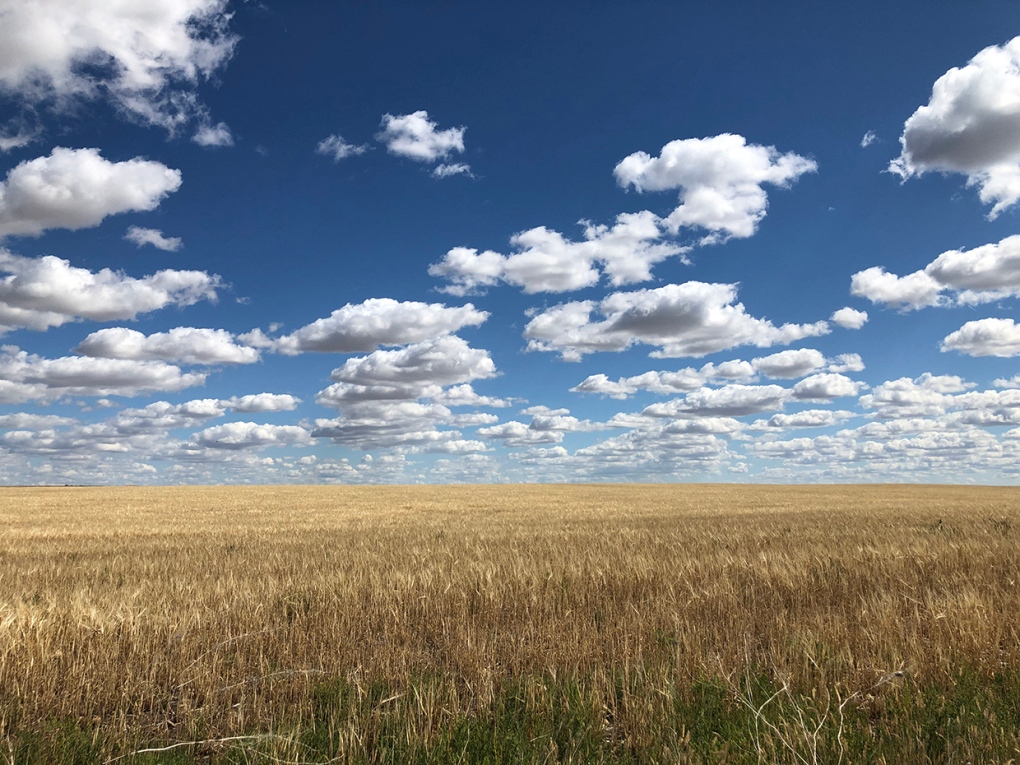
Photo time!
A couple of great ones from the sunrise this morning:
Thanks for this one, JD. He knows where to find me, like clockwork on a beautiful sunrise!
Lastly, one from the weekend, as Mark caught this lovely photo.
Thanks, all! You can submit your photos here, email me directly here, or tweet them over!
Shopping Trends
The Shopping Trends team is independent of the journalists at CTV News. We may earn a commission when you use our links to shop. Read about us.


CTVNews.ca Top Stories

NEW
NEW Federal Liberals to pick new leader on March 9 as rules for leadership race are defined
The Liberal Party of Canada have announced leadership race rules late Thursday, including a significant increase in entrance fees and a requirement for voters to be Canadian citizens.
Canada’s unemployment rate ticks down
Canada’s unemployment rate was 6.7 per cent in December, down 0.1 percentage points from the previous month.
Canadian 'Super Scooper' plane grounded after hitting civilian drone over Los Angeles wildfires
A Canadian “Super Scooper” aircraft fighting the Palisades Fire in Los Angeles had to be grounded after it hit a drone flying in restricted airspace over the devastating blaze on Thursday, the local fire department said.
NEW
NEW Why four Canadians traded their traditional office space for a life on the road
CTVNews.ca asked Canadians who've embraced the digital nomad lifestyle, or have done so in the past, to share their stories — the challenges, triumphs and everything in between.
NEW
NEW Five ways homeowners can protect themselves from contractor fraud
Building or renovating a home can be one of the biggest expenses of one's life. It's costly, and potentially even more expensive if something goes wrong. Between 2022-24, the Better Business Bureau (BBB) received hundreds of complaints about general contractors in Canada.
US$1-billion Dubai skyscrapers to be linked by daring rooftop pool
Two new 591-foot-tall skyscrapers, linked across the top by a daring “sky pool,” are set to rise above Dubai’s Marasi Marina.
Liberals will remove 'fraudulent' memberships, as some register their pets to vote
A federal Liberal spokesman says the party can and will remove "fraudulent profiles" from its list of electors eligible to vote for its next leader.
Wildfires are a threat to mental health that can linger even years later
Uncertainty about losing a home or a neighbourhood is one factor, studies have showed, that can contribute to an increase in mental health problems among people who experience wildfires.
Is the Hollywood sign on fire?
As fires scorch Los Angeles, fake images and videos of a burning Hollywood sign have circulated on social media.
Edmonton
-
NEW
NEW Federal Liberals to pick new leader on March 9 as rules for leadership race are defined
The Liberal Party of Canada have announced leadership race rules late Thursday, including a significant increase in entrance fees and a requirement for voters to be Canadian citizens.
-
Five hurt in Red Deer industrial fire
Five people are in hospital following an explosion Thursday at a Red Deer industrial site.
-
Penguins run up score early in win over visiting Oilers
Sidney Crosby had a goal and two assists to move into ninth on the NHL's career scoring list as the Pittsburgh Penguins beat Connor McDavid and the Edmonton Oilers 5-3 on Thursday night.
Lethbridge
-

Lethbridge police seek help locating suspect in Wednesday night robbery
Lethbridge police are seeking public assistance to locate a suspect in releation to a robbery.
-
Southern Alberta woman sentenced to house arrest, curfew for fatal collision
A southern Alberta woman has been sentenced for a fatal collision that claimed the life of a 26-year-old Okotoks man in 2023.
-
2 people charged after multiple break-and-enters of Nanton businesses
A Nanton resident and a Claresholm resident have been charged in relation to multiple break-and-enters that took place in southeast Nanton.
Vancouver
-

'Incalculably small' amount of diesel visible at site of 8,000-litre B.C. spill
Aerial surveillance over an area where thousands of litres of diesel was spilled last month off Vancouver Island shows most of the fuel is no longer visible on the water.
-
'They don't realize it's not marriage. It's slavery': What a B.C. man is doing to free Cambodians trapped by traffickers
Brian McConaghy began his work in Cambodia decades ago, helping the RCMP on investigations to jail to sex predators from B.C. abusing children overseas. Later, his organization, supported by Canadians, built a secure centre in Phnom Penh, where they protect and support those who have been trafficked internationally.
-
'It's pretty wild out there': Canadian living in L.A. describes life near wildfires
The constant smell of smoke is a reminder all over Los Angeles, even in neighbourhoods far from the flames, that the fight against wildfires isn’t over.
Vancouver Island
-

'They don't realize it's not marriage. It's slavery': What a B.C. man is doing to free Cambodians trapped by traffickers
Brian McConaghy began his work in Cambodia decades ago, helping the RCMP on investigations to jail to sex predators from B.C. abusing children overseas. Later, his organization, supported by Canadians, built a secure centre in Phnom Penh, where they protect and support those who have been trafficked internationally.
-
'It's pretty wild out there': Canadian living in L.A. describes life near wildfires
The constant smell of smoke is a reminder all over Los Angeles, even in neighbourhoods far from the flames, that the fight against wildfires isn’t over.
-
Calls to improve B.C. building codes as fires rage in California
As fires continue raging in California, there are calls here in B.C. to improve building codes to make structures more resistant to wildfire.
Saskatoon
-

'They are hopeless': Saskatoon family desperate to bring sisters to Canada
Two Saskatoon women are desperately trying to get their loved ones out of Afghanistan, as the Taliban continues to oppress women.
-
Canada’s unemployment rate ticks down
Canada’s unemployment rate was 6.7 per cent in December, down 0.1 percentage points from the previous month.
-
'It feels good': First 28 students from University of Saskatchewan's nursing fast-track program graduate
The first students of a fast-track nursing program at the University of Saskatchewan have graduated. The program aims to address the province's healthcare staffing shortage.
Regina
-

Crews called to house fire on Retallack Street
Regina Fire says no one was injured in a house fire late Thursday night.
-
Above average home sales on 18-month streak in Sask.
According to the Saskatchewan Realtors Association, 2024 was the second-best year on record in terms of home sales in the province.
-
NEW
NEW Federal Liberals to pick new leader on March 9 as rules for leadership race are defined
The Liberal Party of Canada have announced leadership race rules late Thursday, including a significant increase in entrance fees and a requirement for voters to be Canadian citizens.
Toronto
-

Toronto police investigating third tow truck-related shooting this week
Toronto police say they are investigating another tow truck-related shooting in Scarborough, the third such incident in just over 24 hours.
-
NEW
NEW Federal Liberals to pick new leader on March 9 as rules for leadership race are defined
The Liberal Party of Canada have announced leadership race rules late Thursday, including a significant increase in entrance fees and a requirement for voters to be Canadian citizens.
-
Ontario homeowners left with expensive contracts after company appears to go out of business
Several homeowners in Ontario signed contracts with Provincial Smart Home Services promising rebates for their energy efficient upgrades, but now won't receive them as the company appears to have gone out of business.
Montreal
-
NEW
NEW Federal Liberals to pick new leader on March 9 as rules for leadership race are defined
The Liberal Party of Canada have announced leadership race rules late Thursday, including a significant increase in entrance fees and a requirement for voters to be Canadian citizens.
-
How to improve climate predictions? McGill researchers turn to 19th century letters
A team led by McGill University researchers came up with a method they hope could improve climate models over Africa by combining them with 19th century missionary records, refashioning dubious documents in a bid to better inform projections of global warming's impact.
-
Côte Saint-Luc tenants currently living without adequate heating and hot water
Residents of an apartment building in Côte Saint-Luc say they are currently living without adequate heating and hot water in the midst of winter.
Atlantic
-

Big jump in gas prices across the Maritimes overnight
There was a big jump in the price of gas in all three Maritime provinces overnight.
-
Suspicious death of woman in Bible Hill ruled a homicide: N.S. RCMP
The RCMP is treating the suspicious death of a woman in Bible Hill, N.S., last week as a homicide.
-
Maritimers flee L.A. homes as fires continue to rage
Several Maritimers have fled their homes in Los Angeles amid the historic fires.
Winnipeg
-

Another big tax hike is potentially coming for Brandon residents
Brandon homeowners are facing the possibility of a double-digit tax increase in 2025.
-
Winnipeg man charged with sexually assaulting children at daycare: police
Police have charged a man with sexually assaulting two children at an unlicensed daycare in Winnipeg.
-
NEW
NEW Federal Liberals to pick new leader on March 9 as rules for leadership race are defined
The Liberal Party of Canada have announced leadership race rules late Thursday, including a significant increase in entrance fees and a requirement for voters to be Canadian citizens.
Ottawa
-

Senators owner optimistic, but cautious on talks for new arena at LeBreton Flats
Ottawa Senators owner Michael Andlauer is cautiously optimistic about finalizing a deal to build a new arena at LeBreton Flats, but says, "let's just hope the NCC doesn't change the rules at the last second."
-
Firefighters battle fire in bungalow in Ottawa's west end
Firefighters responded to reports of a fire on Southwood Drive, near Iris Street, at approximately 8 a.m. Friday.
-
Ottawa rents drop 3 per cent in 2024: Here's how much it costs to rent an apartment
The January rent report from Rentals.ca and Urbanation shows the average cost an apartment in Ottawa was $2,165 a month in December, down from $2,171 in November 2024 and $2,228 in December 2023.
Northern Ontario
-

Former Sudbury, Ont., police officer found guilty of 2007 sexual assault
Wayne Foster, a former police officer with the Greater Sudbury Police Service, has been found guilty of sexual assault in connection with an incident Aug. 24, 2007.
-
Alta. man charged and released twice in one night for violence at northern Ont. hotel
Last weekend, an Alberta man was arrested and released for intimate partner violence at a northern Ontario hotel just hours after being charged and released for assaulting a teen with a weapon at the same location.
-
Superbug outbreak declared at Sault Area Hospital
An outbreak has been declared in a medical unit at the Sault Area Hospital due to a superbug.
Barrie
-
Fatal cyclist crash in Thornbury
A serious collision between a vehicle and cyclist was investigated in Thornbury.
-
Man rolls car into ditch in Collingwood
Driver rolls and ditches car in Collingwood.
-
RVH faces surge in patients amid flu season strain with ER wait times exceeding 8 hours
Royal Victoria Regional Health Centre in Barrie is dealing with unprecedented patient volumes, with occupancy levels far exceeding capacity.
Kitchener
-
NEW
NEW Federal Liberals to pick new leader on March 9 as rules for leadership race are defined
The Liberal Party of Canada have announced leadership race rules late Thursday, including a significant increase in entrance fees and a requirement for voters to be Canadian citizens.
-
Driver arrested after crashing into Cambridge home
A man is facing multiple charges including impaired driving after a vehicle crashed into a Cambridge home Thursday evening.
-
Elderly Guelph man found using locating technology
A missing Guelph man in his 90s was found quickly Wednesday morning using signal locating technology.
London
-
Fatal cyclist crash in Thornbury
A serious collision between a vehicle and cyclist was investigated in Thornbury.
-
Two-vehicle collision near Ingersoll hospitalizes one person
One person is in hospital following a two-vehicle collision on Highway 401 near Ingersoll.
-
More snow coming Friday with cold temperatures expected
A low-pressure system is moving through a cold front, bringing with it some snow Friday afternoon.
Windsor
-

Want to win tickets to see the Detroit Lions? Here’s how
The Downtown Windsor Business Improvement Association (DWBIA) is giving Detroit Lions fans the chance to win tickets to a game, beginning Friday.
-
Sentencing date set for Windsor man convicted of careless driving in fatal Retrofest collision
A sentencing date has been set for a Windsor man convicted of careless driving in a fatal Retrofest collision.
-
Rivals Windsor Spitfires and London Knights set to face off Friday
The Windsor Spitfires and London Knights will go head-to-head on Friday, as the Knights host the Spits.


