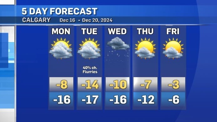
Monday's high of -8 C, the warmest temp until Thursday
Cooler air has started to sink south across Alberta and Saskatchewan, impacting communities beyond the U.S. border.
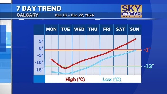
Daytime highs are expected to sit well-below seasonal values in many communities – including Calgary, where Monday’s daytime high of -8 C will be the warmest temperature until Thursday.
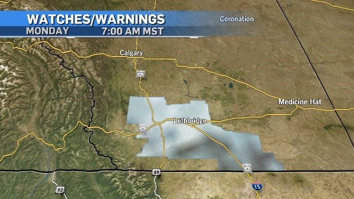
Dense fog covered southern Alberta early Monday, prompting an advisory from Environment and Climate Change Canada. Fog was visible on many 511 Alberta cameras including along Highway 2 S., Highway 9 E., Highway 3 and along the QEII Highway.
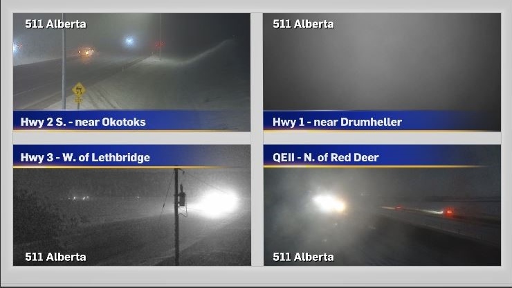
Much of the fog in the southwest corner of Alberta is likely to persist late into the day until snow moves in and helps to mix it out.
Snow will track through southern British Columbia starting on Monday and peak on Tuesday and Wednesday.
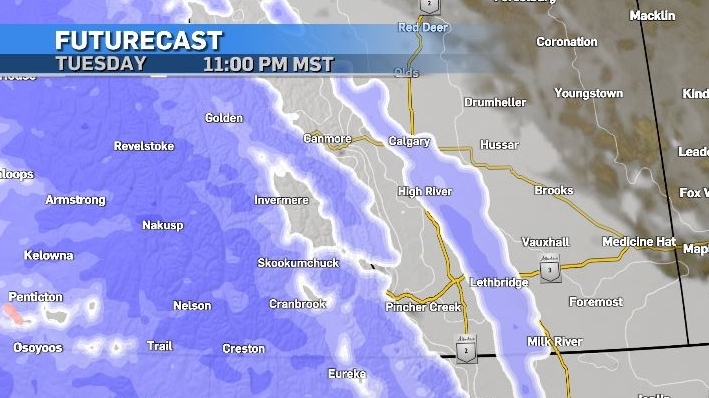
Some of that snow will force it’s way into Alberta, and warnings may need to be issued as colder air and Pacific moisture combine to create heavy accumulations.
Calgary could see light flurries on Monday, with a greater likelihood later Tuesday and on Wednesday.
A strong ridge of high pressure is expected to move across B.C. by the end of the week, extending beyond the northern border.
Under that ridge warmer air will drive temperatures back above normal values for the weekend.
CTVNews.ca Top Stories

LIVE UPDATES Trudeau considering his options as leader after Freeland quits cabinet, sources say
Chrystia Freeland, Canada's finance minister, said in an explosive letter published Monday morning that she will quit cabinet. Follow along for live updates.
BREAKING Finance Minister Chrystia Freeland quits cabinet hours before economic update
Deputy Prime Minister and Finance Minister Chrystia Freeland has announced she's resigning from cabinet. In a letter to Prime Minister Justin Trudeau posted to social media, Freeland said this decision came after Trudeau offered her another position.
Amid Freeland resignation, Department of Finance begins embargoed reading of fall economic statement
Amid the news Finance Minister Chrystia Freeland has resigned from Prime Minister Justin Trudeau’s cabinet, the Department of Finance has begun handing out embargoed copies of the long-anticipated fall economic statement.
W5 Investigates Connecting the dots on a landlord scam: how clues revealed a prolific con artist at work
In part one of a three-part investigation, W5 correspondent Jon Woodward reveals how a convicted con artist bilked dozens of people in a landlord scam.
Shooting at Christian school in Madison, Wisconsin, leaves multiple injured, police say
Multiple injuries have been reported Monday in a shooting at a Christian school in Wisconsin, police said.
Travel risk: Which countries does Canada recommend avoiding?
Canadians planning to travel abroad over the holidays should take precautionary steps to ensure they're not unintentionally putting themselves in harm's way.
Canada Post says workers to return Tuesday after labour board ruling
Operations at Canada Post will resume at 8 a.m. local time on Tuesday, Dec. 17, the company said, after the Canada Industrial Relations Board ordered a return to work.
Jury delivers guilty verdicts for accused in Montreal-area triple homicide trial
The accused in a triple homicide trial south of Montreal has been found guilty.
Second person facing charges in fatal boat crash in eastern Ontario on Victoria Day weekend
A second person is facing charges in connection to a boat crash that killed three people on Bobs Lake in eastern Ontario over the Victoria Day Long Weekend.


