Calgary weather: A better look at tomorrow's snow
AFTERNOON UPDATE: Welp, here we go! The forecast models across a few platforms tell vastly different stories about the happenings tomorrow afternoon. Since we pushed the clocks up eight hours, very little has changed in that regard!
The expectation is that a new low-pressure centre is coming in off the Rockies tomorrow. It'll plant itself over Calgary, with the centre-point +/- 100 km from being directly over the downtown core. As it drags as much moisture into itself as possible, central Alberta and the mountain communities are looking at snowfall-warning-levels of the white stuff - which happens when 10 cm or more of snow falls within 12 hours or less.
Calgary's not out of the woods on one of those, either.
Why the trickery? Why can't every forecast model just get along?
Blame the mountains.
Because we don't - and, frankly, can't - have a complete lock on exactly where the low will form, the challenge becomes an educated guess on which pattern gets to us, and what that means. Most forecast models show a zone of convergence along the northwestern base of the low along the Peace Valley; that's where a consistently heavier base of snow will fall. The image below has an arrow pointed to Calgary, showing that we stand a chance along that heavier precipice - this model run is tomorrow at noon.
This is to say that Airdrie stands an even greater chance of getting hit by the bigger burst of winter.
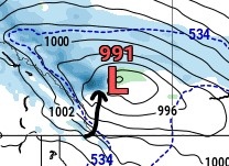 One potential spot this low could land
Still, there's the other side of this coin to consider; if this band populates further north, Calgary gets a full-on grazing and ends up with a negligible total with some rain mixed in. There remains a very strong chance we see that result, and I don't want to dismiss it! Still, those snow shovels may need to come back out if the heaviest happens.
My lean right now, if my chips MUST be down, is at the ~8 cm marker, which includes a shot at rainshowers mixed in. Regardless, this is a state where 8-12 cm will be the forecast note tonight.
Thursday's forecast brought about a high pressure ridge that was slated to work up toward us.
That's not a thing beyond today, any longer.
Today, gusts will enter the 40 km/h range and pile in the warmest day we've seen in a while. Tuesday, however, takes a turn; a large low is rolling off of the Rockies at us. Wind will turn from the northwest and up to 10 centimetres is possible in the Peace Region.
In Calgary, there are two scenarios: rainfall potential (around four millimetres) thanks to marginally-dryer westerlies as part of this setup, helping our high hit 5 C; or, a high of around 2 C and over five centimetres of snow, all within a couple hours of noon. A dryer period will offer reprieve for the commute home, but another couple of centimetres is possible overnight.
I'm leaning into scenario A at this point – I don't think the cooler air mass develops at such an extreme level. I'll have a better idea when the models update through the noon hour – it’s a big split, right now!
I feel it's been said before, but here we go again – after that, things look to steady themselves. Here’s hoping it's right this time. We'll experience middling cloud and temperatures should return to the double digits again just in time for Earth Day on Friday.
YOUR FIVE-DAY CALGARY FORECAST
Tonight
- Scattered flurries, low -5 C
Tuesday
- Rain/snow (8-12 cm), wind gusts NW 50 km/h
- Daytime high: 4 C
- Evening: some cloud, low -2 C
Wednesday
- AM snow clearing
- Daytime high: 4 C
- Evening: some cloud, low -5 C
Thursday
- Chance for AM scattered flurries
- Daytime high: 6 C
- Evening: some cloud, low -2 C
Friday
- Partly cloudy
- Daytime high: 9 C
- Evening: overnight scattered showers, low -1 C
Saturday
- Mainly cloudy, scattered showers
- Daytime high: 11 C
- Evening: some cloud, low -1 C
Today's pic was sent by Charlie of Mt Townsend. Great shot!
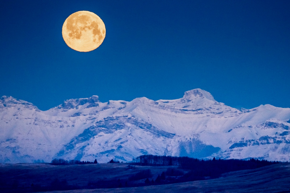 Viewer Charlie's photo of Mount Townshend.
We love to see your pictures of weather, wildlife, and pets – submit your photos here, email me here, or tweet them over.
CTVNews.ca Top Stories

Trump threatens to try to take back the Panama Canal. Panama's president balks at the suggestion
Donald Trump suggested Sunday that his new administration could try to regain control of the Panama Canal that the United States “foolishly” ceded to its Central American ally, contending that shippers are charged “ridiculous” fees to pass through the vital transportation channel linking the Atlantic and Pacific Oceans.
Man handed 5th distracted driving charge for using cell phone on Hwy. 417 in Ottawa
An Ottawa driver was charged for using a cell phone behind the wheel on Sunday, the fifth time he has faced distracted driving charges.
Wrongfully convicted N.B. man has mixed feelings since exoneration
Robert Mailman, 76, was exonerated on Jan. 4 of a 1983 murder for which he and his friend Walter Gillespie served lengthy prison terms.
Can the Governor General do what Pierre Poilievre is asking? This expert says no
A historically difficult week for Prime Minister Justin Trudeau and his Liberal government ended with a renewed push from Conservative Leader Pierre Poilievre to topple this government – this time in the form a letter to the Governor General.
opinion Christmas movies for people who don't like Christmas movies
The holidays can bring up a whole gamut of emotions, not just love and goodwill. So CTV film critic Richard Crouse offers up a list of Christmas movies for people who might not enjoy traditional Christmas movies.
More than 7,000 Jeep SUVs recalled in Canada over camera display concern
A software issue potentially affecting the rearview camera display in select Jeep Wagoneer and Grand Cherokee models has prompted a recall of more than 7,000 vehicles.
'I'm still thinking pinch me': lost puppy reunited with family after five years
After almost five years of searching and never giving up hope, the Tuffin family received the best Christmas gift they could have hoped for: being reunited with their long-lost puppy.
10 hospitalized after carbon monoxide poisoning in Ottawa's east end
The Ottawa Police Service says ten people were taken to hospital, with one of them in life-threatening condition, after being exposed to carbon monoxide in the neighbourhood of Vanier on Sunday morning.
New York City police apprehend suspect in the death of a woman found on fire in a subway car
New York City police announced Sunday they have in custody a “person of interest” in the early morning death of a woman who they believe may have fallen asleep on a stationary subway train before being intentionally lit on fire by a man she didn't know.


