Calgary weather: A second round of winter weather moves into Alberta late Friday
Cleanup continues after Thursday’s intense snowfall which shut down some major highways and brought a rapid return to winter conditions for most of southern Alberta.
With a second system on the way starting Friday, there will be a narrow window to work within.
As expected, Thursday’s system hit hard and fast. Traction was significantly compromised on many road surfaces and sidewalks after a hard layer of ice formed in some areas, a situation further exacerbated by a thick layer of snow that fell overtop of the ice.
By 9:30 a.m. Thursday, 511 Alberta was still reporting many icy and snow-covered routes north, west and south of Calgary, with travel not recommended along the TransCanada highway west of Banff.
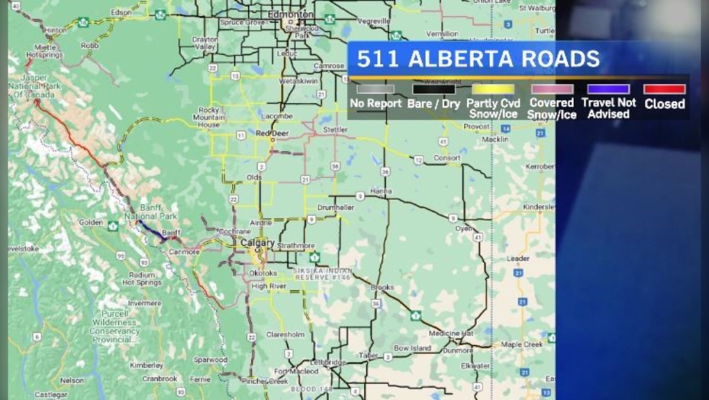 By 9:30 a.m. Thursday 511 Alberta was still reporting many icy and snow-covered routes north, west and south of Calgary, with travel not recommended along the TransCanada highway west of Banff.
According to Environment and Climate Change Canada’s (ECCC) weather summary of Thursday’s weather event, a frontal snowsquall moved through the Canmore to Calgary corridor in the early afternoon Thursday, dumping between 5-10 centimetres of snow in under an hour, as well as dropping temperatures by as much as 20-degrees, also in under one hour.
A strong north wind associated with the front created blowing snow and limited visibility to under 200-metres in some spots.
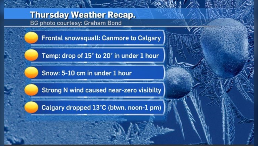 Visibility deteriorated right before the afternoon commute Thursday as snow and blowing snow moved in from the northwest. Ahead of that, the temperature at the ECCC airport weather station dropped from 9 C at noon to -4 C by 1 p.m.
Calgary also felt the impacts of these colliding air masses. Visibility deteriorated right before the afternoon commute Thursday as snow and blowing snow moved in from the northwest. Ahead of that, the temperature at the ECCC airport weather station dropped from 9 C at noon to -4 C by 1 p.m.
Road crews have been working on both rural and urban streets since before the snow started. As of 9:10 a.m. Friday, highways along the Alberta-B.C. corridor were still quite snow-covered and visibility appeared limited.
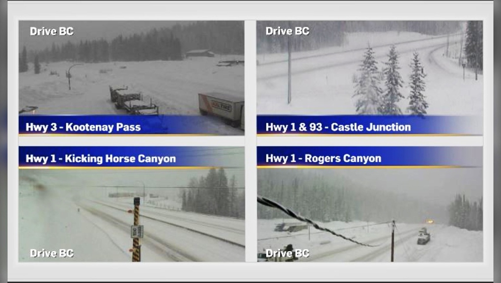 Road crews have been working on both rural and urban streets since before the snow started. As of 9:10 a.m. Friday, highways along the Alberta-B.C. corridor were still quite snow-covered and visibility appeared limited.
The avalanche risk in the Rockies, which was already concerning before this weather event (due to a weak base layer in many locations) is now even worse. Over 40 centimetres of snow fell in some mountain regions adding even more weight to an already-dense top layer.
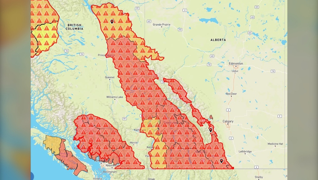 The avalanche risk in the Rockies, which was already concerning before this weather event (due to a weak base layer in many locations) is now even worse.
Unfortunately another system is expected to move in to the region late on Friday bringing more snow, blowing snow, and keeping temperatures well below seasonal.
In a special weather statement for the southeast corridor of the province, on Friday morning, ECCC notes another 10 to 20 centimetres of snow is possible for some areas, including around Medicine Hat, “Snowfall will begin late tonight and will intensify through Saturday. Total amounts of 10 to 20 cm are likely with some pockets of up to 30 cm possible.”
Calgary is expecting another eight to 15 centimetres before the end of the weekend, with the bulk of that snow expected Saturday.
For the latest weather warnings from ECCC click here. Updated road conditions from 511 Alberta can be found here. And click here for highway conditions from Drive BC.
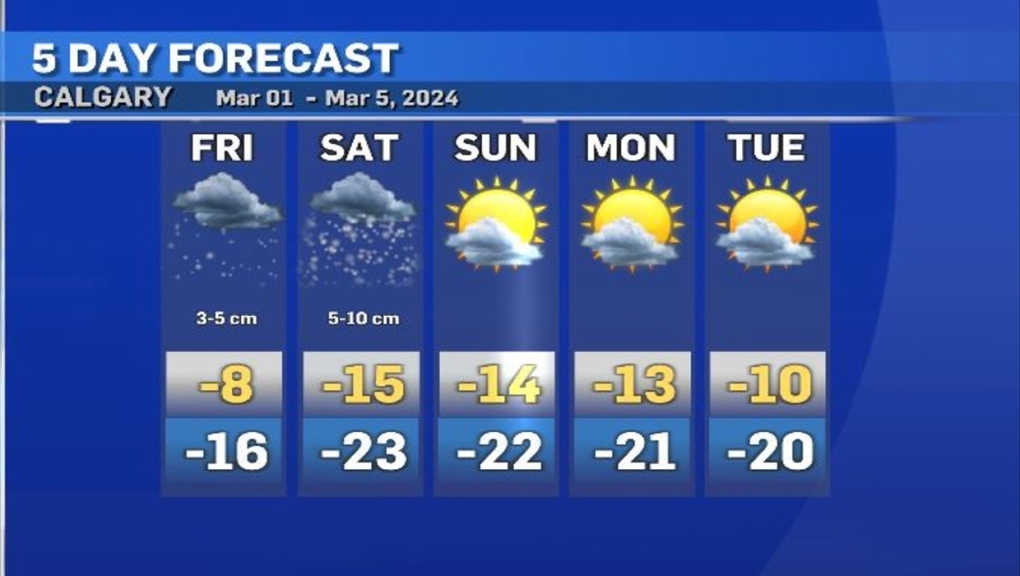 Calgary is expecting another 8 to 15 centimetres before the end of the weekend, with the bulk of that snow expected Saturday.
CTVNews.ca Top Stories

Trudeau's 2024: Did the PM become less popular this year?
Justin Trudeau’s numbers have been relatively steady this calendar year, but they've also been at their worst, according to tracking data from CTV News pollster Nik Nanos.
Manhunt underway after woman, 23, allegedly kidnapped, found alive in river
A woman in her 20s who was possibly abducted by her ex is in hospital after the car she was in plunged into the Richelieu River.
Death toll in attack on Christmas market in Germany rises to 5 and more than 200 injured
Germans on Saturday mourned both the victims and their shaken sense of security after a Saudi doctor intentionally drove into a Christmas market teeming with holiday shoppers, killing at least five people, including a small child, and wounding at least 200 others.
Overheated immigration system needed 'discipline' infusion: minister
An 'overheated' immigration system that admitted record numbers of newcomers to the country has harmed Canada's decades-old consensus on the benefits of immigration, Immigration Minister Marc Miller said, as he reflected on the changes in his department in a year-end interview.
Wild boar hybrid identified near Fort Macleod, Alta.
Acting on information, an investigation by the Municipal District of Willow Creek's Agricultural Services Board (ASB) found a small population of wild boar hybrids being farmed near Fort Macleod.
Summer McIntosh makes guest appearance in 'The Nutcracker'
Summer McIntosh made a splash during her guest appearance in The National Ballet of Canada’s production of 'The Nutcracker.'
The winter solstice is here, the Northern Hemisphere's darkest day
The winter solstice is Saturday, bringing the shortest day and longest night of the year to the Northern Hemisphere — ideal conditions for holiday lights and warm blankets.
Back on air: John Vennavally-Rao on reclaiming his career while living with cancer
'In February, there was a time when I thought my career as a TV reporter was over,' CTV News reporter and anchor John Vennavally-Rao writes.
It's eggnog season. The boozy beverage dates back to medieval England but remains a holiday hit
At Scoma's Restaurant in San Francisco, this holiday season 's batch of eggnog began 11 months ago.


