Extreme cold warnings expanded across country; snowfall warnings remain for southern Alberta
A persistent weather pattern is funnelling arctic air across the Prairies, which forced Environment and Climate Change Canada (ECCC) to issue extreme cold warnings late Thursday.
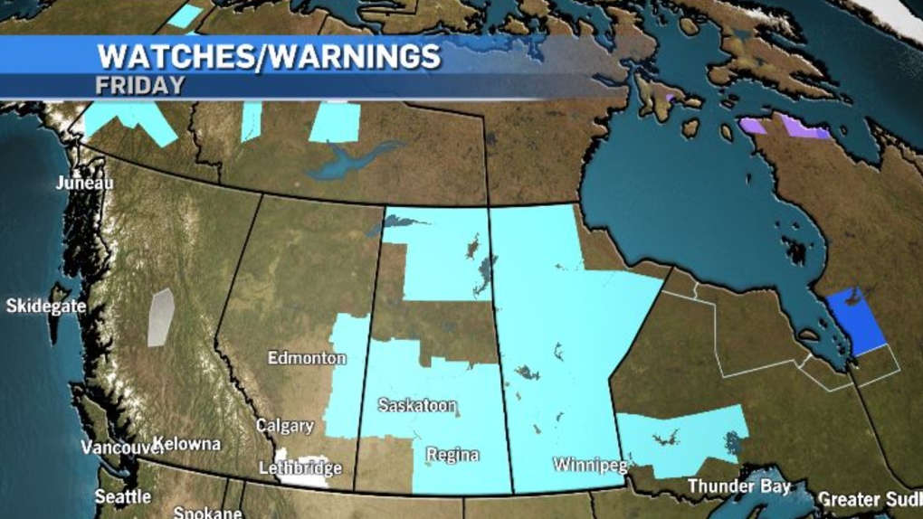
The national weather agency expanded those warnings Friday night, and as of 7:30 p.m., including the Yukon, Northwest Territories, Alberta, Saskatchewan, Manitoba and Ontario.
Wind chill values under the warned areas are likely to drop to at least -40 at times, especially early in the morning Saturday.

At the same time that colder air is meandering south, a slow-moving, moisture-laden system is edging north into southern British Columbia.
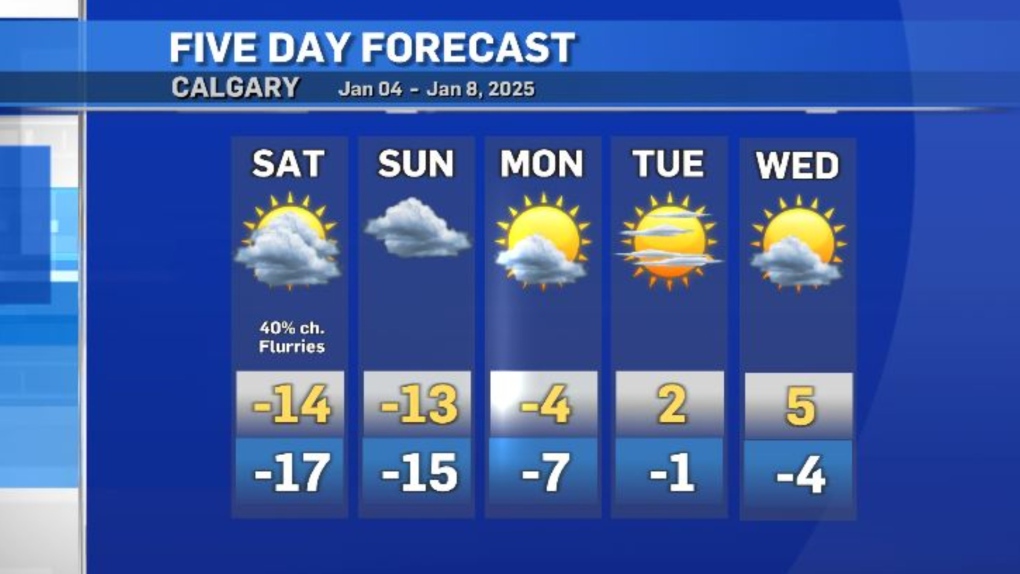
That Pacific air mass is going to track east toward the southern Rockies, where it will meet up with the western edge of the polar air mass and deliver up to 15 centimetres of snow for the southwest corridor of Alberta.
Snowfall warnings issued from ECCC note visibility is likely to be compromised in this area and road conditions will deteriorate when the two systems collide.
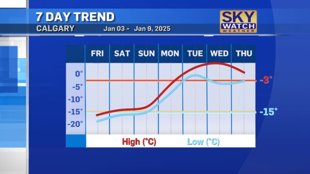
An incoming ridge of high pressure heading up the U.S. west coast will finally dislodge this stagnant pattern early next week, and daytime highs in southern Alberta will rise quickly.

By Wednesday, it could be as warm as 5 C in Calgary, or eight degrees warmer than the average high of -3 C, a sharp change from Friday’s high of -15 C, which equals the average overnight low value this time of year.

CTVNews.ca Top Stories

Canada closes 'flagpoling' loophole for temporary visa holders
Temporary residents of Canada will no longer be able to utilise the flagpoling process to initiate work or study permits, following a ban from the Canada Border Services Agency.
Kieran Culkin, 'Shōgun,' Ali Wong win at Golden Globes
The Golden Globes, which host Nikki Glaser introduced as “Ozempic's biggest night,” got underway Sunday with awards spread around for “Emilia Pérez," “A Real Pain," and “Conclave," as Hollywood's thus-far unpredictable awards season remained hard to pin in the early going.
Driver who entered Canada 'without stopping' at B.C. border crossing arrested: police
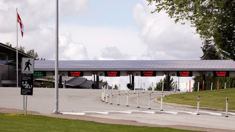
A man who illegally blew through the Canada-U.S. border crossing in Surrey, B.C., Sunday morning has been arrested, according to authorities.
'Absolutely devastating': Southern Manitoba golf course clubhouse burns for second time in 4 years
A golf course clubhouse in Morden, Man. went up in flames Sunday for the second time in less than four years, and mere days after its reopening from the previous fire was celebrated.
Thousands are without power due to winter storm hitting Newfoundland and Labrador
Massive waves slammed Newfoundland and Labrador's coastline on Sunday, as a powerful winter storm left thousands without power.
Man responsible for New Year's truck attack previously visited New Orleans, Ontario, Egypt: FBI
The man responsible for the truck attack in New Orleans on New Year's Day that killed 14 people visited the city twice before and recorded video of the French Quarter with hands-free glasses, an FBI official said Sunday.
The Vivienne, star of 'RuPaul's Drag Race UK', dies at 32
British reality show 'RuPaul's Drag Race UK' winner James Lee Williams, aged 32, popularly known as The Vivienne, has died.
Driving into Manhattan? That'll cost you, as new congestion toll starts Sunday
New York’s new toll for drivers entering the center of Manhattan debuted Sunday, meaning many people will pay US$9 to access its busiest part in peak hours.
WATCH Woman critically injured in explosive Ottawa crash caught on camera
Dashcam footage sent to CTV News shows a vehicle travelling at a high rate of speed in the wrong direction before striking and damaging a hydro pole.


