Longer-range trend shows 15 days straight below freezing; Thursday, Friday, Saturday the coldest
The Arctic polar vortex (a large pocket of cold air at the North Pole, enclosed by the winds around it) will be disrupted from its usual pattern and expand/move south.
This means much colder temperatures than we have had for a long time.
Could it be record-breaking? If it dips a couple of degrees further than what is expected in Calgary, then yes!
There will likely be a number of communities in the province that will either get record-breaking cold or at least colder than any temperatures in the past 20 years.
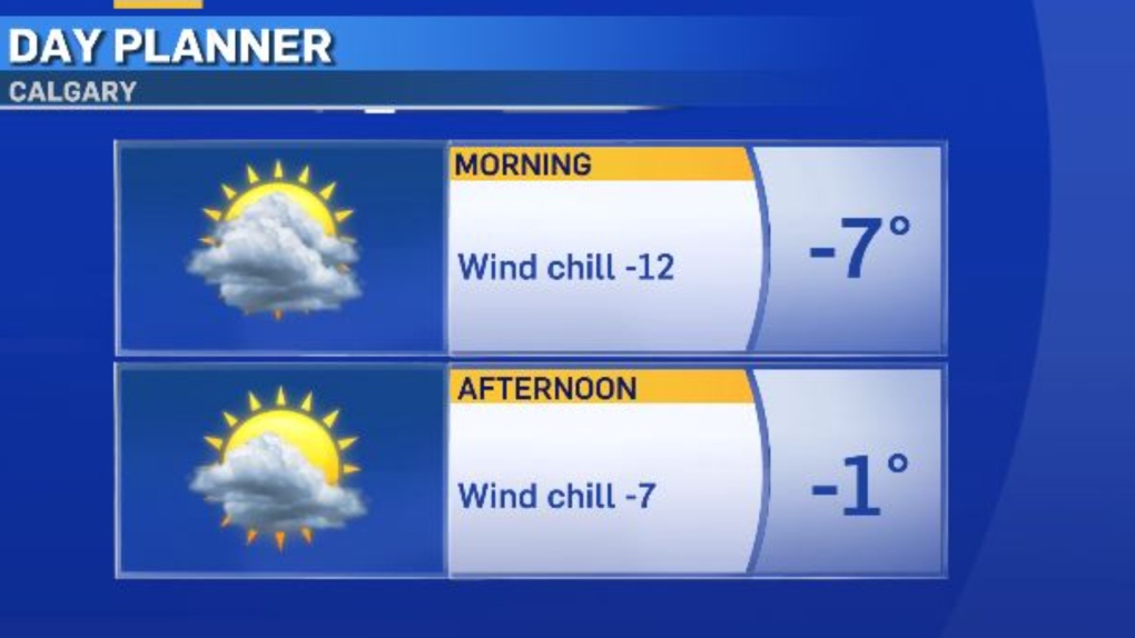
Some cold air has already begun to creep into many areas in Alberta but we still have one more mild day before the colder air mass invades Calgary.
Expect a chilly morning with a wind chill of around -12.
In the afternoon, some sunshine and a high of -1 C.

The longer-range trend is showing 15 days straight below freezing (from Sunday, Jan. 7 to Sunday, Jan. 21) with this Thursday, Friday and Saturday being the coldest days in the stretch.
As you can see by the graphic below, Friday will be at or close to -30 C for our daytime high.
Expect overnight and morning wind chills in the minus 40s Thursday night through Sunday morning.
Also, our best chance of snow this week is Tuesday night to Wednesday.
The amount looks similar to the last burst of snow, two to six centimetres in YYC.

CTVNews.ca Top Stories

Bird flu, measles top 2025 concerns for Canada's chief public health officer
As we enter 2025, Dr. Theresa Tam has her eye on H5N1 bird flu, an emerging virus that had its first human case in Canada this year.
DEVELOPING Body found in wheel well of plane at Maui airport
A person was found dead in the wheel well of a United Airlines flight to Maui on Tuesday.
Raised in Sask. after his family fled Hungary, this man spent decades spying on communists for the RCMP
As a Communist Party member in Calgary in the early 1940s, Frank Hadesbeck performed clerical work at the party office, printed leaflets and sold books.
Ottawa police identify victim of Christmas Day homicide in Hintonburg, charge suspect
The Ottawa Police Service says the victim who has been killed on Christmas Day in Hintonburg has been identified.
Christmas shooting at Phoenix airport leaves 3 people wounded
Police are investigating a Christmas shooting at Sky Harbor Airport in Phoenix that left three people injured by gunfire.
Your kid is spending too much time on their phone. Here's what to do about it
Wondering what your teen is up to when you're not around? They are likely on YouTube, TikTok, Instagram or Snapchat, according to a new report.
Bird flu kills more than half the big cats at a Washington sanctuary
Bird flu has been on the rise in Washington state and one sanctuary was hit hard: 20 big cats – more than half of the facility’s population – died over the course of weeks.
Swimmer Summer McIntosh voted The Canadian Press female athlete of the year for 2024
During the month before her 18th birthday, Summer McIntosh became the first Canadian to win three gold medals in a single Olympic Games, winter or summer, with a silver medal thrown in for good measure.
6,000 inmates stage Christmas Day escape from high-security Mozambique prison
At least 6,000 inmates escaped from a high-security prison in Mozambique's capital on Christmas Day after a rebellion, the country's police chief said, as widespread post-election riots and violence continue to engulf the country.


