Warming trend starts Wednesday, with Friday's high three times warmer than average
Despite similar morning temperatures, Wednesday began with much better weather conditions than Tuesday, with dry road conditions reported across most of Calgary.
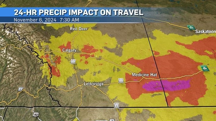
There were still some lingering effects from the early week precipitation across southern Alberta, but Wednesday’s sunshine and warmer temperatures will take care of that by mid-day.

A shifting weather pattern will introduce a persistent westerly flow across southern Alberta for the next few days, elevating both daytime highs and overnight lows.
In Calgary, the wind is expected to shift from the southwest to the west on Wednesday with chinook-like conditions throughout the region.
In the southwest corner of Alberta, wind gusts are expected to reach 40 to 70 km/h which is well below the threshold for a wind warning to be issued for that area.
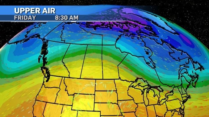
A strong ridge of high pressure will sit over the western provinces for the end of the week – extending as far north as the territories.

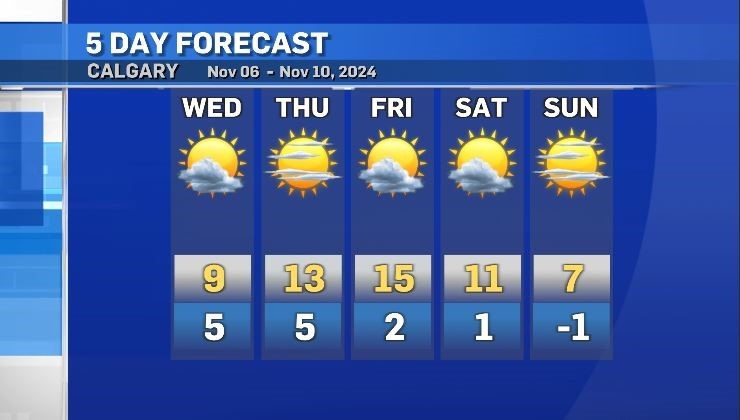
Wednesday’s high of 9 C in Calgary will be the coldest day of the next three, despite an overnight temperature that is as warm as the average daytime high for this time of year.
Most communities in southern Alberta will see a similar trend with temperatures increasing until Friday.
By the end of the week, Calgary is expected a high of 15 C which is three times warmer than the average high of 5 C.
That ridge will start to break down on Sunday and temperatures are expected to dip below seasonal for the start of next week.

CTVNews.ca Top Stories

5 rescued after avalanche triggered north of Whistler, B.C. RCMP say
Emergency crews and heli-skiing staff helped rescue five people who were caught up in a backcountry avalanche north of Whistler, B.C., on Monday morning.
Quebec fugitive killed in Mexican resort town, RCMP say
RCMP are confirming that a fugitive, Mathieu Belanger, wanted by Quebec provincial police has died in Mexico, in what local media are calling a murder.
Bill Clinton hospitalized with a fever but in good spirits, spokesperson says
Former President Bill Clinton was admitted Monday to Georgetown University Medical Center in Washington after developing a fever.
Trump again calls to buy Greenland after eyeing Canada and the Panama Canal
First it was Canada, then the Panama Canal. Now, Donald Trump again wants Greenland. The president-elect is renewing unsuccessful calls he made during his first term for the U.S. to buy Greenland from Denmark, adding to the list of allied countries with which he's picking fights even before taking office.
UN investigative team says Syria's new authorities 'very receptive' to probe of Assad war crimes
The U.N. organization assisting in investigating the most serious crimes in Syria said Monday the country’s new authorities were “very receptive” to its request for cooperation during a just-concluded visit to Damascus, and it is preparing to deploy.
Pioneering Métis human rights advocate Muriel Stanley Venne dies at 87
Muriel Stanley Venne, a trail-blazing Métis woman known for her Indigenous rights advocacy, has died at 87.
King Charles ends royal warrants for Ben & Jerry's owner Unilever and Cadbury chocolatiers
King Charles III has ended royal warrants for Cadbury and Unilever, which owns brands including Marmite and Ben & Jerry’s, in a blow to the household names.
Man faces murder charges in death of woman who was lit on fire in New York City subway
A man is facing murder charges in New York City for allegedly setting a woman on fire inside a subway train and then watching her die after she was engulfed in flames, police said Monday.
Canada regulator sues Rogers for alleged misleading claims about data offering
Canada's antitrust regulator said on Monday it was suing Rogers Communications Inc, for allegedly misleading consumers about offering unlimited data under some phone plans.


