Extreme cold warnings expanded across country; snowfall warnings remain for southern Alberta
A persistent weather pattern is funnelling arctic air across the Prairies, which forced Environment and Climate Change Canada (ECCC) to issue extreme cold warnings late Thursday.
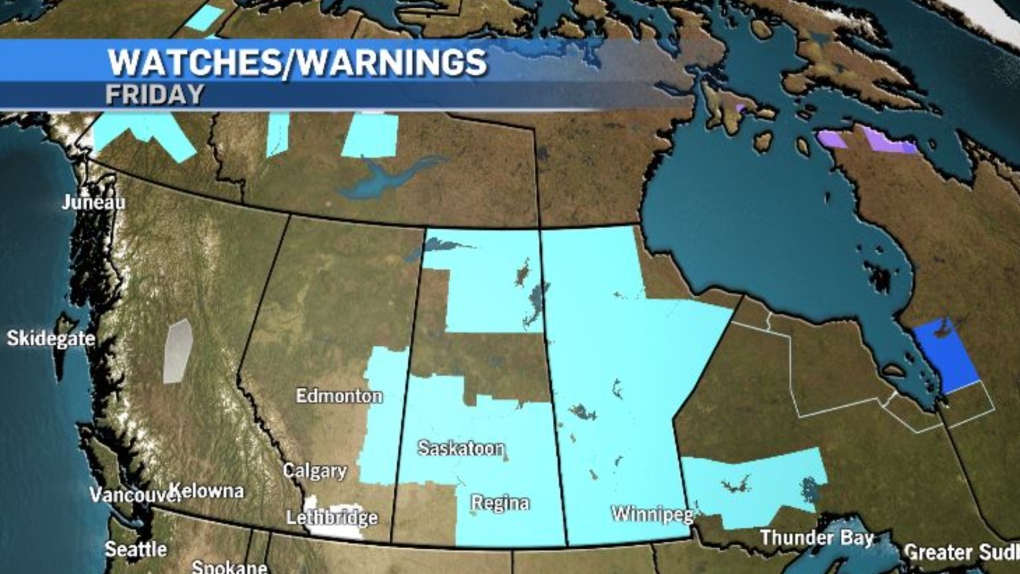
The national weather agency expanded those warnings Friday night, and as of 7:30 p.m., including the Yukon, Northwest Territories, Alberta, Saskatchewan, Manitoba and Ontario.
Wind chill values under the warned areas are likely to drop to at least -40 at times, especially early in the morning Saturday.

At the same time that colder air is meandering south, a slow-moving, moisture-laden system is edging north into southern British Columbia.
That Pacific air mass is going to track east toward the southern Rockies, where it will meet up with the western edge of the polar air mass and deliver up to 15 centimetres of snow for the southwest corridor of Alberta.
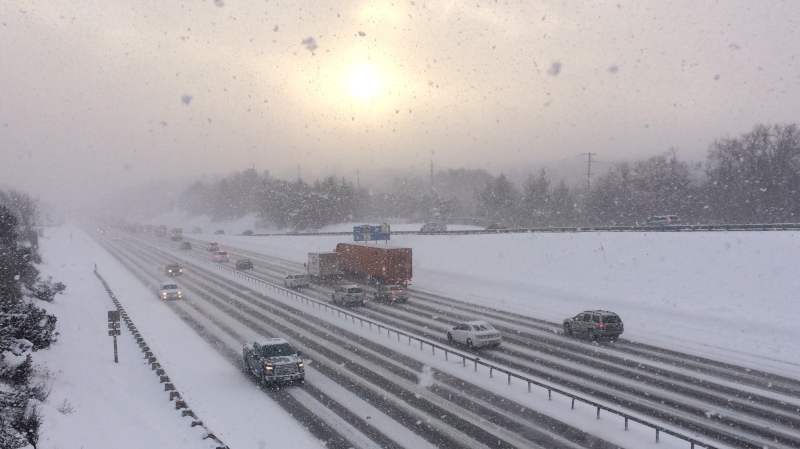
Snowfall warnings issued from ECCC note visibility is likely to be compromised in this area and road conditions will deteriorate when the two systems collide.
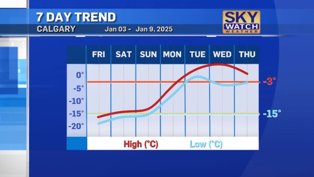
An incoming ridge of high pressure heading up the U.S. west coast will finally dislodge this stagnant pattern early next week, and daytime highs in southern Alberta will rise quickly.

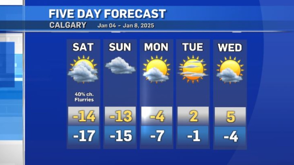
By Wednesday, it could be as warm as 5 C in Calgary, or eight degrees warmer than the average high of -3 C, a sharp change from Friday’s high of -15 C, which equals the average overnight low value this time of year.

CTVNews.ca Top Stories

DEVELOPING Trudeau says not 'a snowball's chance' Canada would become part of U.S.
Prime Minister Justin Trudeau said 'there isn’t a snowball’s chance in hell that Canada would become part of the United States,' on the same day U.S. President-elect Donald Trump declared that he’s open to using 'economic force' to acquire Canada.
Trump refuses to rule out use of military force to take control of Greenland and the Panama Canal
U.S. president-elect Donald Trump on Tuesday said he would not rule out the use of military force to seize control of the Panama Canal and Greenland, as he declared U.S. control of both to be vital to American national security.
Canada has a navy ship near China. Here's what it's like on board
CTV National News is on board the HMCS Ottawa, embedded with Canadian Navy personnel and currently documenting their work in the East China Sea – a region where China is increasingly flexing its maritime muscle. This is the first of a series of dispatches from the ship.
As walking pneumonia rates drop among Canadian children, flu and RSV are back
Following a sharp rise, cases of walking pneumonia across Canada, particularly among children, seem to be dropping.
2 sons of Mexican cartel leader 'El Chapo' are in plea negotiations with U.S., attorneys say
Two sons of notorious Mexican drug kingpin 'El Chapo' facing sweeping drug-trafficking charges in the U.S. are in plea negotiations with the federal government, attorneys acknowledged Tuesday in a Chicago courtroom.
Ontario launches border-strengthening operation as Trump tariff threat looms
The Ontario government says it has launched an operation intended to beef up security along the border with the United States.
Aubrey Plaza addresses 'unimaginable tragedy' of losing her husband
Aubrey Plaza has shared her first statement since the death of her husband, writer and director Jeff Baena.
CRA to continue with capital tax changes despite prorogation: finance department
The federal government says the Canada Revenue Agency will continue to administer the capital gains tax, even though it hasn't passed in Parliament, which is prorogued until March 24.
Justin Trudeau's set to go after the Liberals pick his replacement, what now?
Prime Minister Justin Trudeau, announcing Monday that he intends to resign as Liberal leader and prime minister as soon as his party names his replacement, has set a series of political machinations in motion.


