Nothing like a 30-degree temp drop in less than a week, but that's Calgary in the fall!
We have a low-pressure system over southern Alberta that has pulled in a much cooler air mass from the north.
The spin around this low is also forcing air up the mountains, which is the lift we need to enhance our snowfall amounts here on the leeside of the Rockies.
Expect consistent snowfall through the morning hours on Tuesday.
Roads and sidewalks will continue to be very slick.
Then, in the afternoon, the snow will become more intermittent.
The snow should fully taper off around 3:30 p.m. Tuesday (although still a few stray snowflakes possible later in the afternoon).
From 8 p.m. Monday through Tuesday, Calgary will likely see 11 more centimetres (see snow forecast below).

The cold will stick around a lot longer than the snow.
Expect a wind chill of -14 at times throughout the day on Tuesday.
The below-normal temperatures will be our story all week.
Normal is 9 C.
We will get to (or very close to) the freezing mark on Saturday.
Our best chance for temperatures closer to normal is Sunday.

That's Calgary in the fall!
This past Thursday, we got to 22 C, and Tuesday's expected high is -8 C.
Nothing like a 30-degree temp drop in less than a week!
Have all the things ready in the closet: warm coat, winter boots, snow pants, toques and gloves, but also a light jacket and regular shoes for the weekend.
It helps if you have a big closet in Calgary!
Denise Jasmine sent a picture of the first snow.
She said the drive home was terrible, but her puppies LOVED it.


CTVNews.ca Top Stories

Canada outlines national action plan to fight auto theft
The federal government is launching what it calls its 'national action plan' to combat auto thefts, which will include stronger penalties for thieves, and increased information sharing between police agencies, government officials and border enforcement.
U.S. Supreme Court rejects appeal from former Guantanamo detainee Omar Khadr
The U.S. Supreme Court on Monday rejected an appeal by a Canadian-born former Guantanamo detainee who was seeking to wipe away his war crimes convictions, including for killing a U.S. soldier in Afghanistan.
What is BORG drinking, and why is it a dangerous trend? An expert explains
If you've been to a party lately and haven't seen someone drinking a BORG, you're likely not partying with college students.
Iran's president and foreign minister die in helicopter crash at moment of high tensions in Mideast
Iranian President Ebrahim Raisi and the country's foreign minister were found dead Monday hours after their helicopter crashed in fog, leaving the Islamic Republic without two key leaders as extraordinary tensions grip the wider Middle East.
Michael Cohen says he stole from Trump's company as defence presses key hush money trial witness
Former Donald Trump attorney Michael Cohen admitted Monday to jurors in the Republican's hush money trial that he stole tens of thousands of dollars from Trump's company as defence lawyers seized on the star witness' misdeeds to attack his credibility.
The world's best airline is paying staff a bonus of 8 months' salary
Singapore Airlines will reward its employees with a bonus worth nearly eight months of salary, a person familiar with the matter told CNN on Friday.
Woman, 35, in critical condition after her truck collided with a Via Rail train near Montreal
A 35-year-old woman is in critical condition after the pick-up truck she was driving was struck by a Via Rail passenger train Monday morning in Quebec's Monteregie region.
Investors watching posts from 'Crypto King' in the wake of fraud, money laundering charges
Former investors of the self-styled “Crypto King” say they are watching his social media accounts and worried his displays of wealth are signs he’s spending their money, even now, as another large expense tied to Aiden Pleterski has triggered a previously unreported lawsuit.
Almost 2 months after it destroyed Baltimore's Key Bridge, the Dali cargo ship has been moved
The cargo ship Dali is being moved from the site of its catastrophic collision with the Francis Scott Key Bridge in a crucial step toward fully reopening the busy Port of Baltimore.
Shopping Trends
The Shopping Trends team is independent of the journalists at CTV News. We may earn a commission when you use our links to shop. Read about us.


Edmonton
-

Canucks' Brock Boeser out for decisive Game 7 vs. Oilers: coach
Canucks star Brock Boeser will miss Game 7 of Vancouver's second-round playoff series Monday against the Edmonton Oilers, according to reports.
-
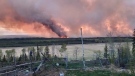
This wildfire season, changes are coming to better inform people about smoke hazards
Last year’s record-breaking wildfire season forced Canadians to become familiar with the scale of air pollution as hazardous smoke drifted across the country.
-
McDavid expects 'great Game 7' after Oilers rebound against Canucks
A full-game effort by the Edmonton Oilers led to their 5-1 victory over the Canucks in Game 6 on Saturday to send the best-of-seven series to the limit, with the decisive showdown set for Monday in Vancouver.
Lethbridge
-

Buttazzoni overtime goal propels Bandits past Crusaders 4-3 in BCHL playoff
With just over two minutes remaining in the first overtime, Mirko Buttazzoni scored to give the Bandits a 4-3 victory over the Sherwood Park Crusaders Saturday in Brooks.
-
Brooks fall 4-3 to Crusaders in BCHL playoff game
The Sherwood Park Crusaders got some great goaltending from Erick Roest Friday night on the way to a 4-3 victory over the Brooks Bandits.
-
Lethbridge home prices continue to rise
The average home price in Lethbridge has jumped 11.6 per cent in the last year. A home in Lethbridge now costs just over $374,000 on average. That's according to the latest data from the Alberta Real Estate Association.
Vancouver
-

This wildfire season, changes are coming to better inform people about smoke hazards
Last year’s record-breaking wildfire season forced Canadians to become familiar with the scale of air pollution as hazardous smoke drifted across the country.
-
Canucks' Brock Boeser out for decisive Game 7 vs. Oilers: coach
Canucks star Brock Boeser will miss Game 7 of Vancouver's second-round playoff series Monday against the Edmonton Oilers, according to reports.
-
Canada outlines national action plan to fight auto theft
The federal government is launching what it calls its 'national action plan' to combat auto thefts, which will include stronger penalties for thieves, and increased information sharing between police agencies, government officials and border enforcement.
Vancouver Island
-
4 homes lost due to wildfire near Fort Nelson, B.C.
A wildfire burning near Fort Nelson, B.C., completely destroyed four homes, according to an update from the Northern Rockies Regional Municipality.
-
Employee information ‘compromised’ during London Drugs cyberattack, company says
Employee information may have been “compromised” during a cyberattack that shut down London Drugs stores across western Canada, according to the company.
-
Doctors, patients want options to reduce dialysis waste adding to climate change
Dr. Caroline Stigant, a nephrologist at Royal Jubilee Hospital in Victoria and a leading advocate for sustainable kidney care, said each hemodialysis treatment uses up to 500 litres of water and large amounts of energy.
Saskatoon
-

Court eases internet restrictions for Sask. man who matched with a 15-year-old girl on Tinder
A Saskatchewan man who had a sexual encounter with a 15-year-old girl he met on Tinder successfully appealed to shorten release conditions barring him from online dating.
-
Thousands from Saskatoon Sikh community celebrate annual Nagar Kirtan parade
The Sikh culture in Saskatoon is growing, and the massive turnout at the Nagar Kirtan parade on Sunday put the strength of their community on full display, as thousands walked up a span of Attridge Drive.
-
Missing 85-year-old rural Sask. man found dead
An 85-year-old man reported missing around Choiceland, Sask. on Saturday has been found dead.
Regina
-

Regina firefighters rescue patient from inside garbage truck
It's not a call that's made often, but Regina fire crews helped rescue someone from inside a garbage truck on Monday morning.
-
Sask. police watchdog called in following 'serious incident' involving Regina SWAT
The Saskatchewan Serious Incident Response Team (SIRT) has been called in to investigate an incident involving Regina's Special Weapons and Tactics Team (SWAT).
-
Moose Jaw street closed 'indefinitely' as police investigate crash scene
Moose Jaw police are advising the public to avoid a tract of 9th Avenue Northeast as officers respond to a collision in the area.
Toronto
-

Investors watching posts from 'Crypto King' in the wake of fraud, money laundering charges
Former investors of the self-styled “Crypto King” say they are watching his social media accounts and worried his displays of wealth are signs he’s spending their money, even now, as another large expense tied to Aiden Pleterski has triggered a previously unreported lawsuit.
-
Canada outlines national action plan to fight auto theft
The federal government is launching what it calls its 'national action plan' to combat auto thefts, which will include stronger penalties for thieves, and increased information sharing between police agencies, government officials and border enforcement.
-
Here's what's open and closed in Toronto on Victoria Day
The unofficial start of summer is upon us. If you still haven't made plans for Victoria Day, here’s what’s open and closed around Toronto on Monday.
Montreal
-

Jury finds Andrei Donet guilty of second-degree murder in stabbing death of Montreal teen
A jury has found a 21-year-old man guilty of second-degree murder in the stabbing death of Montreal teenager Jannai Dopwell-Bailey outside his school in 2021.
-
Woman, 35, in critical condition after her truck collided with a Via Rail train near Montreal
A 35-year-old woman is in critical condition after the pick-up truck she was driving was struck by a Via Rail passenger train Monday morning in Quebec's Monteregie region.
-
Canada outlines national action plan to fight auto theft
The federal government is launching what it calls its 'national action plan' to combat auto thefts, which will include stronger penalties for thieves, and increased information sharing between police agencies, government officials and border enforcement.
Atlantic
-

Runners 'Giv'er' at the Blue Nose Marathon in Halifax
Thousands in Halifax strapped on their running shoes over the weekend, as marathoners in Halifax were ready to “Giv’er” in this years Blue Nose Marathon.
-
Nova Scotia byelection vote set for Tuesday in riding formerly held by popular Tory
Voters in the rural Nova Scotia provincial electoral district of Pictou West are ready to go to the polls Tuesday in a riding that voted decisively Tory in the 2021 provincial election.
-
25-year-old arrested after reports of man with knife at New Glasgow business
New Glasgow Regional Police have arrested a man after receiving reports of someone with a knife at a business on Westville Road in New Glasgow, N.S., on Saturday.
Winnipeg
-

Premier Kinew announces byelection date for Heather Stefanson's former constituency
Premier Wab Kinew announced Monday a byelection will be held in Tuxedo on June 18.
-
Pedestrian dies after being hit by vehicle along Portage Avenue: Winnipeg police
Winnipeg police is investigating after a woman was hit by a vehicle and later died from her injuries Sunday.
-
'A special bird': The unbreakable bond between purple martins and humans
Flashes of purple darting across the sky mixed with the serenading sound of songs will be noticed more with spring in full force in Manitoba.
Ottawa
-

St. Laurent Station to stay closed until at least Wednesday: OC Transpo
The St. Laurent LRT station will remain closed until at least Wednesday as OC Transpo continues to repair and inspect damaged ceiling tiles and concrete above both rail platforms.
-
Stittsville residents seeking answers as bylaw cracks down on street basketball nets
Stittsville residents on Kearnsley Way are seeking answers after an unusual bylaw crackdown on Friday. Every home with a basketball net received a ticket instructing homeowners to remove their nets from the road.
-
What's open and closed in Ottawa on Victoria Day
CTVNewsOttawa.ca looks at what's open and closed in Ottawa over the Victoria Day long weekend.
Northern Ontario
-

Hwy. 144 crash kills northern Ontario motorcycle driver
A 33-year-old from Espanola was killed Sunday following a collision between a motorcycle and a passenger vehicle on Highway 144.
-
What is BORG drinking, and why is it a dangerous trend? An expert explains
If you've been to a party lately and haven't seen someone drinking a BORG, you're likely not partying with college students.
-
Suspect enters Sault police cruiser, challenges officers to fight
A 24-year-old in Sault Ste. Marie has been charged following a bizarre incident in which the suspect got themselves in trouble when police were in the area for another call.
Barrie
-

19-Year-old driver caught speeding double the posted limit
A 19-year-old driver was caught driving double the posted speed limit in Innisfil on Sunday.
-
Boaters issued tickets for alcohol consumption over long weekend
OPP monitored the waters of Georgian Bay during the Victoria Day long weekend and issued tickets to boaters who consumed alcohol.
-
Thousands flock to Simcoe County beaches during long weekend
The Victoria Day long weekend brought crowds to Simcoe County, with beaches and highways bustling with activity.
Kitchener
-

Suspect seriously injured in York, Ont. after ammunition detonates in fire, OPP say
A 56-year-old has been airlifted to hospital with serious injuries after live ammunition exploded in a fire in Haldimand County, Ont.
-
Two people injured in robbery at Fairview Park Mall: police
A police investigation is underway after a jewellery store at Fairview Park Mall in Kitchener was robbed.
-
Police investigating shooting at Waterloo business
Waterloo Regional Police are looking to identify a person in connection to a weekend shooting in Waterloo.
London
-

'I’m fired up': London, Ont. golfer Cam Kellett earns berth into RBC Canadian Open
Cam Kellett of London, Ont. is about to play his first ever PGA Tour event.
-
Canada outlines national action plan to fight auto theft
The federal government is launching what it calls its 'national action plan' to combat auto thefts, which will include stronger penalties for thieves, and increased information sharing between police agencies, government officials and border enforcement.
-
London police seeking missing 14-year-old boy
The London Police Service is asking for the public’s help finding a missing 14-year-old boy.
Windsor
-

Multiple shots fired at vehicle on Erie Street: WPS
Windsor police officers are investigating after multiple shots were fired at a vehicle on Erie Street.
-
Cryptocurrency scam warning from police
Windsor police are warning the public about cryptocurrency scams in the community.
-
Sizzling Victoria Day weather forecast
Environment Canada says Windsor-Essex can expect a hot few days.


