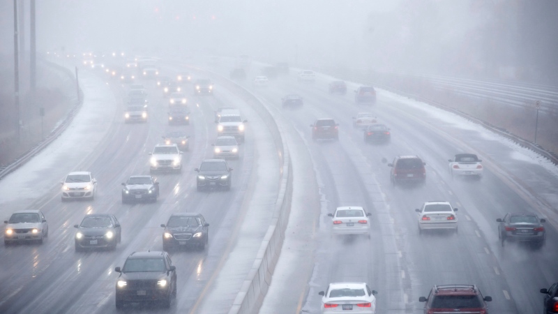
The precipitation stays snowy in Calgary
UPDATE: Well THAT forecast stood better Monday than it did this morning. As of 1 p.m., High River sits at our forecast high of six. Okotoks is at four, and the Calgary Airport ... is at zero. The modeling put Calgary in that warmer bubble this morning, but it's fallen, and with it, this layer of snow has pressed down hard on us, instead. Last night on CTV, and in yesterday's article, I leaned toward 8-12 cm; that looks far more likely now than the morning forecast below.
It's a learning moment for me. Potential was always there, and now we're in it.
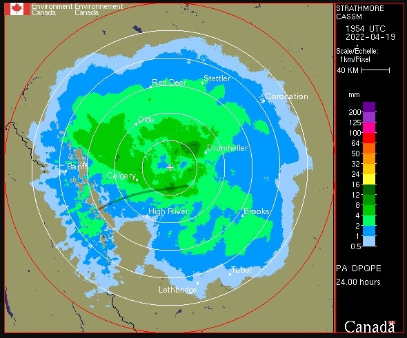
Here's our 24-hour precipitation accumulation. I drew that black line to show where our temperature rises to this becoming rainfall. The important note is that this is precipitable water; that means between four and eight millimetres of snow have fallen in Calgary (likely closer to six), but, as snow and with a portion of ice attached, that can indeed make for eight cm, though ground temperatures and ambient air temperatures around Calgary haven't allowed that to stick around, since a lot of this wet stuff was about ready to melt in the first place.
Beyond, I've adjusted our temperature trend accordingly. Nothing overly different to report; overnight snow showers are possible, and since a lot of forecast models were calling for Calgary to be nearer to 4 C by now, a lot of them probably overestimated our temperature trend. More snow will fall this evening and into tomorrow morning, but sunshine and warmer days are ahead.
It's cliché, but the sentiment of "never say never" applies to this last gasp of winter – the basis of which applies to the longest-range forecast models at my disposal, which show a steady stream of days ahead that are at least within a few degrees of seasonal. Our seasonal high right now is nearly 12 C.
This is all to say we don't have much left to endure before the warm-up begins again.
The evening forecasts had some wild disparity last night; some forecast models predicted as high as 18 centimetres for the Calgary area. Every new update since – and I mean every – has painted a much more muted picture for Calgary. Most suggest that even two centimetres will be tough to match, as the temperature at the base of the cloud has risen more effectively with our surface temperatures.
As the temperature profile in our lower atmosphere goes up, our chance for this precipitation to fall as snow goes down.
By the end of the day, it's doubtful much of this will stick around in Calgary.
Afterward, we’re looking at flurries into Wednesday morning that have a marginally better chance of clinging to grass, if briefly; we're staying in the positives on the high end throughout the next few milder days, after all! The weekend conditions ahead will be more than this layer of snow can handle.
YOUR FIVE-DAY CALGARY FORECAST
Tonight
- Evening: snow showers continue, low -4 C
Wednesday
- A.M. snow clearing, partly cloudy
- Daytime high: 3 C
- Evening: some cloud, low -5 C
Thursday
- Chance for scattered flurries
- Daytime high: 4 C
- Evening: some cloud, low -3 C
Friday
- Partly cloudy
- Daytime high: 9 C
- Evening: overnight scattered showers, low -1 C
Saturday
- Partly cloudy
- Daytime high: 11 C
- Evening: some cloud, low 1 C
Sunday
- Partly cloudy
- Daytime high: 14 C
- Evening: some cloud, low 2 C
Today's pic was sent by Richie on the weekend. What a cool angle!
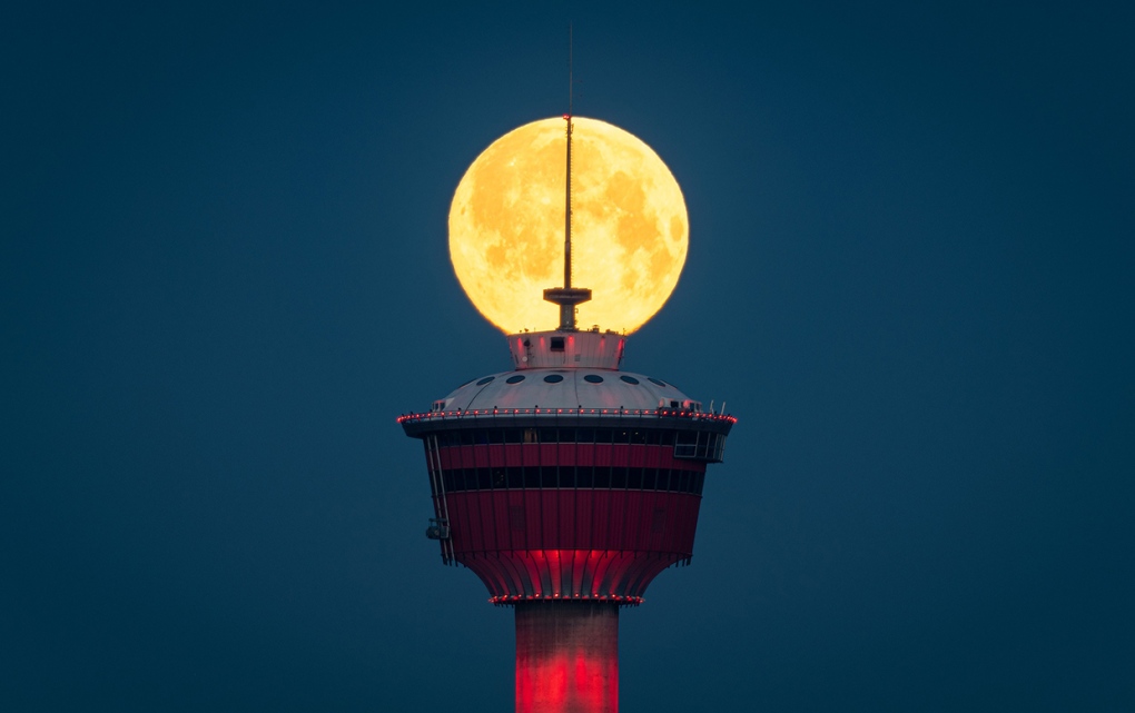 Rich Hannah captured the Calgary Tower in front of a full moon.
We love to see your pictures of weather, wildlife, and pets – submit your photos here, email me here, or tweet them over.
CTVNews.ca Top Stories

Trump threatens to try to take back the Panama Canal. Panama's president balks at the suggestion
Donald Trump suggested Sunday that his new administration could try to regain control of the Panama Canal that the United States “foolishly” ceded to its Central American ally, contending that shippers are charged “ridiculous” fees to pass through the vital transportation channel linking the Atlantic and Pacific Oceans.
Man handed 5th distracted driving charge for using cell phone on Hwy. 417 in Ottawa
An Ottawa driver was charged for using a cell phone behind the wheel on Sunday, the fifth time he has faced distracted driving charges.
Wrongfully convicted N.B. man has mixed feelings since exoneration
Robert Mailman, 76, was exonerated on Jan. 4 of a 1983 murder for which he and his friend Walter Gillespie served lengthy prison terms.
Can the Governor General do what Pierre Poilievre is asking? This expert says no
A historically difficult week for Prime Minister Justin Trudeau and his Liberal government ended with a renewed push from Conservative Leader Pierre Poilievre to topple this government – this time in the form a letter to the Governor General.
opinion Christmas movies for people who don't like Christmas movies
The holidays can bring up a whole gamut of emotions, not just love and goodwill. So CTV film critic Richard Crouse offers up a list of Christmas movies for people who might not enjoy traditional Christmas movies.
More than 7,000 Jeep SUVs recalled in Canada over camera display concern
A software issue potentially affecting the rearview camera display in select Jeep Wagoneer and Grand Cherokee models has prompted a recall of more than 7,000 vehicles.
'I'm still thinking pinch me': lost puppy reunited with family after five years
After almost five years of searching and never giving up hope, the Tuffin family received the best Christmas gift they could have hoped for: being reunited with their long-lost puppy.
10 hospitalized after carbon monoxide poisoning in Ottawa's east end
The Ottawa Police Service says ten people were taken to hospital, with one of them in life-threatening condition, after being exposed to carbon monoxide in the neighbourhood of Vanier on Sunday morning.
New York City police apprehend suspect in the death of a woman found on fire in a subway car
New York City police announced Sunday they have in custody a “person of interest” in the early morning death of a woman who they believe may have fallen asleep on a stationary subway train before being intentionally lit on fire by a man she didn't know.


