Blizzard-like conditions possible in southern Alberta on Saturday
UPDATE: I waited, this time. I had to! I had to see just how many extreme cold warnings would get dropped off ahead of New Years Eve... I was a perfect combination of "not surprised" and "underwhelmed," as only a few areas well to the northwest did. But that's not overly surprising, because, well... this.
So, what then is the point in dropping all of them, if by Sunday, much of the province returns to it? It'd be a second round of the same teaser we just got! Maybe it does happen later on for much of western Alberta... regardless, we're far from the other side of this event.
A quick peek at wind gust potential in the southwest shows increases over what was forecast this morning. Not quite to the 110 km/h marker, but the conditions remain just fine for it. BUT, here's the nice part; the statement involving the word "Blizzard" cleared out in the 3 o'clock hour! Visibility will be poor, at times, but no longer does it fall under the purview of blizzard-like. We'll take it.
Dress warmly this evening; the majority of warmth will rise up late Saturday and early Sunday; models show our temperatures beginning to stagnate by the early afternoon Sunday, with the arctic outbreak beginning closer to midnight. HOWEVER. Model behaviour is almost always slow on these. There's a chance for wind to pick up in Calgary earlier in the evening.
What a double-whammy. First, the return of extreme cold warnings (those’ll likely move along Friday for a fair half of the province), and now, winter storm warnings!?
Catching breaks is not Alberta’s forte.
So, to reiterate from yesterday — the extreme cold warnings were replaced because of potential of -40 wind chill values across the swath of the foothills up to Grande Prairie, and all the way back down to Lethbridge.
For the former, it absolutely lines up; GP is sitting at -40 with the wind chill as of this writing in the 6 o’clock hour. Lethbridge has no wind chill, thanks to a momentary lack of wind.
Calgary has its coolest wind chill of -32 at the moment. The potential was (and still may be) there for a lot of communities, and I agree with Environment Canada’s assessment — this is a ‘better safe than sorry’ scenario.
I bet the meteorologist who gets to slam down the “Clear” button on these is going to feel pretty good later on today. That said, pockets of northern Alberta and east-central Alberta may not be so fortunate. The west wind cycling in as a reinforcement of seasonal temperatures won’t press in those areas.
Okay, so, winter storm watch time.
The reports of strengthening west wind were in the article yesterday. To save you the click, I said gusts in the 80 km/h range are expected. The winter storm watches are projecting gusts from 90-110 km/h in a wide swathe that encompasses Cardston, Crowsnest Pass, K-Country, Lethbridge, and Claresholm (plus associated regions, such as Canmore and Okotoks).
The first line of these watches is “Blizzard conditions are expected Saturday” – the qualifiers for that are:
- Snow or blowing snow, which reduces visibility to less than 400 metres;
- 40 km/h wind gusts or higher, and;
- The first two pieces lasting four hours or more.
These are for Saturday. The total snow in the forecast for Lethbridge and Pincher Creek over the next day: 0 cm. So what you’re looking at here is the heavy wind scooping the light snow and playing havoc through the morning of Jan. 1.
It checks out. And, as the alerts suggest, the warming temperatures will improve and abate these conditions; warm wind and high-ice-content snow don’t mix all that well, after all.
Beyond everything above, the Saturday-Sunday combo of temperatures that will feel like comparative “shorts weather” (this is hyperbole) are still expected to be outliers in a chilly long-range forecast.
The drop is coming. Again. Throw a couple logs on the fire. We’re in for another long week.
Happy New Year to you and yours, reader. I’m sure some of your celebratory plans have changed over the past week-and-a-half.
I used to frequent the saying, “make it a great day” – and I hope you’re able to do that today, this evening, and through the weekend. See you in 2022!
Your five-day forecast:
Tonight
- Mainly clear, low -25 C
Saturday
- New Year's Day - Mainly sunny
- Daytime high: -4 C
- Evening: some cloud, low -10 C
Sunday
- Partly cloudy, late-day cold front
- Daytime high: 0 C
- Evening: snow, low -22 C
Monday
- Cloudy, late flurry risk
- Daytime high: -21 C
- Evening: overnight flurries, low -24 C
Tuesday
- AM flurries, then partly cloudy
- Daytime high: -24 C
- Evening: overnight flurries, low -27 C
Wednesday
- Mainly sunny
- Daytime high: -22 C
- Evening: mainly clear, low -27 C
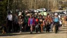
Our pic today is out Millarville-way, taken by George Jackson. It’s a good reminder that while we often discuss shorter walks for the puppers, livestock abroad are also not having a blast in these conditions – but they need strolls, too. Thank a farmer for the long hours, when time allows.

You can submit your photos here, email me here, or tweet them over.


CTVNews.ca Top Stories

From outer space? Sask. farmers baffled after discovering strange wreckage in field
A family of fifth generation farmers from Ituna, Sask. are trying to find answers after discovering several strange objects lying on their land.
Broadcaster and commentator Rex Murphy dead at 77: National Post
The National Post is reporting that Rex Murphy, the pundit and columnist who hosted a national call-in radio show for decades, has died.
Pearson gold heist suspect arrested after flying into Toronto from India
Another suspect is in custody in connection with the gold heist at Toronto Pearson International Airport last year, police say.
Millions of cyberattacks per hour as B.C. government investigates multiple breaches
Careful attention to government statements and legislation is required to get a handle on the level of risk British Columbians’ information is under, as investigators probe multiple breaches under a continued barrage of attacks.
Ontario family receives massive hospital bill as part of LTC law, refuses to pay
A southwestern Ontario woman has received an $8,400 bill from a hospital in Windsor, Ont., after she refused to put her mother in a nursing home she hated -- and she says she has no intention of paying it.
Debate on abortion rights erupts on Parliament Hill, Poilievre vows he won't legislate
A Conservative government led by Pierre Poilievre would not legislate on, nor use the notwithstanding clause, on abortion, his office says, as anti-abortion protesters gather on Parliament Hill.
Justin and Hailey Bieber are expecting their first child together
Hailey and Justin Bieber are going to be parents. The couple announced the news on Thursday on Instagram, both sharing a video that showcases Hailey Bieber's growing belly.
Here are the ultraprocessed foods you most need to avoid, according to a 30-year study
Studies have shown that ultraprocessed foods can have a detrimental impact on health. But 30 years of research show they don’t all have the same impact.
New 'Lord of the Rings' film coming in 2026
The Oscar-winning team behind the nearly US$6 billion blockbuster 'Lord of the Rings' and 'The Hobbit' trilogies is reuniting to produce two new films.
Shopping Trends
The Shopping Trends team is independent of the journalists at CTV News. We may earn a commission when you use our links to shop. Read about us.


Edmonton
-

5 people attacked by dogs in west Edmonton Thursday
Five people were attacked by two pit bulls in Meadowlark Park Thursday afternoon, according to police.
-
Oilers focus on details, aim for more 'O' zone time in Game 2 against Canucks
Given the result of the first game in their playoff series with the Vancouver Canucks — a loss Wednesday night courtesy a third-period collapse — the Edmonton Oilers say they need to play better next time.
-
New bill would give Alberta more power in emergencies, change election date to fall
The Government of Alberta has tabled another bill granting the province greater power to make unilateral decisions.
Lethbridge
-

Southern Alberta farmers optimistic after recent rainfall
After a dry winter, southern Alberta farmers were expecting it to be another tough growing season.
-
Rural crime in decline: southern Alberta RCMP
Rural crime is on the decline, the RCMP said in a media statement released by the Southern Alberta District (SAD) late Wednesday afternoon.
-
Four arrested in drug bust in Medicine Hat, Alta.
Four people are facing a series of charges following a drug bust in Medicine Hat last month.
Vancouver
-

Millions of cyberattacks per hour as B.C. government investigates multiple breaches
Careful attention to government statements and legislation is required to get a handle on the level of risk British Columbians’ information is under, as investigators probe multiple breaches under a continued barrage of attacks.
-
B.C. MLA under fire for saying motherhood begins at conception
After a BC Conservative MLA came under fire for saying motherhood begins at conception, the party's leader says he "will not reopen the abortion debate."
-
Inside the LNG 'floatel' cruise ship that Squamish, B.C., won’t allow
A 35,000 ton cruise ship that been that’s been converted into temporary accommodation for LNG workers at great expense remains anchored in Vancouver’s harbour.
Vancouver Island
-

B.C. launches dedicated squad for gang-related homicides
The percentage of homicides that are gang-related in B.C. has more than doubled in the last 20 years, officials said when announcing a new team that will focus solely on investigating these cases.
-
Police searching for driver after cyclist seriously injured in hit-and-run crash near Victoria
Mounties on Vancouver Island are searching for the driver of a Jeep Wrangler after a cyclist suffered serious injuries in an alleged hit-and-run collision near Victoria early Thursday morning.
-
No ransom demand in B.C. cyberattack, minister says
The 'sophisticated' cyberattack that was recently detected on B.C. government networks has not come with a ransom demand – at least, not yet.
Saskatoon
-

Sask. teachers overwhelmingly reject proposed deal, calling it a 'disservice to students'
Saskatchewan teachers have overwhelmingly voted “no” to a proposed deal that would have marked the end of a nearly year-long labour dispute.
-
'This is a community': City struggling to cope with humanitarian crisis in Pleasant Hill
Dr. Ephthymia Kutsogiannis is running out of options to solve a growing problem outside of her dental clinic.
-
Saskatchewan sky watchers say conditions are perfect for 'extremely strong aurora' on Friday
Saskatchewan sky watchers say the conditions are perfect for a vibrant show of aurora borealis starting on Friday night.
Regina
-
Sask. teachers overwhelmingly reject proposed deal, calling it a 'disservice to students'
Saskatchewan teachers have overwhelmingly voted “no” to a proposed deal that would have marked the end of a nearly year-long labour dispute.
-
From outer space? Sask. farmers baffled after discovering strange wreckage in field
A family of fifth generation farmers from Ituna, Sask. are trying to find answers after discovering several strange objects lying on their land.
-
Cenotaph, other downtown Regina locations vandalized, police investigating
Regina police are investigating a string of graffiti incidents throughout downtown including the Ceonotaph in Victoria Park.
Toronto
-

Pearson gold heist suspect arrested after flying into Toronto from India
Another suspect is in custody in connection with the gold heist at Toronto Pearson International Airport last year, police say.
-
Toronto man pleads guilty to manslaughter in death of CBC journalist
A Toronto man who assaulted and killed an 'exceptional' CBC journalist has pleaded guilty to manslaughter.
-
Toronto-area dessert shop featured by Keith Lee forced to move after zoning complaint
A small Ajax dessert shop that recently received a glowing review from celebrity food critic Keith Lee is being forced to move after a zoning complaint was made following the social media influencer’s visit last month.
Montreal
-

Mice, cockroaches: NDG family raises health concerns over unfixed hole in apartment ceiling
A Montreal family that came to Canada with dreams of building a better life have found themselves living in an apartment in Notre-Dame-de-Grâce where mice and cockroaches are coming through the ceiling because their bathroom ceiling caved in.
-
Family sues Lakeshore Hospital after mother found dead on ER floor
A Montreal family has filed a $1 million lawsuit against the Lakeshore Hospital after their 86-year-old mother fell on the floor and died at the hospital allegedly without anyone noticing.
-
Frankel stops 53, Tapani scores in OT as Boston steals playoff win over Montreal
Aerin Frankel made 53 saves and Susanna Tapani scored in overtime to lead Boston to a 2-1 win in Game 1 of their Professional Women’s Hockey League semifinal series on Thursday.
Atlantic
-

'Nobody should be getting away with murder': Grieving mother speaks out after son killed in North Preston, N.S.
A grieving mother is speaking out after her 36-year-old son was shot and killed in North Preston, N.S., Wednesday night.
-
Rothesay, N.B., woman ready to break barriers at Miss Universe Canada 2024
Lorraine Peters from New Brunswick looks forward to sharing her message on a national stage for women to have the confidence, and courage to pursue whatever they choose no matter their age
-
N.S. delivery driver’s car stolen while picking up order
Tony Dembogaj, owner of Bella Vita Pizzeria in Halifax, was away from work when he received a call informing him his delivery driver’s vehicle was stolen while picking up an order at his shop.
Winnipeg
-

Winnipeg trial hears victims' clothing, DNA found in serial killer's apartment
The trial of serial killer Jeremy Skibicki heard Thursday that police found physical evidence of the victims in his apartment, including jewelry, clothing, DNA and a blood-stained bathtub.
-
-
Winnipeg looking for feedback on future of Graham Avenue
The City of Winnipeg is looking for public feedback on a new vision for Graham Avenue that will see it become a multi-use corridor focused on pedestrians and activities.
Ottawa
-

1 dead in rollover crash in Sharbot Lake, Ont.; 5 others injured
Ontario Provincial Police confirm one person has died after a single-vehicle rollover crash in Sharbot Lake, Ont. that seriously injured five others.
-
NEW THIS MORNING
NEW THIS MORNING What's happening in Ottawa this weekend: May 10-12
CTVNewsOttawa.ca looks at things to do in Ottawa during the Mother's Day weekend.
-
Mail delivery changes looming as Canada Post grapples with financial pressure
Whether you check it every day or not, how and when your mail is delivered could be changing as Canada Post faces mounting financial pressure.
Northern Ontario
-

Skeletal remains found in Sudbury identified man missing since 2013
Sudbury police say they have identified the skeletal remains found last week in a wood area of Chelmsford and that no foul play was involved.
-
Travelling offenders responsible for most gun crime, northern Ont. police say
Following Tuesday’s shooting in Timmins, police officials say there’s been a higher number of weapons-related crimes in recent months.
-
Northern police say break-and-enter suspect walked into Hwy. 11 traffic
A 30-year-old suspect who robbed a residence in Hearst, Ont., was arrested when they left the crime scene and walked into highway traffic.
Barrie
-

Innisfil home suffers 'extensive damage' after fire Thursday evening
One person has been displaced from their home in Innisfil after a fire broke out shortly before sunset.
-
Wasaga Beach assault turns into murder investigation after victim's death
The charge against a Wasaga Beach man has been upgraded to second-degree murder after police say the victim died more than two months after an alleged assault.
-
Barrie man who once feigned cancer to draw sympathy from victims pleads guilty to more sex crimes
A Barrie man convicted of sexually assaulting teenage girls over a decade ago while pretending to have cancer to draw sympathy from his victims pleaded guilty on Thursday, again to sexual assault.
Kitchener
-

Wilfrid Laurier football player drafted despite only playing 27 games in his entire life
A Listowel, Ont. man, drafted by the Hamilton Tigercats last week, is also getting looks from the NFL, despite only playing 27 games of football in his life.
-
Long-time CKCO personality, Janine Grespan, dies at 63
A broadcaster familiar to many CTV News watchers has died at the age of 63.
-
Waterloo Region case changing legal landscape on encampment evictions
A resolution has been reached over evictions at a Cambridge, Ont. encampment and experts say other communities should take note.
London
-

Josh Morgan announces separation from his wife
London Mayor Josh Morgan has announced the separation between him and his wife Melanie.
-
Mother denies sexually assaulting children at child abuse trial
While fighting back tears, a London, Ont. mother denied sexually assaulting or harming her children as she continued to testify in her own defence.
-
Justin and Hailey Bieber are expecting their first child together
Hailey and Justin Bieber are going to be parents. The couple announced the news on Thursday on Instagram, both sharing a video that showcases Hailey Bieber's growing belly.
Windsor
-

Foreman supervisor wins $350,000 with scratch ticket
A Windsor foreman supervisor says he’s going to set himself up for a comfortable retirement after winning $350,000.
-
51-year-old Wheatley man dies in Merlin crash
Chatham-Kent police say a 51-year-old Wheatley man has died after a single vehicle collision south of Merlin, Ont.
-
Developers back city's downtown plan
Eight local developers have unified to back the city’s Strengthen the Core plan.


