CALGARY -- A tale of three forecasts:
Let's start with The Gooder.
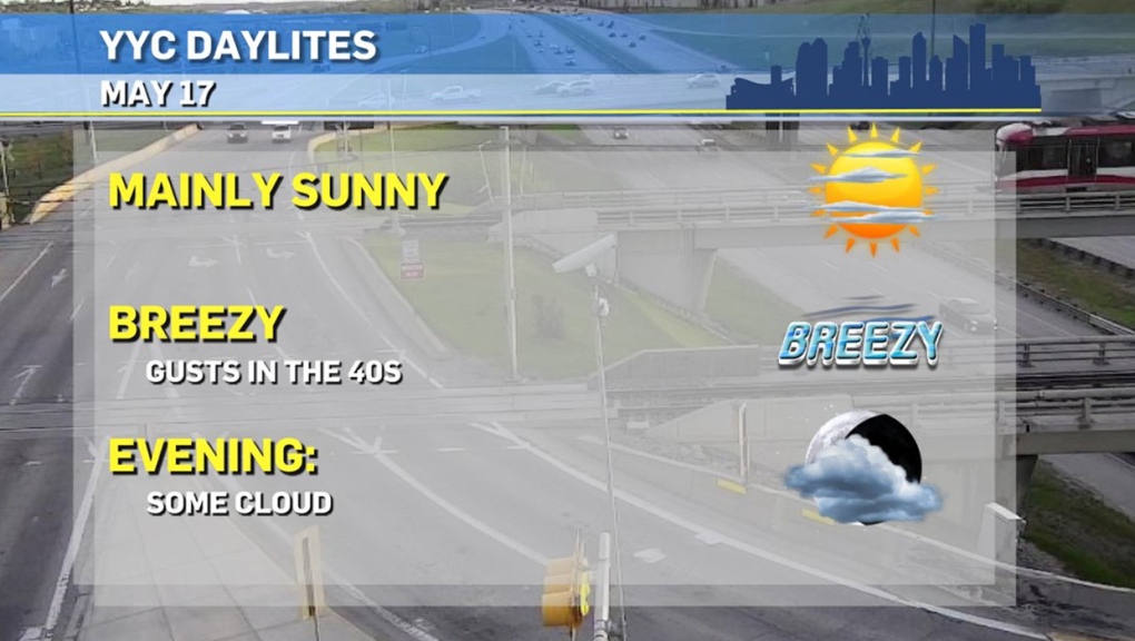
Nobody told this Monday what a "case of the Mondays" is supposed to look like! We're into the entry region of a high pressure ridge, which means it's a sunny, windy-out-of-the-west sort of day. This will generate potentially record-breaking highs across southern Alberta today. Brooks and Medicine Hat should come within two degrees of their high records, and conditions will persist in this fashion well beyond our boundary, with Winnipeg, Brandon, and areas of Saskatchewan seeing highs today hitting the 30s.
Enjoy!
Alright. Forecast two: The Not-So-Gooder.
It starts today, in fact; rainshowers and unstable pockets triggering thundershowers will roll out from Canmore and strike to the northeast, lining up with Edmonton. That's the thing about aligning with the entry-region of a ridge: wind is rising. Rising air cools, and creates unstable conditions. Tomorrow, that trough arrives in earnest and sticks it out for a few days, plummeting us well below seasonal, and dropping our low temperatures to just above the freezing mark! If you haven't got some already, a nice little layer of burlap and some twine may be necessities for your garden beds. We'll look for scattered showers as well, and, if those continue overnight, temperatures will support flurry activity.
Yikes.
Of late, forecast models have been verifying flurries remaining to the west and north, and leaving Calgary well enough alone. We'll hope that trend among models continues later in the week.
Forecast Three. May Long.
Let's get a little bit scientific here. You can see it in the sub-text there: "extraordinarily preliminary" – this is so far out that I don't want to put a ton of stock into it. Why, though? Take this example:
So you have two balls, dropped into a circle. The prevailing theory is that since pi cannot be fully calculated, this environment is going to be unstable. The farther along you get in this little animation, the more "wrong" these two objects become.
Same with forecast models. The moment a forecast model goes a little off the rails, it stays off the rails and becomes more so as time moves along. Another way of looking at it: think about that person you follow on social media who loves to argue. The more they dig into whatever point they are making, the more wrong it seems to become. Welcome to the joys of long-range forecasting!
Your five-day forecast:
Monday:
- Mainly sunny, breezy! SW gusts 40 km/h
- Daytime high: 25 C
- Evening: some cloud, low 10 C
Tuesday:
- Some cloud
- Daytime high: 18 C
- Evening: some cloud, high 3 C
Wednesday:
- Some cloud, chance of scattered showers
- Daytime high: 10 C
- Evening: largely cloudy, high 1 C
Thursday:
- Some cloud, chance of scattered showers
- Daytime high: 8 C
- Evening: largely cloudy, high 1 C
Friday:
- Mainly cloudy
- Daytime high: 9 C
- Evening: some cloud, low 1 C
Photo time!
Plenty of you had amazing weekends:
Bruce went to Cameron Lake:

Ly was at Grassi Lake:

…and Jen checked out Barrier Lake:

I know it may feel like our web vizier Ryan White said "you know you can just embed tweets, right?" since I'm going a little overboard on it, but I stepped out onto broadcast hill just after we opened CTV Morning Live and caught this:
You can submit your weather photos here, or email me: Kevin Stanfield , OR you can just tweet at me!


