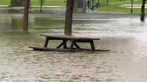
The rain is contributing to the higher than normal water levels in many streams and rivers in southern Alberta but how does it compare to other years? We asked the CTV Weather experts to break it down…
CTV Calgary Sky Watch Weather Specialist Kelsey McEwen took a look at the rainfall statistics for the month of June and says Calgary has had roughly 28mm of rain this June so far.
How does this compare to June 2013?
Calgary saw 146.6mm of rain in June 2013 and from June 17-23 the rainfall was as follows:
- June 17: 2mm
- June 18: 6.4mm
- June 19: 7.8mm
- June 20: 45.0mm
- June 21: 23.0mm
- June 22: 0.6mm
- June 23: 1.2mm
(Note** Two days of missing data on June 10/11 were not included in the 146.6 mm for June 2013)
Calgary Long-term Averages for June:
- 1981-2010 was 93.9mm
- 1971-2000 was 79.8mm
Environment Canada estimates that the city has received about 10 mm of rain over the last few days from this latest weather event.
The weather agency says Lethbridge has received 138.8mm of rain so far this month:
- June 2: 8.8mm
- June 4: 1.5mm
- June 5: 0.6mm
- June 10: 10.8mm
- June 14: 20.4mm
- June 15: 4.5mm
- June 16: 44.2mm
- June 17: 48.0mm
How does this compare to June 1995, when the Lethbridge saw some of the worst flooding in its history?
Lethbridge received 102.4mm of rain in June 1995:
- June 5: Trace rainfall
- June 6: 55.0mm
- June 7: 1.6mm
- June 8: Trace rainfall
- June 9: 2.1mm
- June11: 8mm
Lethbridge Long-term Averages from Environment Canada for June:
- 1981-2010 was 82mm
- 1971-2000 was 63mm
CTV Lethbridge weather specialist Dory Rossiter says June gets about 61mm of rain and that the area has received well over that amount in the last 24 hours.
More long-term averages for June for southern Alberta communities:
- 1981-2010 for Claresholm was 89.3mm
- 1981-2010 for Cardston was 90.7mm
- 1981-2010 for Carway was 91.6mm
Several other southern Alberta communities are also experiencing flooding and are under watches and warnings.
Here are some of the rainfall totals from this latest weather event as of 6:00 a.m. Wednesday, June 18, 2014.
- West Castle 175mm
- Beaver Mines 105mm
- Waterton Park 122mm
- Carway 108mm
- Cardston 91mm
- Raymond 81mm
- Fort Macleod 88mm
- Del Bonita 82mm
- Claresholm 78mm
- Pincher Creek 72mm
- Milk River 52mm
- Foremost 44mm
Click HERE for the latest forecast from the Sky Watch Weather Centre.
(With files from Kelsey McEwen)

