Winter weather on our doorstep
If you've been enjoying these warmer temperatures, be sure to take it all in before the colder weather arrives.
We will slowly ease into winter conditions.
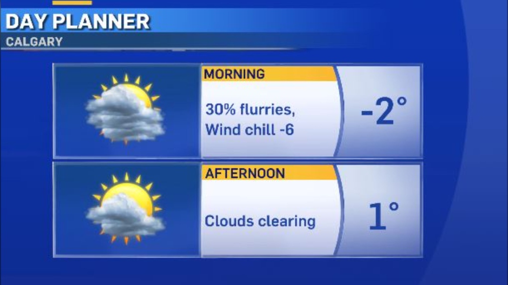
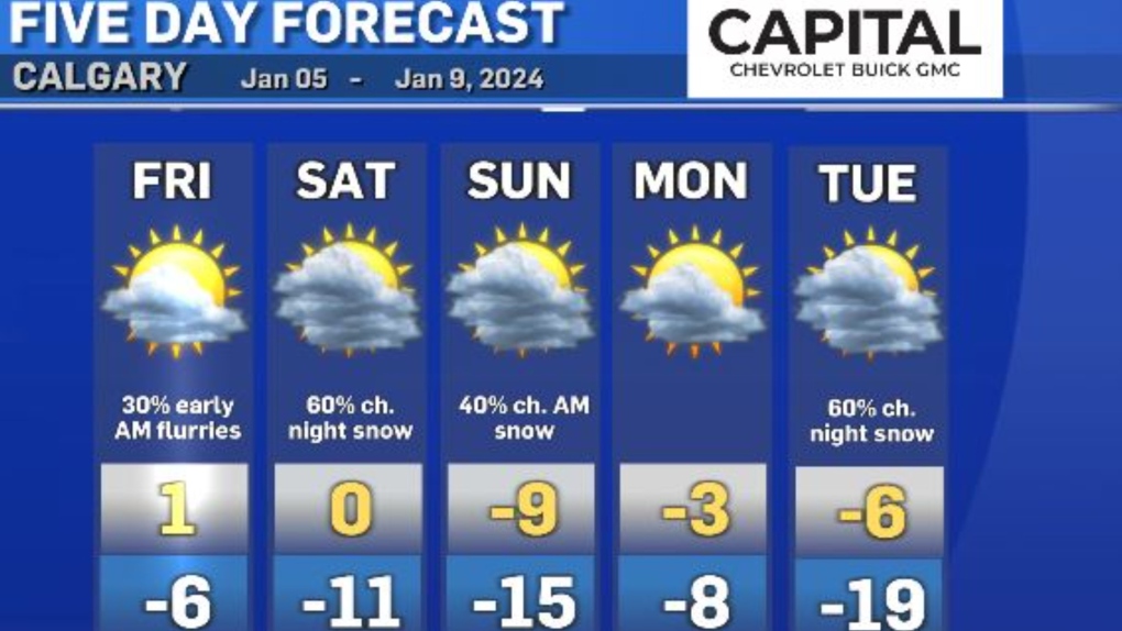
Friday, our high will be just above the freezing mark.

Let's talk about the snow potential for this week -- and boy, do we need the moisture!
Overnight flurries could last until 7 a.m. on Friday.
This little burst of snow is likely just a light dusting (less than two centimetres).
Our greater potential for a large amount of snow is Saturday night into Sunday morning.
This second burst could bring us six to eight centimetres.
Will this be a game-changer? Nope. But it's better than nothing.
The Environment and Climate Change Canada winter forecast calls for below-normal precipitation for the season, which puts us at risk for another rough wildfire season.
So we need lots of moisture over these next few months to catch up to where we need to be.

CTVNews.ca Top Stories

'Environmental racism': First Nations leaders claim cancer-causing contamination was covered up
The people of Fort Chipewyan believe the federal government believe the federal government knew its water was contaminated and hid the issue for years. Now the chief of the Athabasca Chipewyan First Nation is leading the call for immediate action.
Death toll from Hurricane Helene rises to 227 as grim task of recovering bodies continues
The death toll from Hurricane Helene inched up to 227 on Saturday as the grim task of recovering bodies continued more than a week after the monster storm ravaged the Southeast and killed people in six states.
Car flies into B.C. backyard, lands upside down
A driver suffered only minor injuries after going airborne in a residential neighbourhood in Maple Ridge, B.C., on Friday, the car eventually landing on its roof in someone’s backyard.
Donald Trump, Elon Musk attend rally at same Pennsylvania grounds where gunman tried to assassinate Trump
Donald Trump returned on Saturday to the Pennsylvania fairgrounds where he was nearly assassinated in July, holding a sprawling rally with thousands of supporters in a critical swing state Trump hopes to return to his column in November's election.
Tax rebate: Canadians with low to modest incomes to receive payment
Canadians who are eligible for a GST/HST tax credit can expect their final payment of the year on Friday.
'No one has $70,000 dollars lying around': Toronto condo owners facing massive special assessment
The owners of a North York condominium say they are facing a $70,000 special assessment to fix their building's parking garage. '$70,000 is a lot of money. It makes me very nervous and stressed out of nowhere for this huge debt to come in,' said Ligeng Guo.
Police ID mom, daughter killed in Old Montreal; video shows person break into building before fatal fire
Police released the identities of the mother and daughter who were killed after a fire tore through a 160-year-old building in Old Montreal on Friday.
Frequent drinking of fizzy beverages and fruit juice are linked to an increased risk of stroke: research
New data raises questions about the drinks people consume and the potential risks associated with them, according to researchers at Galway University in Ireland, in partnership with Hamilton’s McMaster University.
'I screamed in shock and horror': Family faces deadly Vancouver hit-and-run driver during sentencing
The sentencing of the man who pleaded guilty in the deadly hit-and-run in Kitsilano two years ago began on Friday.


