A warm weekend in Calgary ahead of a cooling early next week
UPDATE: This forecast just keeps on keepin' on. We haven't hit our expected high of 3 just yet, but southwesterly wind is going to pick up into the afternoon and evening, generating temperatures that will periodically warm us overnight.
The Saturday-Sunday forecast line is more-or-less the same, though I've trended down on Sunday's low. I'm wondering if the forecasted west wind doesn't pop us above the called high of 8 tomorrow, too! I'll sit with that.
I may (MAY) be a little shy on Monday's high - and yes, I'm suggesting warmer than 7 C is possible, as we precede evening snow! That's another warm, west wind day. At this time, that forecast snowfall is still sitting at a couple of centimetres.
Well, how about that. This morning's cloud layer and some extra sheltering from our incoming high above kept us from seeing negative temperatures overnight. I track a fair amount of weather data every day to continue improving accuracy, and only a single model predicted anything within seven degrees of what we got overnight.
It doesn't play much into our high for today, however. We'll aim for a low positive, experience a brief dip late this evening, then start to power up Saturday morning. This has created a strange pattern for our overnight conditions, where yesterday, the high for Friday was 3 C (maintaining that) and the low was 5 C (less bullish on that, now). Forecasting out of that little dip, we'll drop closer to freezing, this time around.
Westerlies are returning this evening to southern Alberta, and we'll begin tracing that effect late. That'll be the key marker for yet another warming trend to carry us through Saturday, with local gusts popping to the 40 km/h range in the afternoon. Sunday, we'll coast a little, keeping sunny but dropping free of that wind.
Monday afternoon is the maintained marker for "the drop" – cooler temperatures are just ahead, but it'll be reminiscent of yesterday; early warming, then a late-day plunge. The biggest difference in the early look is additional moisture, which is easily one of the most variable components of a longer-range forecast. Currently calling for five centimetres of overnight snow Monday into Tuesday but that often pares back for us when this far out. Still, it's something to watch. It's worth reiterating – the five-day forecast looks ominous, but the five-day we'll have on Monday shows that this colder passage is quite short-lived, compared to other (unmentionable) moments this winter.
If you're a morning reader or a new reader (welcome!), a note: these articles are updated by 3 p.m. with the latest info.
Have a safe and happy weekend!
YOUR FIVE-DAY FORECAST
Tonight
- Some cloud, low 0 C
Saturday
- Sunny
- Daytime high 8 C
- Evening: some cloud, low -5 C
Sunday
- Sunny
- Daytime high 3 C
- Evening: some cloud, low -2 C
Monday
- Building cloud, cold front, late-day flurries
- Daytime high 7 C
- Evening: flurries, low -12 C
Tuesday
- Partly cloudy
- Daytime high -11 C
- Evening: some cloud, low -17 C
Wednesday
- Partly cloudy
- Daytime high -7 C
- Evening: some cloud, low -9 C
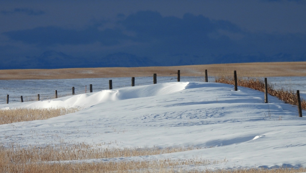
Roy sent a unique shot out Aldersyde-way for us!
You can submit your photos here, email me here, or tweet them over! We're also freshly minted on Instagram and waiting on a few approvals before daily posts pop up there: @CTVCalgaryWeather


CTVNews.ca Top Stories

Expert warns of food consumption habits amid rising prices
A new survey by Dalhousie University's Agri-Food Analytics Lab asked Canadians about their food consumption habits amid rising prices.
Documents reveal Ottawa's efforts to get Loblaw, Walmart on board with grocery code
It was evident to the federal government as early as last fall that Loblaw and Walmart might be holdouts to the grocery code of conduct, jeopardizing the project's success.
opinion
opinion The special relationship between King Charles and the Princess of Wales
Royal commentator Afua Hagan writes that when King Charles recently admitted Catherine to the Order of the Companions of Honour, it not only made history, but it reinforced the strong bond between the King and his beloved daughter-in-law.
Charlie Woods, son of Tiger, shoots 81 in U.S. Open qualifier
Charlie Woods failed to advance in a U.S. Open local qualifying event Thursday, shooting a 9-over 81 at Legacy Golf & Tennis Club.
Improve balance and build core strength with this exercise
When it comes to cardiovascular fitness, you may tend to focus on activities that move you forward, such as walking, running and cycling.
New Norad commander calls Canada's defence policy update 'very encouraging'
American troops will be spending more time training in the Far North, the new commander of Norad says, a strategy that fits 'hand-in-glove' with Canada's renewed focus on Arctic defence.
B.C. tenants evicted for landlord's use after refusing large rent increase to take over neighbouring suite
Ashley Dickey and her mother rented part of the same Coquitlam duplex in three different decades under three different landlords.
Mountain guide dies after falling into a crevasse in Banff National Park
A man who fell into a crevasse while leading a backcountry ski group deep in the Canadian Rockies has died.
$70M Lotto Max winners kept prize a secret from family for 2 months
During a special winner celebration near their hometown, Doug and Enid shared the story of how they discovered they were holding a Lotto Max ticket worth $70 million and how they kept this huge secret for so long.
Shopping Trends
The Shopping Trends team is independent of the journalists at CTV News. We may earn a commission when you use our links to shop. Read about us.


Edmonton
-

UCP able to remove councillors and axe city bylaws in new sweeping bill aimed at municipal politics
The Government of Alberta wants to change how municipalities handle elections and local politics.
-
Oilers 'far superior' to Kings when they're on top of their game: analyst
It's a travel day for the Edmonton Oilers — and some of their fans are along for the ride.
-
Experts urge Albertans to check measles vaccine status after confirmed Edmonton case
A confirmed case of measles in Edmonton has prompted another plea from health officials for people to make sure vaccinations are up to date.
Lethbridge
-

Former U of L student awarded diversity, equity and inclusion medal by NASA
A former University of Lethbridge student has been awarded the Medal for Diversity, Equity, Inclusion and Equity by NASA.
-
Oilers get hat trick from MacNeil en route to 4-1 win over Bandits
The Okotoks Oilers bounced back against the Bandits Wednesday night, defeating Brooks 4-1.
-
Fire risk for southern Alberta high: Natural Resources Canada
It’s not even May 1 and the fire risk for southern Alberta is already alarming.
Vancouver
-

Vancouver developer apologizes for housing scandal at Little Mountain
It’s arguably the biggest social housing scandal in Vancouver’s history and today the developer responsible for the Little Mountain project apologized for the multi-year delay that’s left a massive plot of land vacant during a housing crisis.
-
'So shocking': Roommate of victim left reeling after fatal White Rock stabbing
The roommate and long-time friend of the young man who was killed in White Rock Tuesday night, says he’s still in disbelief over what happened.
-
Inquest into B.C. police shooting deaths recommends emergency events be recorded
An inquest jury looking into the police shooting deaths of a man and the woman he was holding hostage has recommended that events involving the emergency response team be recorded with both video and audio.
Vancouver Island
-

Hiker airlifted to hospital in critical condition after falling into Vancouver Island canyon
A hiker was airlifted to hospital in critical condition Tuesday after he fell approximately 60 metres into a canyon on Vancouver Island.
-
B.C. civil lawsuit against Sex Pistols guitarist alleges 1980 sexual assault
A Vancouver woman has filed a civil lawsuit against Paramount Pictures Corp. and punk rocker Stephen Jones of The Sex Pistols alleging he sexually assaulted her as a teenager while she was a movie extra more than 40 years ago.
-
Harbour Air commits to buying 50 electric engines for seaplane fleet
Harbour Air is travelling towards a more sustainable future, looking to electrify its fleet of 45 aircraft.
Saskatoon
-

Crown argues for life sentence for Sask. Mountie who shot and killed his lover
A Crown prosecutor says the former RCMP officer who shot and killed his lover should be sentenced to life in prison.
-
'Difficult to maintain': Private Sask. school embroiled in abuse allegations may soon close
A private Christian school at the centre of a civil lawsuit and several criminal cases might soon be taken over by an affiliated group, according to a letter obtained by CTV News.
-
Council votes for bike safety improvements at corner where cyclist was killed
Saskatoon city council is making road safety improvements following the death of a cyclist at a busy intersection last year.
Regina
-

RCMP make 2 arrests in connection to Oxbow area homicide
Saskatchewan RCMP have made two arrests in a homicide investigation in the province's southeast.
-
'Get these doctors here': Sask. family calls on province to step up gastroenterologist recruitment
The Weber family is being forced to travel to Toronto due to a lack of pediatric gastroenterologists (GIs) in the province. The family’s situation was highlighted by Saskatchewan’s official opposition.
-
Looking ahead to the upcoming CFL Draft
The draft will take place on Tuesday, April 30, the Saskatchewan Roughriders currently hold the third overall pick.
Toronto
-

'I was scared': Ontario man's car repossessed after missing two repair loan payments
An Ontario man who took out a loan to pay for auto repairs said his car was repossessed after he missed two payments.
-
'Wallet-bursting' housing costs have some Torontonians ditching the city for cheaper pastures
Mauro Quattrochi is facing a decision shared by many in Toronto: commit to a “wallet-bursting life in the city, or a car-bound, almost-as-expensive life outside it?”
-
Subway service on Line 2 partially shutdown after fire: TTC
The TTC says riders using part of Line 2 can expect to face some delays this morning.
Montreal
-

Body of Quebec man who died in Cuba found in Russia, family confirms
A Montreal-area family confirmed to CTV News that the body of their loved one who died while on vacation in Cuba is being repatriated to Canada after it was mistakenly sent to Russia.
-
Parks Canada trashes pilot project, reinstalls garbage cans along Lachine Canal
Parks Canada said on Thursday that it was ending its pilot project and reinstalling garbage cans along the Lachine Canal Historic Site.
-
Woman transported to hospital in critical condition after fire in Montreal's Ste. Marie neighbourhood
A woman was taken to the hospital in critical condition on Thursday night after a fire broke out in a Montreal apartment building. The woman's condition has since improved.
Atlantic
-

'They followed their gut': N.B. RCMP say wellbeing check led to rescue of human trafficking victims
The New Brunswick RCMP say a wellbeing check that led to the rescue of three women from alleged human trafficking in Moncton earlier this month was the result of someone following their gut.
-
N.S. residents arrested at New Brunswick border with multiple weapons
Canadian Border Services Agency (CBSA) officers arrested two Nova Scotia residents at the New Brunswick border after they seized multiple prohibited firearms.
-
2 teens charged in Halifax homicide: police
Two teenagers have been charged with second-degree murder in connection to an alleged homicide near the Halifax Shopping Centre earlier this week.
Winnipeg
-

'Deep ignorance': Calls for Manitoba trustee to resign sparked after comments about Indigenous people and reconciliation
A rural Manitoba school trustee is facing calls to resign over comments he made about Indigenous people and residential schools earlier this week.
-
Former Manitoba premier Heather Stefanson leaving politics after 23 years
Former Manitoba premier Heather Stefanson is resigning her legislature seat and leaving political life.
-
Arrest made in 2021 northern Manitoba double homicide: RCMP
Manitoba RCMP have arrested a suspect in relation to a 2021 double homicide in a remote northern community.
Ottawa
-

Flood watch warning in effect along areas of Ottawa River until May 3
The Ministry of Natural Resources and Forestry has issued a flood watch warning for the Pembroke, Ont. area.
-
Warm temperatures in forecast for Ottawa Friday
The weather is nice in the capital this Friday, as it’s going to be sunny and warm.
-
NEW THIS MORNING
NEW THIS MORNING The Almonte Hospital's mystery March baby boom
This spring has been full of life in Almonte, as the local hospital has seen its biggest baby boom in recent memory.
Northern Ontario
-

Fire victims in Timmins say thieves have stolen their personal belongings
A month after an accidental fire forced more than 100 people out of their apartments at the Empire Complex in Timmins, residents are now dealing with being victims of theft.
-
Former head of Ont. tech company charged in $6M fraud case
A years-long fraud investigation by the Ontario Provincial Police’s anti-rackets branch has resulted in fraud and other charges for the former head of BioNorth Technology Group, Frank Benincasa
-
Expert warns of food consumption habits amid rising prices
A new survey by Dalhousie University's Agri-Food Analytics Lab asked Canadians about their food consumption habits amid rising prices.
Barrie
-
Police warn of caller ID phone scams
Faking a caller identity has never been so easy.
-
Wasaga Beach welcomes new family doctor
New doctor will expand services at the Georgian Bay Family Health Team.
-
Honda unveils $15B investment plan to build new EV plant in Alliston
Prime Minister Justin Trudeau and Premier Doug Ford visited Alliston on Thursday to unveil a $15 billion investment in an electric vehicle and battery facility.
Kitchener
-

Generational farm could be impacted if Wilmot land assembly goes ahead
A family of farmers say their operations would be significantly impacted if the Region of Waterloo goes ahead with a land assembly project in the Wilmot Township area.
-
Fatal crash closes section of Highway 401
A fatal crash in Thames Centre has closed down a portion of Highway 401 westbound. Around 2:15 a.m., first responders were called to westbound lanes of the highway between Culloden and Putnam Roads for a two-vehicle crash.
-
Over 40 charges laid to Cambridge man following break-in arrest
Waterloo regional police have handed out over 40 criminal charges to a Cambridge man following an investigation into several break-ins.
London
-

Fatal crash closes section of Highway 401
A fatal crash in Thames Centre has closed down a portion of Highway 401 westbound. Around 2:15 a.m., first responders were called to westbound lanes of the highway between Culloden and Putnam Roads for a two-vehicle crash.
-
Aamjiwnaang First Nation declares state of emergency over benzene levels
On Thursday, Aamjiwnaang First Nation Chief Chris Plain declared a state of emergency due to the high levels of benzene.
-
Tentative agreement reached between GTAs and Western
The union representing western's graudate teacher's assistants says a tentative agreement has been reached with the university.
Windsor
-

Local job protection a concern as Canada's auto sector faces EV renaissance
Canada's auto industry is experiencing a renaissance as it transitions from building gas-powered vehicles to ones that run on batteries, but some are raising the alarm over the protection of local jobs.
-
Preparations underway for Wheatley demos
Preparations are underway for the demolition of nine building that remain fenced off from the explosion that rocked the downtown core of Wheatley in 2021, injuring 20 people.
-
Fatal crash closes section of Highway 401
A fatal crash in Thames Centre has closed down a portion of Highway 401 westbound. Around 2:15 a.m., first responders were called to westbound lanes of the highway between Culloden and Putnam Roads for a two-vehicle crash.


