Brief cool down starts Thursday with snowfall warnings possible west of Calgary
Wednesday will bring more melting in Calgary with a daytime high around 6 C – which is seasonal.
This will be the warmest temperature since last Tuesday, but this bump will be very brief.
A low-pressure system in northern Alberta is expected to intensify and slide further south on Wednesday and Thursday.
Snow is expected along the associated cold front and as that frontal system tracks southeast through Alberta early Thursday, there is the potential for instability and a return to upsloping flow west of Calgary.
Upsloping – air moving east to west against the leeward (east side) of the Rockies – can produce high-precipitation weather events, like last week’s snowfall.
For this incoming system, areas west of Calgary are likely to see higher accumulations over a short period of time – which may prompt weather warnings.
Accumulations in the foothills could measure between eight to 10 centimetres over a relatively short period of time, compared to the City of Calgary which is expecting light and scattered flurries Thursday and Friday and total accumulations of two to four centimetres.
The good news is the avalanche risk in the mountains has improved considerably.
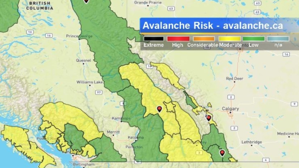 A map showing avalanche risk in Alberta and B.C. (CTV News)
According to Avalanche Canada, on March 27, 2024, all of the mountain regions in Alberta and B.C. were assessed between a low and moderate risk as compared to the considerable to extreme ratings earlier in the month.
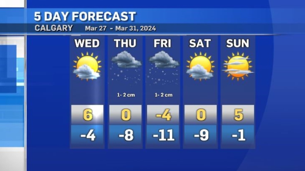 Calgary five-day forecast for March 27-31, 2024. (CTV News)
A strong ridge of high pressure will move across B.C. and into Alberta on Sunday – kicking off warming trend. By Monday and Tuesday daytime highs in Calgary are forecast to hit between 11 C and 13 C.
CTVNews.ca Top Stories

More than 115 cases of eye damage reported in Ontario after solar eclipse
More than 115 people who viewed the solar eclipse in Ontario earlier this month experienced eye damage after the event, according to eye doctors in the province.
Toxic testing standoff: Family leaves house over air quality
A Sherwood Park family says their new house is uninhabitable. The McNaughton's say they were forced to leave the house after living there for only a week because contaminants inside made it difficult to breathe.
Decoy bear used to catch man who illegally killed a grizzly, B.C. conservation officers say
A man has been handed a lengthy hunting ban and fined thousands of dollars for illegally killing a grizzly bear, B.C. conservation officers say.
B.C. seeks ban on public drug use, dialing back decriminalization
The B.C. NDP has asked the federal government to recriminalize public drug use, marking a major shift in the province's approach to addressing the deadly overdose crisis.
OPP responds to apparent video of officer supporting anti-Trudeau government protestors
The Ontario Provincial Police (OPP) says it's investigating an interaction between a uniformed officer and anti-Trudeau government protestors after a video circulated on social media.
An emergency slide falls off a Delta Air Lines plane, forcing pilots to return to JFK in New York
An emergency slide fell off a Delta Air Lines jetliner shortly after takeoff Friday from New York, and pilots who felt a vibration in the plane circled back to land safely at JFK Airport.
Sophie Gregoire Trudeau on navigating post-political life, co-parenting and freedom
Sophie Gregoire Trudeau says there is 'still so much love' between her and Prime Minister Justin Trudeau, as they navigate their post-separation relationship co-parenting their three children.
Last letters of pioneering climber who died on Everest reveal dark side of mountaineering
George Mallory is renowned for being one of the first British mountaineers to attempt to scale the dizzying heights of Mount Everest during the 1920s. Nearly a century later, newly digitized letters shed light on Mallory’s hopes and fears about ascending Everest.
Loud boom in Hamilton caused by propane tank, police say
A loud explosion was heard across Hamilton on Friday after a propane tank was accidentally destroyed and detonated at a local scrap metal yard, police say.


