Record-breaking heat chased with a winter-weather wallop... yup, that tracks
After many days of record-breaking heat in southern Alberta and spring officially beginning on Tuesday, it seems about right that we get a winter-weather wallop.
Spring is a transitional season in which we typically get huge temperature swings, and March is usually the snowiest month of the year. So keep your winter gear by the door, because that is what you will need for the rest of the week.
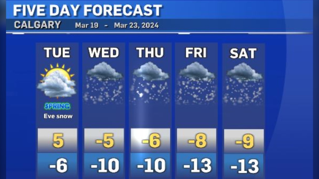
On Tuesday, you will notice the clouds increase, the winds pick up and we will struggle to get to 5 C in the afternoon (fresh off the heels of a high of 16 C on Monday).
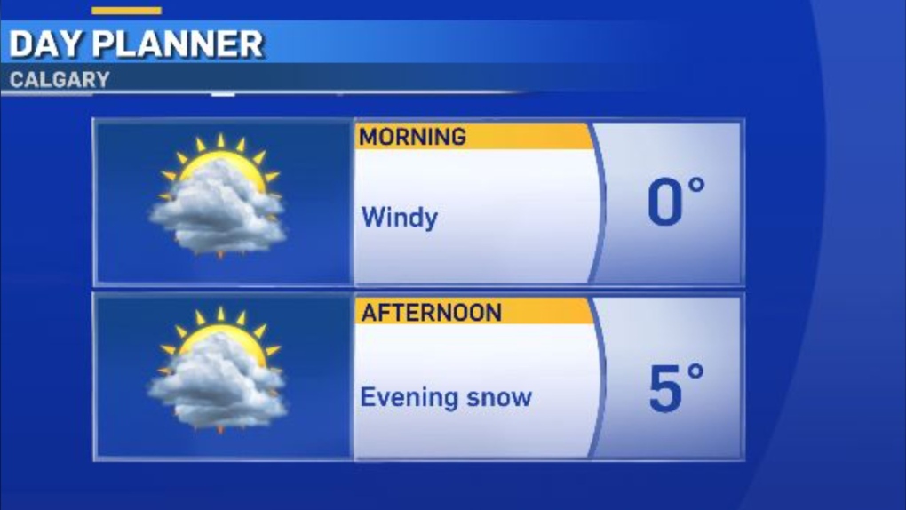
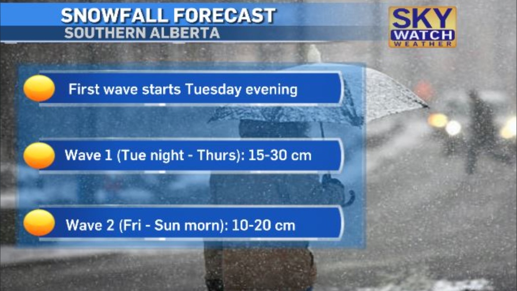
The snow will start in the foothills Tuesday afternoon and should creep to the QEII/Highway 2 by 8 p.m.
The snow will be heavy at times and continue (on/off) until Sunday morning.
Because we have a very cold air mass meeting with lots of moisture, a bunch of snow is possible this week.
In the beginning, it will melt on contact with the ground because it is so warm but then, it will start to accumulate:
We need the moisture but this will definitely come with messy driving conditions.
Along with the snow, daytime highs will be in the minus single digits.
We likely won't get back above freezing until the middle of next week.
But boy, was it a beautiful spring-ish weekend!
CTVNews.ca Top Stories

More than 115 cases of eye damage reported in Ontario after solar eclipse
More than 115 people who viewed the solar eclipse in Ontario earlier this month experienced eye damage after the event, according to eye doctors in the province.
Toxic testing standoff: Family leaves house over air quality
A Sherwood Park family says their new house is uninhabitable. The McNaughton's say they were forced to leave the house after living there for only a week because contaminants inside made it difficult to breathe.
Decoy bear used to catch man who illegally killed a grizzly, B.C. conservation officers say
A man has been handed a lengthy hunting ban and fined thousands of dollars for illegally killing a grizzly bear, B.C. conservation officers say.
B.C. seeks ban on public drug use, dialing back decriminalization
The B.C. NDP has asked the federal government to recriminalize public drug use, marking a major shift in the province's approach to addressing the deadly overdose crisis.
OPP responds to apparent video of officer supporting anti-Trudeau government protestors
The Ontario Provincial Police (OPP) says it's investigating an interaction between a uniformed officer and anti-Trudeau government protestors after a video circulated on social media.
An emergency slide falls off a Delta Air Lines plane, forcing pilots to return to JFK in New York
An emergency slide fell off a Delta Air Lines jetliner shortly after takeoff Friday from New York, and pilots who felt a vibration in the plane circled back to land safely at JFK Airport.
Sophie Gregoire Trudeau on navigating post-political life, co-parenting and freedom
Sophie Gregoire Trudeau says there is 'still so much love' between her and Prime Minister Justin Trudeau, as they navigate their post-separation relationship co-parenting their three children.
Last letters of pioneering climber who died on Everest reveal dark side of mountaineering
George Mallory is renowned for being one of the first British mountaineers to attempt to scale the dizzying heights of Mount Everest during the 1920s. Nearly a century later, newly digitized letters shed light on Mallory’s hopes and fears about ascending Everest.
Loud boom in Hamilton caused by propane tank, police say
A loud explosion was heard across Hamilton on Friday after a propane tank was accidentally destroyed and detonated at a local scrap metal yard, police say.


