Cool and wet end to the week with frost likely overnight in central/southern Alberta
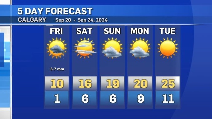
Friday will be cool and wet with intermittent showers likely through most of the day.
That moisture combined with overnight clearing will enhance the risk of widespread frost across central and southern Alberta – especially west of Calgary.
Overnight temperatures could dip below the freezing mark – especially in rural or low-lying areas.
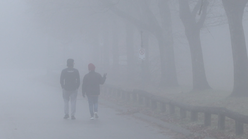
Visibility could be compromised early Saturday as overnight evaporation will saturate the cooler air just above the surface, and in areas with little to no wind to mix those lower atmospheric layers, fog is possible.
A more typical weather pattern will emerge on Saturday bringing a west-to-east flow, and elevating temperatures once again.
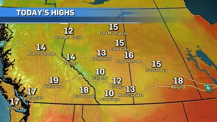
Stability is also expected to remain persistent into early next week, and by Tuesday the daytime high in Calgary is forecast to reach the mid-20s with an overnight low warmer than Friday’s daytime high.
CTVNews.ca Top Stories

Five years after toddler's brutal death, Northern Ont. family struggles to find peace, justice
A North Bay family is struggling to find peace and justice as the five-year anniversary of the brutal death of toddler Oliver McCarthy approaches.
Alberta RCMP officer charged with 2 counts of sexual assault
Const. Bridget Morla, a Leduc RCMP officer, has been charged with two counts of sexual assault in connection with an incident that happened two years ago.
Ontario dad removes hockey rink at heart of neighbour dispute
A Markham dad who drew the ire of neighbours and the city after installing a hockey rink in his backyard says the rink has now been taken down.
Kingston, Ont. doctor in 'disbelief' after being ordered to repay $600K for pandemic vaccination payments
An Ontario health tribunal has ordered a Kingston, Ont. doctor to repay over $600,000 to the Ontario government for improperly billing thousands of COVID-19 vaccinations at the height of the pandemic.
Three climbers from the U.S. and Canada are missing on New Zealand's highest peak
Three mountain climbers from the U.S. and Canada are missing after they failed to return from a planned ascent of New Zealand's highest peak, Aoraki, authorities said Tuesday.
Motivated by obsession: Canadians accused in botched California murder plot in police custody
Two Canadians are in police custody in Monterey County, California, after a triple stabbing police say was motivated by a B.C. man's obsession with a woman he played video games with online.
Trump demands immediate release of Oct. 7 hostages, says otherwise there will be 'HELL TO PAY'
President-elect Donald Trump is demanding the immediate release of the Israeli hostages still being held in Gaza, saying that if they are not freed before he is sworn into office there will be “HELL TO PAY."
Belly fat linked to signs of Alzheimer’s 20 years before symptoms begin, study says
As the size of a person’s belly grows, the memory centre of their brain shrinks and beta amyloid and tau may appear — all of this occurring as early as a person’s 40s and 50s, well before any cognitive decline is apparent, according to new research.
More RCMP and CBSA ‘human resources’ destined for border, Public Safety Minister LeBlanc says
Public Safety Minister Dominic LeBlanc says the federal government will 'absolutely' be adding more Canadian Border Services Agency (CBSA) and RCMP ‘human resources’ at the border.


