It looks like we've got a warm, windy weekend ahead of us
The official start to spring is still more than a week away, but the conditions this weekend will definitely have people gearing up for shorts and t-shirt weather.
A chinook arch swept through southern Alberta on Friday, with the Calgary airport recording a high of 8 C today fuelled by gusty westerly winds at 20-45 km/h.
The winds will calm down overnight in the city with a low of -1 C but will pick up again Saturday from a southwesterly direction at 20-40 km/h.
That westerly flow really is the weather-maker for the next five days at least, so temperatures are expected to remain in the mid to high single digits.

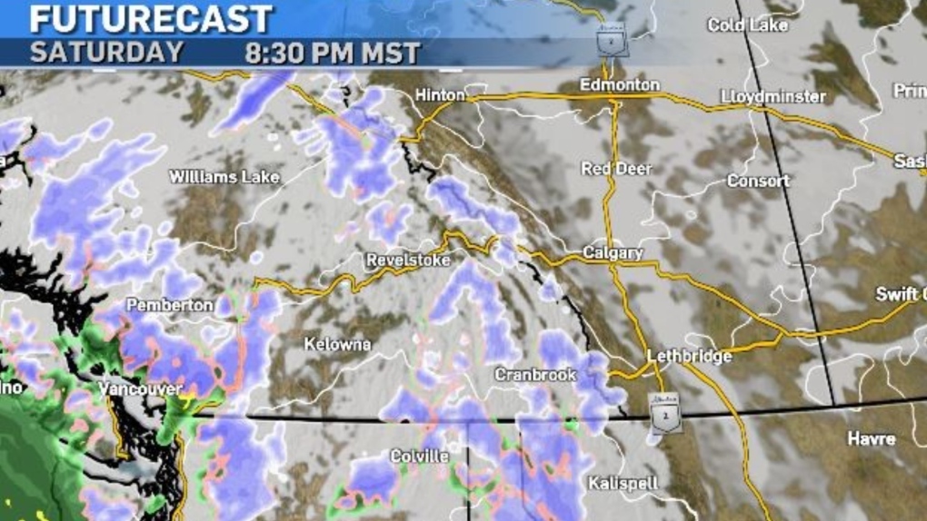
A majority of the province will also be protected under a ridge of high pressure keeping our conditions tame for a good stretch as well, with the exception of the northwest corner of the province, which could get hit by some freezing rain by Sunday.
If you do have travel plans to B.C. this weekend, keep in mind roads could be messy in the East Kootenays, as a low-pressure system brings a mix of rain and snow to the area Saturday night into Sunday.

Another reminder for those heading into the mountain range, a special avalanche warning has been issued for Banff, Kootenay and Yoho national parks and Kananaskis Country due to a very unstable snowpack and the ongoing mild temperatures.

It's also Daylight Saving Time this weekend, so make sure to boost your clock an hour ahead on Sunday!
Have a great weekend!
CTVNews.ca Top Stories

Celine Dion delivers stirring comeback performance at Paris Olympics opening ceremony
Against the rainy Paris night sky, Celine Dion staged the comeback of her career with a powerful performance from the Eiffel Tower to open the Olympic Games.
Jasper wildfire: 'Several weeks' before Jasper can return, premier says
Premier Danielle Smith said Friday afternoon in Hinton while weather conditions are cooler, the Jasper fire is still considered out of control and that Jasper residents can expect to be away from their homes "for several weeks."
Missing 3-year-old boy found dead in creek in Mississauga: police
A three-year-old boy has been found dead a day after he went missing in a park in Mississauga, Peel police say.
Irish museum pulls Sinead O'Connor waxwork after just one day due to backlash
An Irish museum will withdraw a waxwork of singer-songwriter Sinéad O’Connor just one day after installing it, following a backlash from her family and the public, it told CNN in a statement on Friday.
Winnipeg senior's account overdrawn for $146,000 water bill
A Winnipeg senior is getting soaked with a six figure water bill.
Turpel-Lafond won't sue CBC over Cree heritage report that took 'heavy toll': lawyer
The lawyer for a former judge whose claims to be Cree were questioned in a CBC investigation says his client is not considering legal action against the broadcaster after the Law Society of British Columbia this week backed her claims of Indigenous heritage.
Driver charged after flashing high beams at approaching police
Orillia OPP arrested and charged a driver with impaired driving after flashing their high beams.
Health Canada warns some naloxone kits contain false instructions
Health Canada is warning some take-home naloxone kits come with bad instructions that should be ignored in favour of the correct guidance.
Paris dazzles with a rainy Olympics opening ceremony on the Seine River
Celebrating its reputation as a cradle of revolution, Paris kicked off its first Summer Olympics in a century on Friday with a rain-soaked, rule-breaking opening ceremony studded with stars and fantasy along the Seine River.


